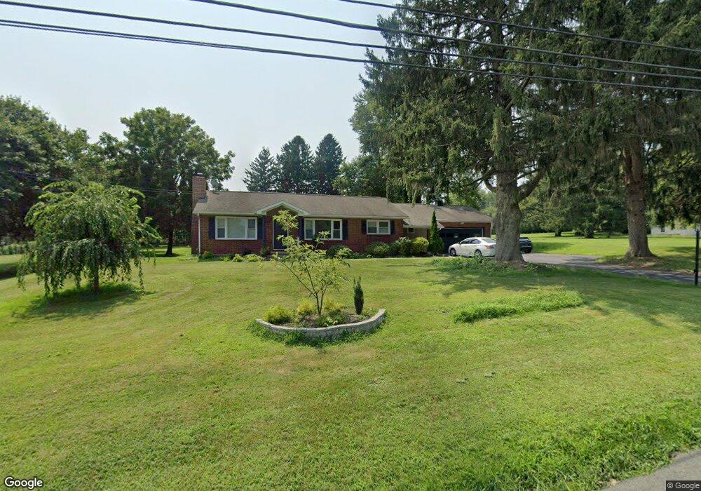
480 State Route 173 Stewartsville, NJ 08886
Estimated Value: $400,000 - $518,000
--
Bed
--
Bath
1,420
Sq Ft
$331/Sq Ft
Est. Value
About This Home
This home is located at 480 State Route 173, Stewartsville, NJ 08886 and is currently estimated at $469,389, approximately $330 per square foot. 480 State Route 173 is a home located in Warren County with nearby schools including Greenwich Elementary School and Stewartsville Middle School.
Ownership History
Date
Name
Owned For
Owner Type
Purchase Details
Closed on
May 6, 2024
Sold by
Karam N Natalia Llc
Bought by
Wala Patryk
Current Estimated Value
Home Financials for this Owner
Home Financials are based on the most recent Mortgage that was taken out on this home.
Original Mortgage
$380,000
Outstanding Balance
$374,580
Interest Rate
6.79%
Mortgage Type
New Conventional
Estimated Equity
$94,809
Purchase Details
Closed on
Dec 15, 2015
Sold by
Heebner Charlotte and Howey Charlotte
Bought by
Paytt Michelle
Purchase Details
Closed on
Mar 16, 2006
Sold by
Meyers Anna
Bought by
Meyers Charles L and Meyers Anna
Purchase Details
Closed on
Nov 19, 1996
Sold by
Meyers Charles L and Meyers Anna
Bought by
Meyers Anna
Create a Home Valuation Report for This Property
The Home Valuation Report is an in-depth analysis detailing your home's value as well as a comparison with similar homes in the area
Home Values in the Area
Average Home Value in this Area
Purchase History
| Date | Buyer | Sale Price | Title Company |
|---|---|---|---|
| Wala Patryk | $475,000 | Fidelity National Title | |
| Wala Patryk | $475,000 | Fidelity National Title | |
| Paytt Michelle | $214,900 | None Available | |
| Meyers Charles L | -- | None Available | |
| Meyers Anna | -- | -- |
Source: Public Records
Mortgage History
| Date | Status | Borrower | Loan Amount |
|---|---|---|---|
| Open | Wala Patryk | $380,000 | |
| Closed | Wala Patryk | $380,000 |
Source: Public Records
Tax History Compared to Growth
Tax History
| Year | Tax Paid | Tax Assessment Tax Assessment Total Assessment is a certain percentage of the fair market value that is determined by local assessors to be the total taxable value of land and additions on the property. | Land | Improvement |
|---|---|---|---|---|
| 2025 | $8,542 | $214,400 | $62,100 | $152,300 |
| 2024 | $7,721 | $214,400 | $62,100 | $152,300 |
| 2023 | $7,448 | $214,400 | $62,100 | $152,300 |
| 2022 | $7,448 | $214,400 | $62,100 | $152,300 |
| 2021 | $7,277 | $214,400 | $62,100 | $152,300 |
| 2020 | $7,144 | $214,400 | $62,100 | $152,300 |
| 2019 | $6,942 | $214,400 | $62,100 | $152,300 |
| 2018 | $6,895 | $214,400 | $62,100 | $152,300 |
| 2017 | $6,895 | $214,400 | $62,100 | $152,300 |
| 2016 | $6,809 | $214,400 | $62,100 | $152,300 |
| 2015 | $6,433 | $210,300 | $62,100 | $148,200 |
| 2014 | $6,408 | $210,300 | $62,100 | $148,200 |
Source: Public Records
Map
Nearby Homes
- 400 Bradford Ln
- 402 Parker Rd
- 705 Warren Glen Rd
- 101 Parker Rd
- 333 Greens Ridge Rd
- 1 Woodland Terrace
- 63 Main St
- 2141 New Village Rd
- 125 Brunswick Ave
- 104 Fox Run Rd
- 668 S Main St Unit 1
- 50 Route 639
- 1508 West Ave
- 14 Tulip Ln
- 503 Dori Place
- 103 Cardinal Way
- 80-84 County Road 519
- 631 S Main St
- 268 County Road 579
- 80 Route 519
- 480 New Jersey 173
- 478 State Route 173
- 478 Route 173
- 482 New Jersey 173
- 482 State Route 173
- 300 Aldin Rd
- 476 State Route 173
- 224 Aldin Rd
- 111 Kennedy Mill Rd
- 109 Kennedy Mill Rd
- 113 Kennedy Mill Rd
- 222 Aldin Rd
- 302 Aldin Rd
- 484 State Route 173
- 220 Aldin Rd
- 107 Kennedy Mill Rd
- 474 New Jersey 173
- 474 State Route 173
- 115 Kennedy Mill Rd
- 301 Aldin Rd