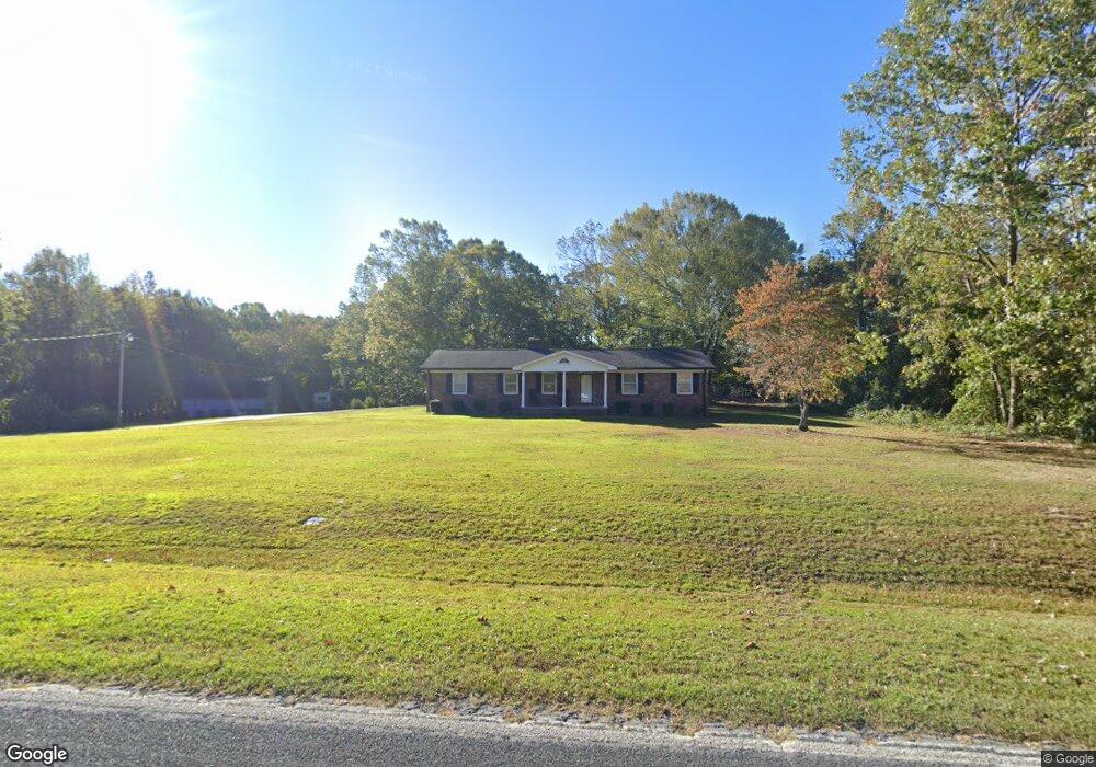
480 Watson Rd Enoree, SC 29335
Estimated Value: $162,000 - $342,000
3
Beds
2
Baths
1,326
Sq Ft
$174/Sq Ft
Est. Value
About This Home
This home is located at 480 Watson Rd, Enoree, SC 29335 and is currently estimated at $230,294, approximately $173 per square foot. 480 Watson Rd is a home located in Spartanburg County with nearby schools including Woodruff Primary School, Woodruff Elementary School, and Woodruff Middle School.
Ownership History
Date
Name
Owned For
Owner Type
Purchase Details
Closed on
Apr 20, 2009
Sold by
Jarrell Jason Hughes
Bought by
Hughes Joe Perry
Current Estimated Value
Purchase Details
Closed on
Nov 17, 2008
Sold by
Jarrell Jack
Bought by
Hughes Joe Perry
Purchase Details
Closed on
Dec 30, 2002
Sold by
Hughes Joe Perry
Bought by
Jarrell Sandra Hughes
Create a Home Valuation Report for This Property
The Home Valuation Report is an in-depth analysis detailing your home's value as well as a comparison with similar homes in the area
Purchase History
| Date | Buyer | Sale Price | Title Company |
|---|---|---|---|
| Hughes Joe Perry | -- | -- | |
| Hughes Joe Perry | -- | -- | |
| Jarrell Sandra Hughes | -- | -- |
Source: Public Records
Tax History
| Year | Tax Paid | Tax Assessment Tax Assessment Total Assessment is a certain percentage of the fair market value that is determined by local assessors to be the total taxable value of land and additions on the property. | Land | Improvement |
|---|---|---|---|---|
| 2022 | $353 | $4,192 | $1,008 | $3,184 |
| 2021 | $353 | $4,192 | $1,008 | $3,184 |
| 2020 | $320 | $4,192 | $1,008 | $3,184 |
| 2019 | $324 | $4,192 | $1,008 | $3,184 |
| 2018 | $324 | $4,192 | $1,008 | $3,184 |
| 2017 | $279 | $3,788 | $1,000 | $2,788 |
| 2016 | $280 | $3,788 | $1,000 | $2,788 |
| 2015 | $275 | $3,788 | $1,000 | $2,788 |
| 2014 | $271 | $3,788 | $1,000 | $2,788 |
Source: Public Records
Map
Nearby Homes
- 00 S 114
- 0 Watson Rd Unit 1582740
- 0 Watson Rd Unit SPN333926
- 00 Ball Park Rd
- 700 Hadley Place
- 491 Adhurst Dr Unit AA 60 Inlet B
- 708 Hadley Place
- 700 Hadley Place Unit AA 70 Dawson D
- 491 Adhurst Dr
- 717 Adhurst Dr
- 389 Timberidge Rd Unit AA 33 Inlet C
- 389 Timberidge Rd
- 495 Adhurst Dr Unit AA 61 Davenport C
- 708 Hadley Place Unit AA 68 Inlet B
- 709 Adhurst Dr
- 495 Adhurst Dr
- 488 Adhurst Dr
- 00 Frontier Rd
- 709 Hadley Place Unit AA 64 Dawson A
- 709 Hadley Place
- 510 Watson Rd
- 491 Watson Rd
- 441 Watson Rd
- 103 Liberty Ridge Rd
- 421 Watson Rd
- 0 Weaver St Unit 180945
- 0 Ramey Rd Unit 194492
- 0 Charles St Unit 195676
- 0 Highway 56 Unit 217540
- 0 Browning Rd Unit 217932
- 0 Frontier Rd Unit 221514
- 00 Mountain Shoals Rd
- 0 Highway 56 Unit 236822
- 0 Hwy 92 Unit 241372
- 00 Browning Rd
- Lot 13 Fleming Cir
- 0 Rocky Ridge Unit 248719
- 0 Ridge Road Track 6 Unit 1170114
- 00 Hwy 92
- 00 Mount Shoals Rd
Your Personal Tour Guide
Ask me questions while you tour the home.