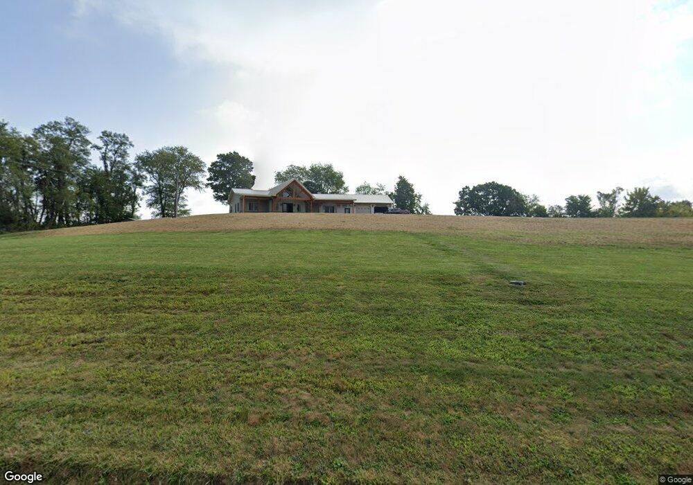
4800 State Route 792 Stockport, OH 43787
Estimated Value: $349,000 - $358,552
3
Beds
2
Baths
2,766
Sq Ft
$128/Sq Ft
Est. Value
About This Home
This home is located at 4800 State Route 792, Stockport, OH 43787 and is currently estimated at $353,776, approximately $127 per square foot. 4800 State Route 792 is a home with nearby schools including Morgan High School.
Ownership History
Date
Name
Owned For
Owner Type
Purchase Details
Closed on
Nov 4, 2014
Sold by
Cunningham Marta
Bought by
Konkler Nathan R
Current Estimated Value
Home Financials for this Owner
Home Financials are based on the most recent Mortgage that was taken out on this home.
Original Mortgage
$72,000
Outstanding Balance
$25,639
Interest Rate
4.99%
Mortgage Type
Adjustable Rate Mortgage/ARM
Estimated Equity
$328,137
Purchase Details
Closed on
Oct 23, 2014
Sold by
Cunningham Elmer L
Bought by
Cunningham Marta and Cunningham Marta K
Home Financials for this Owner
Home Financials are based on the most recent Mortgage that was taken out on this home.
Original Mortgage
$72,000
Outstanding Balance
$25,639
Interest Rate
4.99%
Mortgage Type
Adjustable Rate Mortgage/ARM
Estimated Equity
$328,137
Create a Home Valuation Report for This Property
The Home Valuation Report is an in-depth analysis detailing your home's value as well as a comparison with similar homes in the area
Home Values in the Area
Average Home Value in this Area
Purchase History
| Date | Buyer | Sale Price | Title Company |
|---|---|---|---|
| Konkler Nathan R | $17,000 | None Available | |
| Cunningham Marta | -- | None Available |
Source: Public Records
Mortgage History
| Date | Status | Borrower | Loan Amount |
|---|---|---|---|
| Open | Konkler Nathan R | $72,000 |
Source: Public Records
Tax History Compared to Growth
Tax History
| Year | Tax Paid | Tax Assessment Tax Assessment Total Assessment is a certain percentage of the fair market value that is determined by local assessors to be the total taxable value of land and additions on the property. | Land | Improvement |
|---|---|---|---|---|
| 2024 | $2,655 | $82,600 | $15,250 | $67,350 |
| 2023 | $2,655 | $39,200 | $12,430 | $26,770 |
| 2022 | $1,280 | $39,200 | $12,430 | $26,770 |
| 2021 | $1,293 | $39,200 | $12,430 | $26,770 |
| 2019 | $1,231 | $35,660 | $11,300 | $24,360 |
| 2018 | $1,186 | $35,660 | $11,300 | $24,360 |
| 2017 | $1,057 | $30,986 | $9,590 | $21,396 |
| 2016 | $187 | $4,823 | $4,823 | $0 |
| 2015 | $187 | $5,306 | $5,306 | $0 |
| 2014 | -- | $4,823 | $4,823 | $0 |
| 2013 | $179 | $4,823 | $4,823 | $0 |
Source: Public Records
Map
Nearby Homes
- 3111 Big Bottom Ln
- 5174 Lightner Ridge Rd
- 0 Meadow St Unit Lot 9 5158299
- 0 Meadow St Unit Lot 9 225008020
- 0 Kosky Dr
- 3291 Kosky Dr
- 1715 South St
- 1960 Broadway St
- 1770 Broadway St
- 1920 North St
- 3265 Tieber Rd
- 3020 State Route 376
- 75 S River Rd SE
- 2712 Sycamore Ln
- 2444 Ervin Ln
- 4660 E J Ross Ln
- 681 Downing Rd
- 781 Downing Rd
- 0 Downing Rd
- 3130 Ohio 266
- 4700 State Route 792
- 0 Ellis Rd Unit 3781895
- 0 Ellis Rd Unit 3837749
- 0 Ellis Rd Unit 3867000
- 0 Ellis Rd Unit 4474202
- 2355 Keffer Rd
- 4505 Ohio 792
- 5035 State Route 792
- 4378 State Route 792
- 4378 State Route 792
- 4287 Salt Works Hill Rd
- 2525 Keffer Rd
- 2605 Keffer Rd
- 2605 Keffer Rd
- 4296 State Route 792
- 00 E River Rd
- 2605 S River Rd
- 2725 E River Rd
- 2340 E River Rd
- 2441 E River Rd