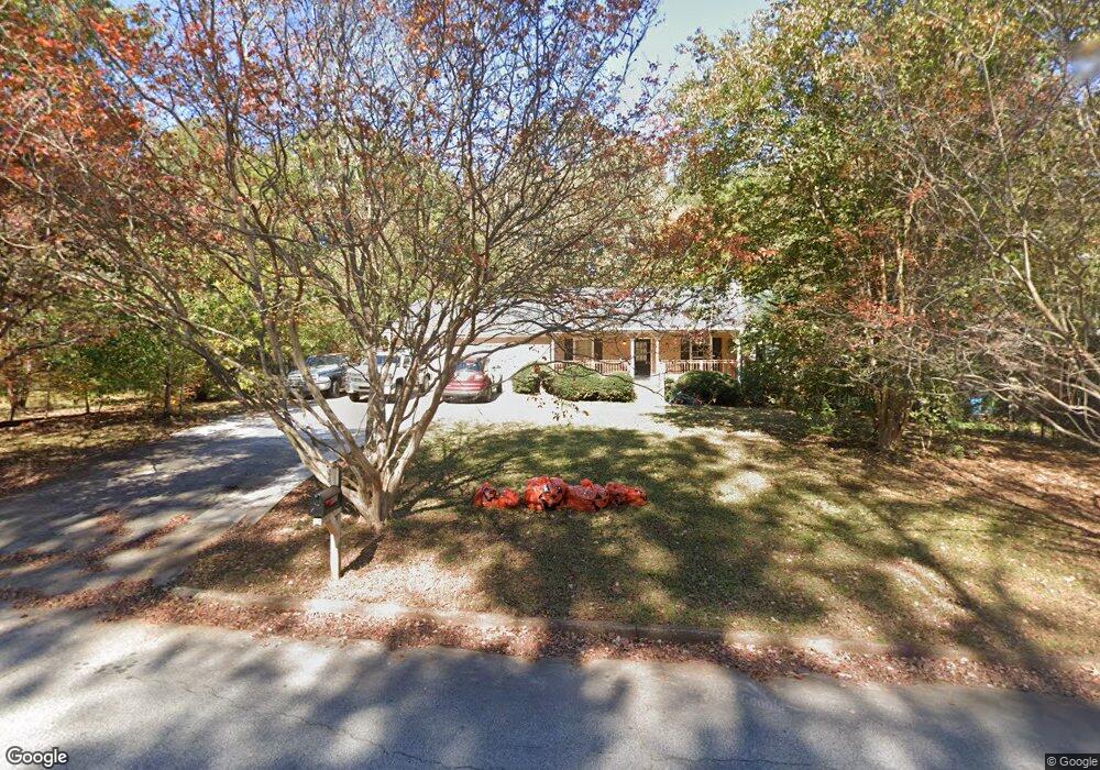
4801 Cedar Brook Dr SE Conyers, GA 30094
Estimated Value: $237,000 - $264,000
3
Beds
2
Baths
1,383
Sq Ft
$180/Sq Ft
Est. Value
About This Home
This home is located at 4801 Cedar Brook Dr SE, Conyers, GA 30094 and is currently estimated at $248,737, approximately $179 per square foot. 4801 Cedar Brook Dr SE is a home located in Rockdale County with nearby schools including Barksdale Elementary School, Gen. Ray Davis Middle School, and Salem High School.
Ownership History
Date
Name
Owned For
Owner Type
Purchase Details
Closed on
Feb 25, 2022
Sold by
Baf 2 Llc
Bought by
Baf Assets 4 Llc
Current Estimated Value
Purchase Details
Closed on
Feb 23, 2011
Sold by
Federal Natl Mtg Assn Fnma
Bought by
All-Star Properties & Invs Llc
Purchase Details
Closed on
Dec 7, 2010
Sold by
Wells Fargo Bk Na
Bought by
Federal Natl Mtg Assn Fnma
Purchase Details
Closed on
Mar 16, 2000
Sold by
Vanburen Bruce and Vanburen Carolyn A
Bought by
Folsom Kenneth L
Home Financials for this Owner
Home Financials are based on the most recent Mortgage that was taken out on this home.
Original Mortgage
$82,700
Interest Rate
8.37%
Mortgage Type
New Conventional
Create a Home Valuation Report for This Property
The Home Valuation Report is an in-depth analysis detailing your home's value as well as a comparison with similar homes in the area
Home Values in the Area
Average Home Value in this Area
Purchase History
| Date | Buyer | Sale Price | Title Company |
|---|---|---|---|
| Baf Assets 4 Llc | $250,000 | -- | |
| All-Star Properties & Invs Llc | -- | -- | |
| Federal Natl Mtg Assn Fnma | $76,904 | -- | |
| Wells Fargo Bk Na | $76,904 | -- | |
| Folsom Kenneth L | $91,900 | -- |
Source: Public Records
Mortgage History
| Date | Status | Borrower | Loan Amount |
|---|---|---|---|
| Previous Owner | Folsom Kenneth L | $82,700 |
Source: Public Records
Tax History Compared to Growth
Tax History
| Year | Tax Paid | Tax Assessment Tax Assessment Total Assessment is a certain percentage of the fair market value that is determined by local assessors to be the total taxable value of land and additions on the property. | Land | Improvement |
|---|---|---|---|---|
| 2024 | $3,324 | $82,520 | $17,040 | $65,480 |
| 2023 | $3,132 | $75,600 | $17,720 | $57,880 |
| 2022 | $2,430 | $57,920 | $14,160 | $43,760 |
| 2021 | $2,227 | $53,480 | $10,200 | $43,280 |
| 2020 | $2,007 | $46,680 | $9,160 | $37,520 |
| 2019 | $1,764 | $38,920 | $7,640 | $31,280 |
| 2018 | $1,514 | $33,200 | $6,840 | $26,360 |
| 2017 | $1,248 | $27,040 | $4,920 | $22,120 |
| 2016 | $1,213 | $26,280 | $4,920 | $21,360 |
| 2015 | $961 | $24,360 | $3,600 | $20,760 |
| 2014 | $1,139 | $24,360 | $3,600 | $20,760 |
| 2013 | -- | $15,200 | $2,918 | $12,281 |
Source: Public Records
Map
Nearby Homes
- 801 Greenwood Trail SE
- 821 Greenwood Trail SE
- 4938 Lake Forest Dr SE
- 634 Knollwood Cir SE
- 2178 NE Hillwood Dr
- 4710 Cedar Brook Dr SE
- 824 Cedar Lake Dr SE
- 5312 Ashley Dr SE
- 4811 W Lake Dr SE
- 4670 Cedar Brook Dr SE
- 4822 Navajo Trail SE
- 4773 Bell Cir SE
- 4931 W Lake Dr SE
- 4753 Bell Cir SE
- 4731 Shadybrook Way SE Unit 2
- 4980 W Lake Dr SE
- 570 Bell Rd SE
- 4797 Hemlock Dr SE
- 4824 Georgia 20
- 4801 Cedar Brook Dr SE
- 4811 Cedar Brook Dr SE
- 4791 Cedar Brook Dr SE
- 4781 Cedar Brook Dr SE
- 4860 Cedar Brook Dr SE
- 4860 Cedar Brook Dr SE Unit 4
- 803 Brook Hollow Cir SE
- 4758 Cedar Lake Dr SE
- 4754 Cedar Lake Dr SE Unit 3/24
- 4754 Cedar Lake Dr SE
- 4850 Cedar Brook Dr SE
- 4870 Cedar Brook Dr SE
- 4750 Cedar Lake Dr SE
- 4771 Cedar Brook Dr SE Unit 4
- 4840 Cedar Brook Dr SE Unit 4
- 4746 Cedar Lake Dr SE
- 4880 Cedar Brook Dr SE Unit 4
- 4905 Cedar Brook Dr SE
- 813 Brook Hollow Cir SE
- 4830 Cedar Brook Dr SE Unit 4