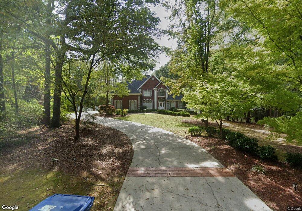
4801 Laurel Trace Anniston, AL 36207
Estimated Value: $504,000 - $713,000
4
Beds
4
Baths
4,162
Sq Ft
$150/Sq Ft
Est. Value
About This Home
This home is located at 4801 Laurel Trace, Anniston, AL 36207 and is currently estimated at $624,837, approximately $150 per square foot. 4801 Laurel Trace is a home located in Calhoun County with nearby schools including White Plains Elementary School, White Plains Middle School, and White Plains High School.
Ownership History
Date
Name
Owned For
Owner Type
Purchase Details
Closed on
Jun 10, 2020
Sold by
Tillery Cathy M and Mcguirk Cathy W
Bought by
Tillery Thomas C and Tillery Cathy M
Current Estimated Value
Purchase Details
Closed on
Jan 30, 2018
Bought by
Tillery Thomas C and Tillery Cathy M
Home Financials for this Owner
Home Financials are based on the most recent Mortgage that was taken out on this home.
Original Mortgage
$384,000
Outstanding Balance
$326,510
Interest Rate
4.15%
Estimated Equity
$298,327
Create a Home Valuation Report for This Property
The Home Valuation Report is an in-depth analysis detailing your home's value as well as a comparison with similar homes in the area
Home Values in the Area
Average Home Value in this Area
Purchase History
| Date | Buyer | Sale Price | Title Company |
|---|---|---|---|
| Tillery Thomas C | -- | None Available | |
| Tillery Thomas C | -- | -- |
Source: Public Records
Mortgage History
| Date | Status | Borrower | Loan Amount |
|---|---|---|---|
| Open | Tillery Thomas C | $384,000 | |
| Closed | Tillery Thomas C | -- |
Source: Public Records
Tax History Compared to Growth
Tax History
| Year | Tax Paid | Tax Assessment Tax Assessment Total Assessment is a certain percentage of the fair market value that is determined by local assessors to be the total taxable value of land and additions on the property. | Land | Improvement |
|---|---|---|---|---|
| 2024 | $2,395 | $59,870 | $7,810 | $52,060 |
| 2023 | $2,395 | $58,420 | $7,810 | $50,610 |
| 2022 | $2,205 | $55,110 | $7,810 | $47,300 |
| 2021 | $2,038 | $50,940 | $7,810 | $43,130 |
| 2020 | $1,894 | $48,614 | $7,810 | $40,804 |
| 2019 | $1,895 | $47,848 | $7,806 | $40,042 |
| 2018 | $1,863 | $47,840 | $0 | $0 |
| 2017 | $390 | $43,740 | $0 | $0 |
| 2016 | $1,699 | $43,740 | $0 | $0 |
| 2013 | -- | $42,840 | $0 | $0 |
Source: Public Records
Map
Nearby Homes
- 4803 Laurel Trace
- 4809 Laurel Trace Unit 7
- 136 Dewey Ln Unit 4
- 39 Carnoustie Place
- 121 Eastwood Dr
- 115 Carnoustie Place
- 65 Casey Ct
- 1001 Kingsway Dr
- 390 Jamestown Way Unit 9
- 43 Faulkner Dr
- 1250 Old Downing Mill Rd
- 833 Lillian Ln
- 115 Sandy Ln
- 65 Camelot Ln
- 70 Camelot Ln
- 64 Avalon Ln
- 257 Hawk Pass
- 6922 Choccolloco Rd
- 294 Raptor Way
- 90 Deerfield Cir
- 4801 Laurel Trc
- 4802 Laurel Trace
- 4705 Choccolocco Rd
- 4669 Choccolocco Rd
- 4805 Laurel Trace
- 4902 Laurel Trace N
- 4901 Choccolocco Rd
- 1729 Old Choccolocco Rd
- 0 Laurel Trace Unit 388298
- 0 Laurel Trace Unit S 432470
- 0 Laurel Trace Unit 5 546034
- 0 Laurel Trace
- 4901 Laurel Trace N
- 4901 Laurel Trace N
- 4904 Laurel Trace N
- 4807 Laurel Trace Unit 5
- 4595 Choccolocco Rd
- 4647 Choccolocco Rd
- 1771 Old Choccolocco Rd
- 1565 Old Choccolocco Rd