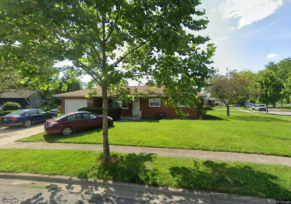
4801 Maize Rd Columbus, OH 43229
Woodward Park NeighborhoodEstimated Value: $277,260 - $316,000
3
Beds
3
Baths
1,388
Sq Ft
$207/Sq Ft
Est. Value
About This Home
This home is located at 4801 Maize Rd, Columbus, OH 43229 and is currently estimated at $287,565, approximately $207 per square foot. 4801 Maize Rd is a home located in Franklin County with nearby schools including Valley Forge Elementary School, Woodward Park Middle School, and Northland High School.
Ownership History
Date
Name
Owned For
Owner Type
Purchase Details
Closed on
Jun 20, 2006
Sold by
Fannie Mae
Bought by
Orosco Joel
Current Estimated Value
Home Financials for this Owner
Home Financials are based on the most recent Mortgage that was taken out on this home.
Original Mortgage
$133,602
Outstanding Balance
$77,553
Interest Rate
6.73%
Mortgage Type
FHA
Estimated Equity
$210,012
Purchase Details
Closed on
Jan 9, 2006
Sold by
Years Scott A
Bought by
Federal National Mortgage Association
Purchase Details
Closed on
Oct 12, 2001
Sold by
Powell Melanie A
Bought by
Years Scott A and Years Ruth P
Home Financials for this Owner
Home Financials are based on the most recent Mortgage that was taken out on this home.
Original Mortgage
$119,700
Interest Rate
6.88%
Mortgage Type
Purchase Money Mortgage
Purchase Details
Closed on
Aug 4, 1988
Bought by
Powell Melanie A
Create a Home Valuation Report for This Property
The Home Valuation Report is an in-depth analysis detailing your home's value as well as a comparison with similar homes in the area
Home Values in the Area
Average Home Value in this Area
Purchase History
| Date | Buyer | Sale Price | Title Company |
|---|---|---|---|
| Orosco Joel | $134,900 | Title First | |
| Federal National Mortgage Association | $90,000 | None Available | |
| Years Scott A | $126,000 | -- | |
| Powell Melanie A | -- | -- |
Source: Public Records
Mortgage History
| Date | Status | Borrower | Loan Amount |
|---|---|---|---|
| Open | Orosco Joel | $133,602 | |
| Previous Owner | Years Scott A | $119,700 |
Source: Public Records
Tax History
| Year | Tax Paid | Tax Assessment Tax Assessment Total Assessment is a certain percentage of the fair market value that is determined by local assessors to be the total taxable value of land and additions on the property. | Land | Improvement |
|---|---|---|---|---|
| 2025 | $3,853 | $85,860 | $21,140 | $64,720 |
| 2024 | $3,853 | $85,860 | $21,140 | $64,720 |
| 2023 | $3,804 | $85,855 | $21,140 | $64,715 |
| 2022 | $2,661 | $51,310 | $13,930 | $37,380 |
| 2021 | $2,666 | $51,310 | $13,930 | $37,380 |
| 2020 | $2,669 | $51,310 | $13,930 | $37,380 |
| 2019 | $2,463 | $40,600 | $11,130 | $29,470 |
| 2018 | $2,433 | $40,600 | $11,130 | $29,470 |
| 2017 | $2,461 | $40,600 | $11,130 | $29,470 |
| 2016 | $2,652 | $40,040 | $9,800 | $30,240 |
| 2015 | $2,408 | $40,040 | $9,800 | $30,240 |
| 2014 | $2,414 | $40,040 | $9,800 | $30,240 |
| 2013 | $1,253 | $42,140 | $10,325 | $31,815 |
Source: Public Records
Map
Nearby Homes
- 1116 Tulsa Dr
- 1144 Reed Circle Dr
- 4800 Bourke Rd
- 4795 Colonel Perry Dr
- 1485 Norma Rd
- 4923 Karl Rd Unit 4925
- 5004 Julie Place
- 5010 Julie Place
- 4605 Glenmawr Ave
- 4450 N 4th St
- 1685 Norma Rd
- 4320 Sandy Lane Rd
- 1130 Carbone Dr
- 952 Minerva Ave
- 940 Minerva Ave
- 5318 Eisenhower Rd
- 4852 Snowbird Cir Unit 13B
- 4143 Karl Rd Unit 215
- 4143 Karl Rd Unit 314
- 4145 Karl Rd Unit 223
- 4819 Almont Dr
- 4793 Maize Rd
- 4792 Maize Rd
- 4827 Almont Dr
- 4785 Maize Rd
- 4808 Esterbrook Rd
- 4800 Esterbrook Rd
- 4812 Almont Dr
- 4820 Almont Dr
- 4820 Esterbrook Rd
- 4806 Almont Dr
- 4793 Almont Dr
- 4792 Esterbrook Rd
- 4777 Maize Rd
- 4778 Maize Rd
- 4832 Almont Dr
- 4800 Almont Dr
- 4835 Almont Dr
- 4784 Esterbrook Rd
- 4787 Almont Dr
Your Personal Tour Guide
Ask me questions while you tour the home.