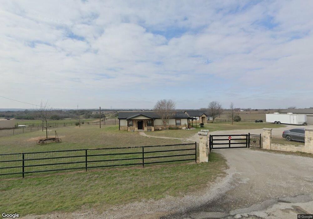
4801 Upper Denton Rd Weatherford, TX 76085
Estimated Value: $391,000 - $565,000
--
Bed
--
Bath
2,050
Sq Ft
$216/Sq Ft
Est. Value
About This Home
This home is located at 4801 Upper Denton Rd, Weatherford, TX 76085 and is currently estimated at $442,668, approximately $215 per square foot. 4801 Upper Denton Rd is a home located in Parker County with nearby schools including Crockett Elementary School, Tison Middle School, and Weatherford High School.
Ownership History
Date
Name
Owned For
Owner Type
Purchase Details
Closed on
Dec 16, 2014
Sold by
Pippin Greg
Bought by
Pippin Gregg and Pippin Staci
Current Estimated Value
Home Financials for this Owner
Home Financials are based on the most recent Mortgage that was taken out on this home.
Original Mortgage
$120,000
Outstanding Balance
$40,038
Interest Rate
3.21%
Mortgage Type
Stand Alone First
Estimated Equity
$402,630
Purchase Details
Closed on
Oct 15, 2001
Sold by
Bryant Dana C and Bryant Bruce O
Bought by
Pippin Gregg and Pippin Staci
Purchase Details
Closed on
Jul 23, 2001
Sold by
Bryant Dana C and Bryant Bruce O
Bought by
Pippin Gregg and Pippin Staci
Purchase Details
Closed on
May 11, 2000
Sold by
Bryant Dana C and Bryant Bruce O
Bought by
Pippin Gregg and Pippin Staci
Create a Home Valuation Report for This Property
The Home Valuation Report is an in-depth analysis detailing your home's value as well as a comparison with similar homes in the area
Home Values in the Area
Average Home Value in this Area
Purchase History
| Date | Buyer | Sale Price | Title Company |
|---|---|---|---|
| Pippin Gregg | -- | -- | |
| Pippin Gregg | -- | Allegiance Title Company | |
| Pippin Gregg | -- | -- | |
| Pippin Gregg | -- | -- | |
| Pippin Gregg | -- | -- |
Source: Public Records
Mortgage History
| Date | Status | Borrower | Loan Amount |
|---|---|---|---|
| Open | Pippin Gregg | $120,000 |
Source: Public Records
Tax History Compared to Growth
Tax History
| Year | Tax Paid | Tax Assessment Tax Assessment Total Assessment is a certain percentage of the fair market value that is determined by local assessors to be the total taxable value of land and additions on the property. | Land | Improvement |
|---|---|---|---|---|
| 2025 | $2,598 | $245,364 | -- | -- |
| 2024 | $2,598 | $223,058 | -- | -- |
| 2023 | $2,598 | $202,780 | $0 | $0 |
| 2022 | $3,432 | $216,340 | $10,450 | $205,890 |
| 2021 | $3,376 | $216,340 | $10,450 | $205,890 |
| 2020 | $3,090 | $158,830 | $10,540 | $148,290 |
| 2019 | $2,997 | $158,830 | $10,540 | $148,290 |
| 2018 | $2,739 | $125,910 | $6,150 | $119,760 |
| 2017 | $2,925 | $131,760 | $12,000 | $119,760 |
| 2016 | $2,830 | $127,510 | $12,000 | $115,510 |
| 2015 | $2,410 | $127,510 | $12,000 | $115,510 |
| 2014 | $2,073 | $107,440 | $12,000 | $95,440 |
Source: Public Records
Map
Nearby Homes
- 2065 Preserve Trail
- 4895 Upper Denton Rd
- 5350 Upper Denton Rd
- 0 R000118724 Unit 20846338
- 748 Rocky Ridge Ln
- 209 Timber Valley Ct
- TBD Lot 42 Blk 2 Timber Valley Ln
- TBD Lot 43 Blk 2 Timber Valley Ln
- TBD Lots 42 & 43 Bl Timber Valley Ln
- 152 Katy Ranch Dr
- 1009 Sabrina Ct
- 1357 Friendship Rd
- 2000 Collin St
- 319 Denton Heights Ln
- 5885-A Old Springtown Rd
- 5885-B Old Springtown Rd
- 5885-C Old Springtown Rd
- 5885-E Old Springtown Rd
- 5885-D Old Springtown Rd
- 1000 Rays Way
- 4739 Upper Denton Rd
- 4725 Upper Denton Rd
- .... Grant Alan Ct
- TBD Deer Butte St
- TBD Carter Hills Ln
- 4885 Upper Denton Rd
- 4691 Upper Denton Rd
- 142 Cedar Rd
- 4899 Upper Denton Rd
- 4659 Upper Denton Rd
- Lot 6 Flagstone Dr
- Lot 1 Flagstone Dr
- Lot 10 Flagstone Dr
- Lot 3 Boulder Rd
- Lot 5 Flagstone Dr
- Lot 15 Flagstone Dr
- Lot 1 Boulder Rd
- 5141 Upper Denton Rd
- 4673 Upper Denton Rd
- 4629 Upper Denton Rd