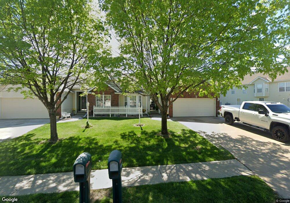
4802 Ashbey Dr Saint Joseph, MO 64506
East Saint Joseph NeighborhoodEstimated Value: $290,000 - $320,802
2
Beds
2
Baths
1,494
Sq Ft
$207/Sq Ft
Est. Value
About This Home
This home is located at 4802 Ashbey Dr, Saint Joseph, MO 64506 and is currently estimated at $309,451, approximately $207 per square foot. 4802 Ashbey Dr is a home located in Buchanan County with nearby schools including Oak Grove Elementary School, Bode Middle School, and Central High School.
Ownership History
Date
Name
Owned For
Owner Type
Purchase Details
Closed on
Aug 21, 2020
Sold by
Sollars Rita J
Bought by
Mckernan Beverly D
Current Estimated Value
Purchase Details
Closed on
Jun 1, 2017
Sold by
Sollars Rita J
Bought by
Sollars Michael S and Sollars Scott B
Purchase Details
Closed on
May 25, 2012
Sold by
Sollars Rita J
Bought by
Thomas Frank M
Purchase Details
Closed on
May 15, 2009
Sold by
Furlong Kirsten D and Rosenbaum Zvika
Bought by
Sollars Rita J
Home Financials for this Owner
Home Financials are based on the most recent Mortgage that was taken out on this home.
Original Mortgage
$40,000
Interest Rate
4.48%
Mortgage Type
New Conventional
Create a Home Valuation Report for This Property
The Home Valuation Report is an in-depth analysis detailing your home's value as well as a comparison with similar homes in the area
Home Values in the Area
Average Home Value in this Area
Purchase History
| Date | Buyer | Sale Price | Title Company |
|---|---|---|---|
| Mckernan Beverly D | -- | Preferred Title | |
| Sollars Michael S | -- | -- | |
| Thomas Frank M | -- | St Joseph Title & Abstract C | |
| Sollars Rita J | -- | Preferred Title Of St Joseph |
Source: Public Records
Mortgage History
| Date | Status | Borrower | Loan Amount |
|---|---|---|---|
| Previous Owner | Sollars Rita J | $40,000 |
Source: Public Records
Tax History Compared to Growth
Tax History
| Year | Tax Paid | Tax Assessment Tax Assessment Total Assessment is a certain percentage of the fair market value that is determined by local assessors to be the total taxable value of land and additions on the property. | Land | Improvement |
|---|---|---|---|---|
| 2024 | $2,251 | $32,190 | $3,420 | $28,770 |
| 2023 | $2,251 | $32,190 | $3,420 | $28,770 |
| 2022 | $2,083 | $32,190 | $3,420 | $28,770 |
| 2021 | $2,093 | $32,190 | $3,420 | $28,770 |
| 2020 | $2,081 | $32,190 | $3,420 | $28,770 |
| 2019 | $364 | $32,190 | $3,420 | $28,770 |
| 2018 | $1,809 | $32,190 | $3,420 | $28,770 |
| 2017 | $1,792 | $32,190 | $0 | $0 |
| 2015 | $0 | $32,190 | $0 | $0 |
| 2014 | $1,970 | $32,190 | $0 | $0 |
Source: Public Records
Map
Nearby Homes
- 4703 Wilshire Dr N
- 1901 Lion Rd
- 0 N Pointe Dr
- 5411 N Pointe Dr
- 5408 N Pointe Dr
- 2 N Pointe Dr
- 5415 N Pointe Dr
- 5418 N Pointe Dr
- 2409 Elephant Trail
- 4809 N Lakewood Dr
- 4902 Corinth Dr
- 4311 Hidden Valley Dr
- 4313 Hidden Valley Dr
- 2607 Ashmat Ln
- 4216 Gene Field Rd
- 1414 Rifle Terrace
- 2306 Woodridge Ct
- 4304 Kensington Dr
- 3201 Sheffield Ln
- 3804 Kingston Ct
- 4804 Ashbey Dr
- 2905 Eastbrook Ct
- 2907 Eastbrook Ct
- 4806 Ashbey Dr
- 2903 Eastbrook Ct
- 4808 Ashbey Dr
- 2901 Eastbrook Ct
- 4805 Ashbey Dr
- 4807 Ashbey Dr
- 4803 Ashbey Dr
- 2815 Eastbrook Ct
- 4801 Ashbey Dr
- 2813 Eastbrook Ct
- 4811 Ashbey Dr
- 4810 Ashbey Dr
- 4812 Ashbey Dr
- 2811 Eastbrook Ct
- 2809 Eastbrook Ct
- 4813 Ashbey Dr
- 2912 Eastbrook Ct