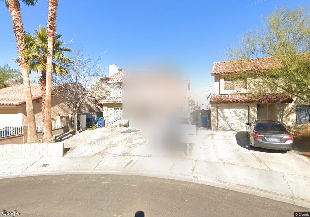
4802 Osborn Ct Las Vegas, NV 89110
East Las Vegas NeighborhoodEstimated Value: $325,000 - $405,000
3
Beds
3
Baths
1,679
Sq Ft
$219/Sq Ft
Est. Value
About This Home
This home is located at 4802 Osborn Ct, Las Vegas, NV 89110 and is currently estimated at $368,082, approximately $219 per square foot. 4802 Osborn Ct is a home located in Clark County with nearby schools including Elbert Edwards Elementary School, Dell H Robison Middle School, and Eldorado High School.
Ownership History
Date
Name
Owned For
Owner Type
Purchase Details
Closed on
Sep 26, 2024
Sold by
County Treasurer
Bought by
Ramos Daniel
Current Estimated Value
Purchase Details
Closed on
Jun 10, 2024
Sold by
Ex Officio Tax Receiver Of The County Of
Bought by
Treasurer Of Clark County
Purchase Details
Closed on
Nov 30, 2010
Sold by
Aurora Loan Services Llc
Bought by
Ramos Daniel and Lamas Delia
Purchase Details
Closed on
Jun 24, 2010
Sold by
Deleon Julio C
Bought by
Aurora Loan Services Llc
Create a Home Valuation Report for This Property
The Home Valuation Report is an in-depth analysis detailing your home's value as well as a comparison with similar homes in the area
Home Values in the Area
Average Home Value in this Area
Purchase History
| Date | Buyer | Sale Price | Title Company |
|---|---|---|---|
| Ramos Daniel | $4,509 | None Listed On Document | |
| Treasurer Of Clark County | $187,776 | None Listed On Document | |
| Ramos Daniel | $54,000 | Ticor Title Las Vegas | |
| Aurora Loan Services Llc | $80,000 | Accommodation |
Source: Public Records
Tax History Compared to Growth
Tax History
| Year | Tax Paid | Tax Assessment Tax Assessment Total Assessment is a certain percentage of the fair market value that is determined by local assessors to be the total taxable value of land and additions on the property. | Land | Improvement |
|---|---|---|---|---|
| 2025 | $1,034 | $60,954 | $23,800 | $37,154 |
| 2024 | $958 | $60,954 | $23,800 | $37,154 |
| 2023 | $958 | $64,051 | $28,000 | $36,051 |
| 2022 | $887 | $55,245 | $22,050 | $33,195 |
| 2021 | $822 | $52,230 | $20,300 | $31,930 |
| 2020 | $760 | $49,507 | $17,500 | $32,007 |
| 2019 | $712 | $45,889 | $14,000 | $31,889 |
| 2018 | $680 | $41,850 | $11,200 | $30,650 |
| 2017 | $1,368 | $41,742 | $10,500 | $31,242 |
| 2016 | $637 | $35,632 | $7,000 | $28,632 |
| 2015 | $883 | $32,462 | $5,600 | $26,862 |
| 2014 | $615 | $18,206 | $4,200 | $14,006 |
Source: Public Records
Map
Nearby Homes
- 621 Sponseller St
- 4612 Soda Ash Ave
- 500 Prescott St
- 579 Roxella Ln Unit D
- 567 Roxella Ln Unit D
- 574 Roxella Ln Unit A
- 574 Roxella Ln Unit C
- 558 Roxella Ln Unit D
- 409 Marion Dr
- 4705 Elm Ave
- 4533 Diamond Head Dr
- 4632 Shoen Ave
- 4509 Bingham Ave
- 724 Concrete Ct
- 729 Concrete Ct
- 4828 Lakestream Ave
- 231 Samantha St
- 4809 Sunny Brook Ave
- 4421 Halbert Ave
- 854 Stainglass Ln
- 4800 Osborn Ct
- 4804 Osborn Ct
- 4806 Osborn Ct
- 4808 Osborn Ct
- 554 Prescott St
- 552 Prescott St
- 4801 Osborn Ct
- 4803 Osborn Ct
- 4807 Osborn Ct
- 550 Prescott St
- 548 Prescott St
- 546 Prescott St
- 564 Croft Way
- 544 Prescott St
- 4802 Linkwood Dr
- 4800 Linkwood Dr Unit 1
- 4804 Linkwood Dr
- 4716 Cram Dr
- 4806 Linkwood Dr
- 4808 Linkwood Dr