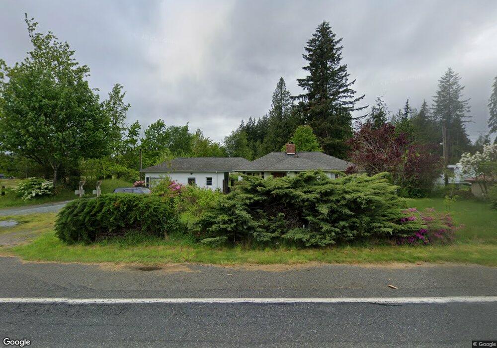
4804 State Route 9 Sedro Woolley, WA 98284
Estimated Value: $595,000 - $771,000
1
Bed
2
Baths
2,833
Sq Ft
$236/Sq Ft
Est. Value
About This Home
This home is located at 4804 State Route 9, Sedro Woolley, WA 98284 and is currently estimated at $667,882, approximately $235 per square foot. 4804 State Route 9 is a home located in Skagit County with nearby schools including Sedro-Woolley Senior High School.
Ownership History
Date
Name
Owned For
Owner Type
Purchase Details
Closed on
Apr 27, 2022
Sold by
Arentzen Kathleen A and Arentzen Russell A
Bought by
Grisham Jacob F and Grisham Caitlin E
Current Estimated Value
Home Financials for this Owner
Home Financials are based on the most recent Mortgage that was taken out on this home.
Original Mortgage
$468,000
Outstanding Balance
$441,105
Interest Rate
4.42%
Mortgage Type
New Conventional
Estimated Equity
$226,777
Purchase Details
Closed on
Dec 3, 2013
Sold by
Arentzen Kathleen
Bought by
Arentzen Kathleen A and Smith Russell A
Home Financials for this Owner
Home Financials are based on the most recent Mortgage that was taken out on this home.
Original Mortgage
$95,500
Interest Rate
4.08%
Create a Home Valuation Report for This Property
The Home Valuation Report is an in-depth analysis detailing your home's value as well as a comparison with similar homes in the area
Home Values in the Area
Average Home Value in this Area
Purchase History
| Date | Buyer | Sale Price | Title Company |
|---|---|---|---|
| Grisham Jacob F | -- | Chicago Title | |
| Arentzen Kathleen A | -- | Chicago Title |
Source: Public Records
Mortgage History
| Date | Status | Borrower | Loan Amount |
|---|---|---|---|
| Open | Grisham Jacob F | $468,000 | |
| Previous Owner | Arentzen Kathleen A | $95,500 |
Source: Public Records
Tax History Compared to Growth
Tax History
| Year | Tax Paid | Tax Assessment Tax Assessment Total Assessment is a certain percentage of the fair market value that is determined by local assessors to be the total taxable value of land and additions on the property. | Land | Improvement |
|---|---|---|---|---|
| 2024 | $4,804 | $545,100 | $355,100 | $190,000 |
| 2023 | $4,804 | $515,400 | $326,300 | $189,100 |
| 2022 | $1,152 | $483,800 | $303,600 | $180,200 |
| 2021 | $1,129 | $224,400 | $0 | $0 |
| 2020 | $1,122 | $215,300 | $0 | $0 |
| 2019 | $1,072 | $215,300 | $0 | $0 |
| 2018 | $1,185 | $218,300 | $0 | $0 |
| 2017 | $1,176 | $211,000 | $0 | $0 |
| 2016 | $1,202 | $214,500 | $135,400 | $79,100 |
| 2015 | $2,669 | $206,300 | $135,400 | $70,900 |
| 2013 | $2,547 | $191,500 | $0 | $0 |
Source: Public Records
Map
Nearby Homes
- 23404 Prairie Rd
- 4776 Prairie Ln
- 22484 Grip Rd
- 7311 State Route 9
- 6948 Howell Ln
- 22788 Grip Rd
- 7203 Erna Ln
- 0 262XX Helmick Rd
- 1537 E Gateway Heights Loop
- 5353 Wildlife Acres Ln
- 26204 Helmick Rd
- 20756 Prairie Rd
- 7654 Renic Dr
- 1479 W Gateway Heights Loop
- 1422 Porto Bello Ave
- 7514 Avalon Heights Way
- 7833 Renic Dr
- 918 Marie Place
- 7583 Avalon Heights Way
- 426 Longtime Ln
- 4501 Washington 9
- 4770 State Route 9
- 4824 State Route 9
- 4878 State Route 9
- 4694 State Route 9
- 4704 State Route 9
- 4628 State Route 9
- 4586 State Route 9
- 23850 Terrell Ln
- 23942 Thornwood Place
- 4558 State Route 9
- 24051 Mangat Lane Lot#1
- 5058 State Route 9
- 24071 Mangat Ln
- 24051 Mangat Ln
- 24105 Mangat Ln
- 24133 Mangat Ln
- 24159 Mangat Ln
- 5051 Aerie Ln
- 5047 Aerie Ln