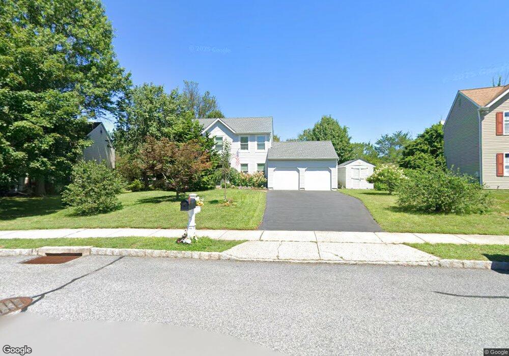
4806 Woodspring Dr Pipersville, PA 18947
Plumstead NeighborhoodEstimated Value: $551,823 - $638,000
4
Beds
3
Baths
1,810
Sq Ft
$337/Sq Ft
Est. Value
About This Home
This home is located at 4806 Woodspring Dr, Pipersville, PA 18947 and is currently estimated at $610,706, approximately $337 per square foot. 4806 Woodspring Dr is a home located in Bucks County with nearby schools including Groveland Elementary School, Tohickon Middle School, and Central Bucks High School-West.
Ownership History
Date
Name
Owned For
Owner Type
Purchase Details
Closed on
Oct 27, 2005
Sold by
Heller William M and Heller Joan E
Bought by
Hashkowitz Robert J and Hashkowitz Diane J
Current Estimated Value
Purchase Details
Closed on
Dec 28, 1993
Sold by
Cabin Run Ltd Partnership
Bought by
Heller William M and Heller Joan E
Home Financials for this Owner
Home Financials are based on the most recent Mortgage that was taken out on this home.
Original Mortgage
$146,250
Interest Rate
7.22%
Create a Home Valuation Report for This Property
The Home Valuation Report is an in-depth analysis detailing your home's value as well as a comparison with similar homes in the area
Home Values in the Area
Average Home Value in this Area
Purchase History
| Date | Buyer | Sale Price | Title Company |
|---|---|---|---|
| Hashkowitz Robert J | $408,500 | None Available | |
| Heller William M | -- | -- |
Source: Public Records
Mortgage History
| Date | Status | Borrower | Loan Amount |
|---|---|---|---|
| Previous Owner | Heller William M | $146,250 |
Source: Public Records
Tax History Compared to Growth
Tax History
| Year | Tax Paid | Tax Assessment Tax Assessment Total Assessment is a certain percentage of the fair market value that is determined by local assessors to be the total taxable value of land and additions on the property. | Land | Improvement |
|---|---|---|---|---|
| 2025 | $5,678 | $32,680 | $4,960 | $27,720 |
| 2024 | $5,678 | $32,680 | $4,960 | $27,720 |
| 2023 | $5,498 | $32,680 | $4,960 | $27,720 |
| 2022 | $5,436 | $32,680 | $4,960 | $27,720 |
| 2021 | $5,376 | $32,680 | $4,960 | $27,720 |
| 2020 | $5,376 | $32,680 | $4,960 | $27,720 |
| 2019 | $5,343 | $32,680 | $4,960 | $27,720 |
| 2018 | $5,343 | $32,680 | $4,960 | $27,720 |
| 2017 | $5,269 | $32,680 | $4,960 | $27,720 |
| 2016 | $5,269 | $32,680 | $4,960 | $27,720 |
| 2015 | -- | $32,680 | $4,960 | $27,720 |
| 2014 | -- | $32,680 | $4,960 | $27,720 |
Source: Public Records
Map
Nearby Homes
- 4811 Lincoln Aly
- 5068 Kratz Carriage Rd
- 5403 Stump Rd
- 4936 Curly Hill Rd
- 4000 Miriam Dr
- 1222 Hockley Dr
- 1214 Hockley Dr
- 5529 Geddes Way
- 204 Pennland Farm Dr
- 0 Old Durham Rd
- 0 Valley Park Rd
- 0 Old Easton Rd Unit PABU2095398
- 6398 Durham Rd
- 3789 Stump Rd
- 5090 Durham Rd
- 319 Pennington Way
- Lot 10 Schadle Rd
- 316 Schadle Rd
- 17 Ruhl Dr
- 81 Williams Dr
- 4808 Woodspring Dr
- 4804 Woodspring Dr
- 4809 Woodspring Dr
- 4802 Woodspring Dr
- 6089 High Meadow Dr
- 4801 Woodspring Dr
- 4811 Woodspring Dr
- 6079 High Meadow Dr
- 6091 High Meadow Dr
- 4815 Woodspring Dr
- 6190 Kellers Church Rd
- 6086 High Meadow Dr
- 4816 Woodspring Dr
- 6077 High Meadow Dr
- 6088 High Meadow Dr
- 6084 High Meadow Dr
- 6082 High Meadow Dr
- 6093 High Meadow Dr
- 4819 Woodspring Dr
- 6090 High Meadow Dr