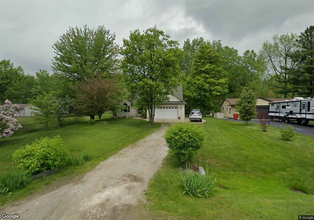
48067 Forbes Dr Chesterfield, MI 48047
Estimated Value: $342,000 - $463,000
4
Beds
3
Baths
2,346
Sq Ft
$173/Sq Ft
Est. Value
About This Home
This home is located at 48067 Forbes Dr, Chesterfield, MI 48047 and is currently estimated at $406,544, approximately $173 per square foot. 48067 Forbes Dr is a home with nearby schools including Dean A. Naldrett School, Anchor Bay Middle School South, and Anchor Bay High School.
Ownership History
Date
Name
Owned For
Owner Type
Purchase Details
Closed on
Oct 10, 1998
Sold by
Wheeler Mary J
Bought by
Buric John R
Current Estimated Value
Purchase Details
Closed on
Oct 12, 1994
Sold by
Walter M Wheeler
Bought by
Buric John R and Buric Yolanda P
Purchase Details
Closed on
Sep 15, 1994
Sold by
Leslie J Mcreynolds Est
Bought by
Buric John R and Buric Yolanda P
Create a Home Valuation Report for This Property
The Home Valuation Report is an in-depth analysis detailing your home's value as well as a comparison with similar homes in the area
Home Values in the Area
Average Home Value in this Area
Purchase History
| Date | Buyer | Sale Price | Title Company |
|---|---|---|---|
| Buric John R | $26,000 | -- | |
| Buric John R | $26,000 | -- | |
| Buric John R | -- | -- |
Source: Public Records
Mortgage History
| Date | Status | Borrower | Loan Amount |
|---|---|---|---|
| Closed | Buric John R | $0 |
Source: Public Records
Tax History Compared to Growth
Tax History
| Year | Tax Paid | Tax Assessment Tax Assessment Total Assessment is a certain percentage of the fair market value that is determined by local assessors to be the total taxable value of land and additions on the property. | Land | Improvement |
|---|---|---|---|---|
| 2025 | $4,880 | $211,700 | $0 | $0 |
| 2024 | $2,810 | $211,600 | $0 | $0 |
| 2023 | $2,663 | $210,000 | $0 | $0 |
| 2022 | $4,415 | $187,900 | $0 | $0 |
| 2021 | $4,141 | $182,900 | $0 | $0 |
| 2020 | $2,361 | $170,000 | $0 | $0 |
| 2019 | $3,670 | $162,600 | $0 | $0 |
| 2018 | $3,722 | $157,500 | $16,700 | $140,800 |
| 2017 | $3,678 | $146,100 | $16,700 | $129,400 |
| 2016 | $3,670 | $146,100 | $0 | $0 |
| 2015 | $1,705 | $129,350 | $0 | $0 |
| 2014 | $1,705 | $111,550 | $14,100 | $97,450 |
| 2012 | -- | $0 | $0 | $0 |
Source: Public Records
Map
Nearby Homes
- 48041 Sugarbush Rd
- 47812 Forbes Dr
- 47978 Jefferson Ave
- 50426 Jim Dr
- 47685 Jefferson Ave
- 50013 S Jimmy Ct
- 29705 Alexandra Ln Unit 13
- 29213 Rachid Ln
- 48526 Jefferson Ave
- 50218 N Benny Ct
- 28771 Squire Dr
- 50131 N Benny Ct
- 28734 Yarmouth Ct Unit 18
- 29371 Bayside Cir N
- 48556 Harbor Dr
- 28715 Portsmouth Ct Unit 32
- 48713 Chelmsford Ct Unit 127
- 48832 Birmingham Dr
- 47460 Sugarbush Rd
- 25200 23 Mile Rd
- 48075 Forbes Dr
- 48051 Forbes Dr
- 48085 Forbes St
- 48074 Forbes Dr
- 48055 Forbes St
- 48066 Forbes St
- 48043 Forbes Dr
- 48056 Forbes St
- 48101 Forbes Dr
- 48046 Forbes St
- 48036 Forbes Dr
- 48094 Forbes St
- 48084 Forbes Dr
- 48109 Forbes St
- 48102 Forbes Dr
- 48023 Forbes St
- 48027 Forbes Dr
- 48110 Forbes Dr
- 48117 Forbes Dr
- 48019 Forbes Dr