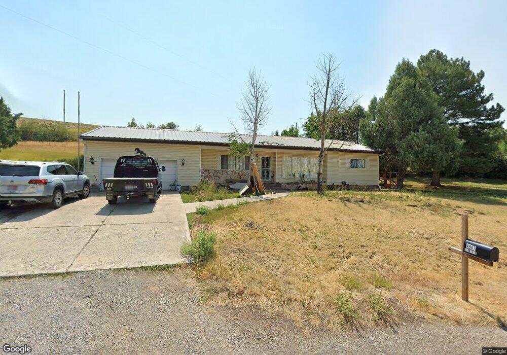
4807 E Highway 36 Preston, ID 83263
Estimated Value: $455,261 - $861,000
4
Beds
2
Baths
3,408
Sq Ft
$185/Sq Ft
Est. Value
About This Home
This home is located at 4807 E Highway 36, Preston, ID 83263 and is currently estimated at $629,065, approximately $184 per square foot. 4807 E Highway 36 is a home located in Franklin County with nearby schools including Oakwood Elementary School, Pioneer Elementary School, and Preston Junior High School.
Ownership History
Date
Name
Owned For
Owner Type
Purchase Details
Closed on
Apr 15, 2019
Sold by
Wylie Sandra Carol
Bought by
Devries Mack D and Devries Roxanna L
Current Estimated Value
Home Financials for this Owner
Home Financials are based on the most recent Mortgage that was taken out on this home.
Original Mortgage
$5,540
Outstanding Balance
$2,221
Interest Rate
4.4%
Mortgage Type
Stand Alone Second
Estimated Equity
$626,844
Create a Home Valuation Report for This Property
The Home Valuation Report is an in-depth analysis detailing your home's value as well as a comparison with similar homes in the area
Home Values in the Area
Average Home Value in this Area
Purchase History
| Date | Buyer | Sale Price | Title Company |
|---|---|---|---|
| Devries Mack D | -- | First American Title |
Source: Public Records
Mortgage History
| Date | Status | Borrower | Loan Amount |
|---|---|---|---|
| Open | Devries Mack D | $5,540 |
Source: Public Records
Tax History Compared to Growth
Tax History
| Year | Tax Paid | Tax Assessment Tax Assessment Total Assessment is a certain percentage of the fair market value that is determined by local assessors to be the total taxable value of land and additions on the property. | Land | Improvement |
|---|---|---|---|---|
| 2025 | $1,211 | $317,090 | $76,650 | $240,440 |
| 2024 | $1,211 | $317,090 | $76,650 | $240,440 |
| 2023 | $1,173 | $320,065 | $76,650 | $243,415 |
| 2022 | $1,113 | $256,498 | $39,800 | $216,698 |
| 2021 | $1,071 | $237,287 | $39,800 | $197,487 |
| 2019 | $1,028 | $183,909 | $39,800 | $144,109 |
| 2018 | $1,029 | $175,309 | $31,200 | $144,109 |
| 2017 | $946 | $149,037 | $31,200 | $117,837 |
| 2016 | $935 | $138,820 | $31,200 | $107,620 |
| 2015 | $461 | $138,820 | $31,200 | $107,620 |
| 2014 | $15,885 | $138,820 | $31,200 | $107,620 |
| 2013 | $13,988 | $146,110 | $31,200 | $114,910 |
Source: Public Records
Map
Nearby Homes
- 282 N 400 W
- 283 N 300 W
- 432 Tee Cir
- 174 N 400 W
- 233 N 300 W
- 8610 E Highway 36 S
- 263 N 300 W
- 5654 E Cub Rd
- 2900 E 2600 N Unit 7
- 2900 E 2600 N Unit 4 & 5
- 3020 Fords Bend
- 6810 E Highway 36 S
- 2901 E 2600 N Unit 5
- 1524 E 1800 S Unit 2
- 5000 N 3500 W
- 1000 W Mail Rte Rd N
- 3864 E Highway 36
- 0 Oneida Narrows Unit Lot WP001 15693240
- Parcel 61215 Bear River Ranch
- 7180 E Birch Creek Rd
- 4807 Idaho 36
- 4696 E Highway 36
- 4798 E Highway 36
- 4747 E Highway 36
- 4803 E Glencoe Rd
- 4564 E Highway 36
- 6644 E Cub Rd
- 1524 E 1800 S
- 273 N 300 W
- 2400 N 2800 E Unit 23
- 820 N Brookside Dr
- 302 E Eagle Way
- 812 N Brookside Dr
- 808 N Brookside Dr
- 827 N Brookside Dr
- 823 N Brookside Dr
- 819 N Brookside Dr
- 298 E Eagle Way
- 294 E Eagle Way
- 814 N Brookside Dr