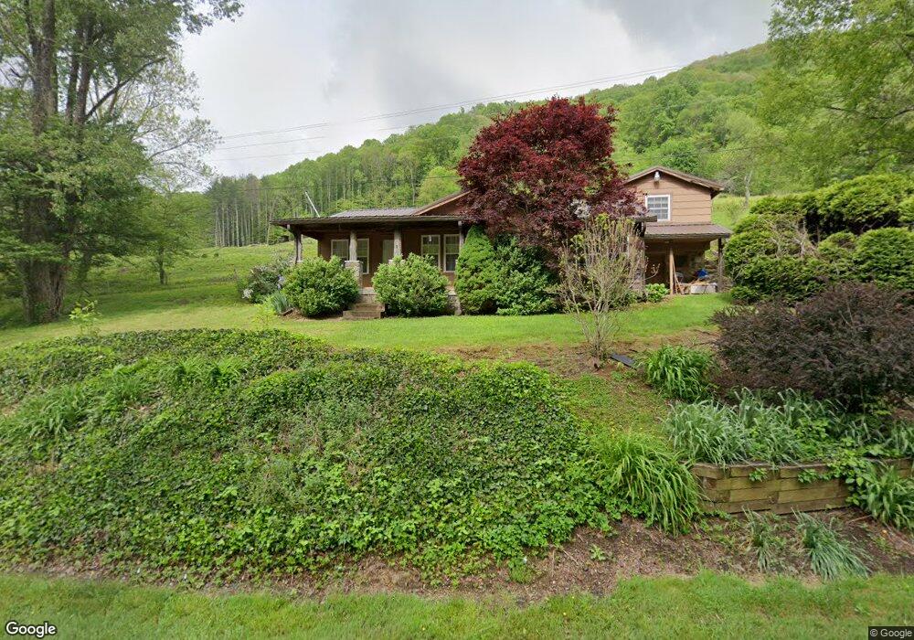
4807 N Us 19e Hwy Newland, NC 28657
Estimated Value: $192,227 - $249,000
4
Beds
2
Baths
1,100
Sq Ft
$206/Sq Ft
Est. Value
About This Home
This home is located at 4807 N Us 19e Hwy, Newland, NC 28657 and is currently estimated at $226,557, approximately $205 per square foot. 4807 N Us 19e Hwy is a home with nearby schools including Freedom Trail Elementary School, Cranberry Middle School, and Avery County High School.
Ownership History
Date
Name
Owned For
Owner Type
Purchase Details
Closed on
Jul 26, 2010
Sold by
Roland Andrew B and Roland Billie K
Bought by
Clement Donald and Clement Rebecca K
Current Estimated Value
Home Financials for this Owner
Home Financials are based on the most recent Mortgage that was taken out on this home.
Original Mortgage
$89,600
Outstanding Balance
$30,155
Interest Rate
4.61%
Mortgage Type
New Conventional
Estimated Equity
$196,402
Create a Home Valuation Report for This Property
The Home Valuation Report is an in-depth analysis detailing your home's value as well as a comparison with similar homes in the area
Home Values in the Area
Average Home Value in this Area
Purchase History
| Date | Buyer | Sale Price | Title Company |
|---|---|---|---|
| Clement Donald | $112,000 | None Available |
Source: Public Records
Mortgage History
| Date | Status | Borrower | Loan Amount |
|---|---|---|---|
| Open | Clement Donald | $89,600 |
Source: Public Records
Tax History Compared to Growth
Tax History
| Year | Tax Paid | Tax Assessment Tax Assessment Total Assessment is a certain percentage of the fair market value that is determined by local assessors to be the total taxable value of land and additions on the property. | Land | Improvement |
|---|---|---|---|---|
| 2024 | $400 | $100,000 | $9,700 | $90,300 |
| 2023 | $400 | $100,000 | $9,700 | $90,300 |
| 2022 | $400 | $100,000 | $9,700 | $90,300 |
| 2021 | $496 | $90,200 | $6,800 | $83,400 |
| 2020 | $496 | $90,200 | $6,800 | $83,400 |
| 2019 | $496 | $90,200 | $6,800 | $83,400 |
| 2018 | $496 | $90,200 | $6,800 | $83,400 |
| 2017 | $446 | $81,000 | $0 | $0 |
| 2016 | $362 | $81,000 | $0 | $0 |
| 2015 | $362 | $81,000 | $6,800 | $74,200 |
| 2012 | -- | $91,500 | $7,700 | $83,800 |
Source: Public Records
Map
Nearby Homes
- Lot 24 Jewel Weed
- 409 Jewel Weed Trail
- Lot 32 Jewel Weed Trail
- Lot 31 Jewel Weed Trail
- 331 May Apple Trail
- Lot 44 May Apple Trail
- TBD Jewel Weed Trail
- Lot14 Cranberry View
- Lot 39 May Apple Trail
- Lot 38 May Apple Trail
- tbd Poplar Dr
- 840 Brooks Shell Rd
- 370 Woodland Hills Dr Unit 44
- 370 Woodland Hills Dr
- 5023 Elk Park Hwy
- 3018 N Hwy Us 19 Hwy E
- 625 Mountain Glen Dr
- Lot C15 Autumnwood Trace
- tbd Bear Paw Unit 15
- tbd Bear Paw
- 4788 N Us 19e Hwy
- 4830 N Us 19e Hwy
- tbd Mayberry Hollow Ln
- xx Mayberry Hollow Ln
- 100 Mayberry Hollow Ln
- 5029 N Us 19e Hwy
- 142 Mayberry Hollow Ln
- 4545 N Us 19e Hwy
- 204 Alpine Dr
- 211 Tucker Hollow Rd
- 4127 U S 19e
- 4451 N Us 19e Hwy
- 283 Tucker Hollow Rd
- Lot 3 Alpine Dr
- 183 Tucker Hollow Rd
- 383 Tucker Hollow Rd
- 463 Tucker Hollow Rd
- TBD N Us 19e Hwy
- 161 Tucker Hollow Rd
- 298 Tucker Hollow Rd