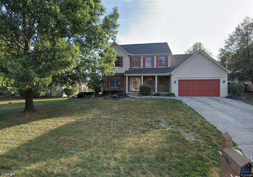
4807 Saint Andrews Cir Westerville, OH 43082
Genoa NeighborhoodEstimated Value: $542,803 - $626,000
4
Beds
3
Baths
2,532
Sq Ft
$227/Sq Ft
Est. Value
About This Home
This home is located at 4807 Saint Andrews Cir, Westerville, OH 43082 and is currently estimated at $573,951, approximately $226 per square foot. 4807 Saint Andrews Cir is a home located in Delaware County with nearby schools including Fouse Elementary School, Genoa Middle School, and Westerville Central High School.
Ownership History
Date
Name
Owned For
Owner Type
Purchase Details
Closed on
Aug 28, 2009
Sold by
Moore Jeffrey L
Bought by
Griffith Douglas L and Griffith Deena G
Current Estimated Value
Home Financials for this Owner
Home Financials are based on the most recent Mortgage that was taken out on this home.
Original Mortgage
$208,800
Interest Rate
5.28%
Mortgage Type
New Conventional
Create a Home Valuation Report for This Property
The Home Valuation Report is an in-depth analysis detailing your home's value as well as a comparison with similar homes in the area
Home Values in the Area
Average Home Value in this Area
Purchase History
| Date | Buyer | Sale Price | Title Company |
|---|---|---|---|
| Griffith Douglas L | $261,000 | Title Link |
Source: Public Records
Mortgage History
| Date | Status | Borrower | Loan Amount |
|---|---|---|---|
| Closed | Griffith Douglas L | $208,800 |
Source: Public Records
Tax History Compared to Growth
Tax History
| Year | Tax Paid | Tax Assessment Tax Assessment Total Assessment is a certain percentage of the fair market value that is determined by local assessors to be the total taxable value of land and additions on the property. | Land | Improvement |
|---|---|---|---|---|
| 2024 | $7,719 | $149,210 | $33,950 | $115,260 |
| 2023 | $7,566 | $149,210 | $33,950 | $115,260 |
| 2022 | $6,897 | $104,690 | $21,000 | $83,690 |
| 2021 | $6,966 | $104,690 | $21,000 | $83,690 |
| 2020 | $7,008 | $104,690 | $21,000 | $83,690 |
| 2019 | $6,770 | $97,090 | $21,000 | $76,090 |
| 2018 | $6,563 | $97,090 | $21,000 | $76,090 |
| 2017 | $6,313 | $85,930 | $18,480 | $67,450 |
| 2016 | $6,247 | $85,930 | $18,480 | $67,450 |
| 2015 | $6,197 | $85,930 | $18,480 | $67,450 |
| 2014 | $6,122 | $85,930 | $18,480 | $67,450 |
| 2013 | $5,901 | $83,340 | $18,480 | $64,860 |
Source: Public Records
Map
Nearby Homes
- 377 Westgreen Ln Unit 377
- 7373 Frasier Rd
- 7513 Africa Rd
- 5515 Stillwater Ave
- 5552 Quail Hollow Way
- 5633 Travis Pointe Ct
- 7697 Bale Kenyon Rd
- 705 N State St Unit 211
- 5259 Sorrento Ct
- 49 Village Green Dr
- 6573 Kenwood Place
- 6954 Lakeside Ct
- 4960 Hawthorne Valley Dr
- 543 N State St
- 449 Buckstone Place
- 160 Moss Rd
- 5532 Meadowood Ln
- 114 Canterbrick Dr
- 6394 Mission Hills Place
- 66 Abbeycross Ln
- 4819 Saint Andrews Cir
- 4840 Saint Andrews Dr
- 4868 Saint Andrews Dr
- 4845 Saint Andrews Cir
- 4882 Saint Andrews Dr
- 4816 Saint Andrews Cir
- 4806 Saint Andrews Cir
- 4681 Saint Andrews Cir
- 4810 Saint Andrews Cir
- 4800 Saint Andrews Dr
- 4877 Saint Andrews Cir
- 4861 Saint Andrews Dr
- 4822 Saint Andrews Cir
- 4909 Saint Andrews Cir
- 4879 Saint Andrews Dr
- 4834 Saint Andrews Cir
- 4931 Saint Andrews Cir
- 4833 Saint Andrews Dr
- 4782 Saint Andrews Cir
- 4856 Saint Andrews Cir