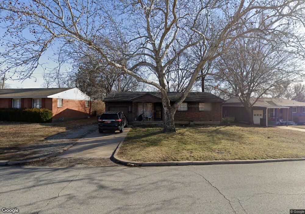
4808 E Frank Phillips Blvd Bartlesville, OK 74006
Estimated Value: $111,000 - $131,000
3
Beds
1
Bath
1,060
Sq Ft
$112/Sq Ft
Est. Value
About This Home
This home is located at 4808 E Frank Phillips Blvd, Bartlesville, OK 74006 and is currently estimated at $118,594, approximately $111 per square foot. 4808 E Frank Phillips Blvd is a home located in Washington County with nearby schools including Hoover Elementary School, Madison Middle School, and Bartlesville High School.
Ownership History
Date
Name
Owned For
Owner Type
Purchase Details
Closed on
Sep 5, 2008
Sold by
Hunt Richard K and Hunt Susan E
Bought by
Mckenzie Devin L
Current Estimated Value
Home Financials for this Owner
Home Financials are based on the most recent Mortgage that was taken out on this home.
Original Mortgage
$65,324
Outstanding Balance
$43,563
Interest Rate
6.66%
Mortgage Type
FHA
Estimated Equity
$75,031
Purchase Details
Closed on
Nov 16, 2004
Sold by
Hunt Marshall D Trust Richard K Hu
Create a Home Valuation Report for This Property
The Home Valuation Report is an in-depth analysis detailing your home's value as well as a comparison with similar homes in the area
Home Values in the Area
Average Home Value in this Area
Purchase History
| Date | Buyer | Sale Price | Title Company |
|---|---|---|---|
| Mckenzie Devin L | $66,500 | None Available | |
| -- | -- | -- |
Source: Public Records
Mortgage History
| Date | Status | Borrower | Loan Amount |
|---|---|---|---|
| Open | Mckenzie Devin L | $65,324 |
Source: Public Records
Tax History
| Year | Tax Paid | Tax Assessment Tax Assessment Total Assessment is a certain percentage of the fair market value that is determined by local assessors to be the total taxable value of land and additions on the property. | Land | Improvement |
|---|---|---|---|---|
| 2025 | $947 | $8,890 | $1,020 | $7,870 |
| 2024 | $916 | $8,631 | $1,020 | $7,611 |
| 2023 | $916 | $8,380 | $1,020 | $7,360 |
| 2022 | $884 | $8,380 | $1,020 | $7,360 |
| 2021 | $866 | $8,380 | $1,020 | $7,360 |
| 2020 | $867 | $8,218 | $1,020 | $7,198 |
| 2019 | $838 | $7,979 | $1,020 | $6,959 |
| 2018 | $807 | $7,755 | $1,020 | $6,735 |
| 2017 | $799 | $7,529 | $1,020 | $6,509 |
| 2016 | $750 | $7,529 | $1,020 | $6,509 |
| 2015 | $814 | $7,979 | $527 | $7,452 |
| 2014 | $811 | $7,979 | $527 | $7,452 |
Source: Public Records
Map
Nearby Homes
- 4709 Amherst Dr
- 543 SE Wilshire Ave
- 4507 E Frank Phillips Blvd
- 5012 Allen Ct
- 1001 May Ln
- 919 Terri Dr
- 0 E Frank Phillips Blvd Unit 2608484
- 1045 Rolling Meadows Ct
- 1037 Meadow Dr
- 0 SE Adams Rd Unit 2606810
- 320 SE Greystone Ave
- 4610 Rolling Meadows Rd
- 1030 East Dr
- 1115 Grandview Rd
- 4008 State St
- 1309 Harned Dr
- 1307 S Madison Blvd
- 1324 Lariat Dr
- 5712 Hazel Rd
- 6413 Belmont Rd
- 4804 E Frank Phillips Blvd
- 4904 E Frank Phillips Blvd
- 4908 E Frank Phillips Blvd
- 5121 Harvard Dr
- 4756 E Frank Phillips Blvd
- 5125 Harvard Dr
- 4748 Baylor Dr
- 5117 Harvard Dr
- 4749 Baylor Dr
- 4905 E Frank Phillips Blvd
- 4912 E Frank Phillips Blvd
- 4744 Baylor Dr
- 4749 Amherst Dr
- 4752 E Frank Phillips Blvd
- 5113 Harvard Dr
- 5129 Harvard Dr
- 4909 E Frank Phillips Blvd
- 4916 E Frank Phillips Blvd
- 4740 Baylor Dr
- 5109 Harvard Dr
Your Personal Tour Guide
Ask me questions while you tour the home.