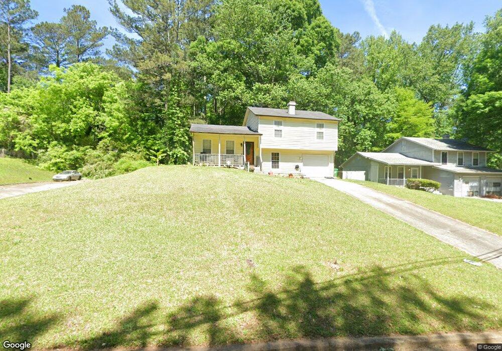
4808 White Oak Path Unit 1 Stone Mountain, GA 30088
Estimated Value: $192,227 - $214,000
2
Beds
2
Baths
1,344
Sq Ft
$151/Sq Ft
Est. Value
About This Home
This home is located at 4808 White Oak Path Unit 1, Stone Mountain, GA 30088 and is currently estimated at $202,307, approximately $150 per square foot. 4808 White Oak Path Unit 1 is a home located in DeKalb County with nearby schools including Woodridge Elementary School, Miller Grove Middle School, and Miller Grove High School.
Ownership History
Date
Name
Owned For
Owner Type
Purchase Details
Closed on
Aug 12, 1998
Sold by
Shover Paulette
Bought by
Mcbean Collin and Mcbean Kren
Current Estimated Value
Home Financials for this Owner
Home Financials are based on the most recent Mortgage that was taken out on this home.
Original Mortgage
$75,552
Outstanding Balance
$15,354
Interest Rate
6.92%
Mortgage Type
FHA
Estimated Equity
$186,953
Create a Home Valuation Report for This Property
The Home Valuation Report is an in-depth analysis detailing your home's value as well as a comparison with similar homes in the area
Home Values in the Area
Average Home Value in this Area
Purchase History
| Date | Buyer | Sale Price | Title Company |
|---|---|---|---|
| Mcbean Collin | $77,000 | -- |
Source: Public Records
Mortgage History
| Date | Status | Borrower | Loan Amount |
|---|---|---|---|
| Open | Mcbean Collin | $75,552 |
Source: Public Records
Tax History Compared to Growth
Tax History
| Year | Tax Paid | Tax Assessment Tax Assessment Total Assessment is a certain percentage of the fair market value that is determined by local assessors to be the total taxable value of land and additions on the property. | Land | Improvement |
|---|---|---|---|---|
| 2025 | $2,335 | $81,440 | $14,000 | $67,440 |
| 2024 | $2,437 | $83,760 | $14,000 | $69,760 |
| 2023 | $2,437 | $84,400 | $14,000 | $70,400 |
| 2022 | $1,742 | $57,040 | $4,040 | $53,000 |
| 2021 | $1,317 | $39,760 | $4,040 | $35,720 |
| 2020 | $1,178 | $35,600 | $4,040 | $31,560 |
| 2019 | $1,308 | $39,720 | $4,040 | $35,680 |
| 2018 | $851 | $31,680 | $4,040 | $27,640 |
| 2017 | $876 | $26,400 | $4,040 | $22,360 |
| 2016 | $832 | $25,680 | $4,040 | $21,640 |
| 2014 | $424 | $13,560 | $4,040 | $9,520 |
Source: Public Records
Map
Nearby Homes
- 4831 Oak Path
- 4734 White Oak Trail
- 1248 Tyne Way Unit 1
- 1337 S Hairston Rd
- 1491 S Hairston Rd
- 1512 S Hairston Rd
- 1323 S Hairston Rd
- 1246 Adcox Square
- 4909 Woodhurst Way
- 4641 Wendover Dr Unit 1
- 1559 Fieldgreen Overlook
- 4821 Mainstreet Valley Trace
- 4817 Mainstreet Valley Trace
- 4927 Millstone Walk
- 4605 Mercer Rd
- 4981 Millstone Walk
- 1139 Mainstreet Valley Dr
- 1126 Mainstreet Valley Dr
- 1215 Sheppard Place
- 4962 Redan Rd
- 4798 White Oak Path Unit 1
- 4818 White Oak Path
- 4817 White Oak Path Unit 1
- 4811 White Oak Path
- 4811 White Oak Path
- 4792 White Oak Path
- 4824 White Oak Path
- 4821 White Oak Path Unit 1
- 4805 White Oak Path Unit 1
- 4823 White Oak Path
- 4786 White Oak Path Unit 1
- 4799 White Oak Path
- 4832 White Oak Trail
- 4838 White Oak Trail
- 4826 White Oak Trail
- 4782 White Oak Path
- 4822 White Oak Trail
- 4816 White Oak Trail
- 4789 White Oak Path
- 4812 White Oak Trail