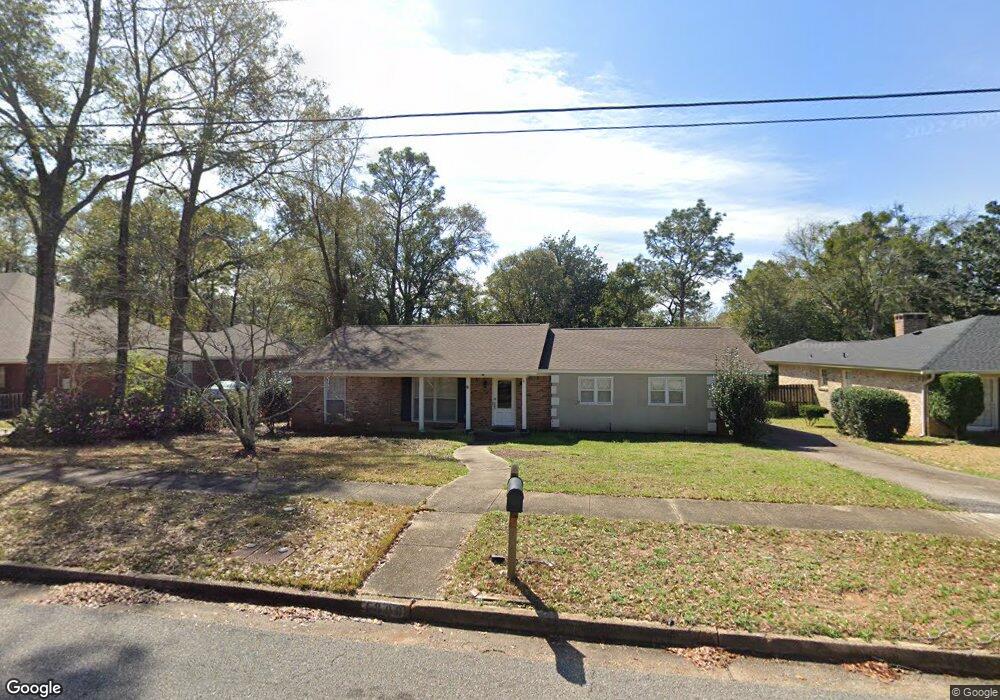
4809 Janice Dr Mobile, AL 36618
Bellewood NeighborhoodEstimated Value: $194,000 - $225,000
3
Beds
2
Baths
2,069
Sq Ft
$99/Sq Ft
Est. Value
About This Home
This home is located at 4809 Janice Dr, Mobile, AL 36618 and is currently estimated at $204,009, approximately $98 per square foot. 4809 Janice Dr is a home located in Mobile County with nearby schools including Forest Hill Elementary School, CL Scarborough Middle School, and Mattie T Blount High School.
Ownership History
Date
Name
Owned For
Owner Type
Purchase Details
Closed on
Apr 20, 2010
Sold by
Powell Richard B
Bought by
Bernardo Joseph John
Current Estimated Value
Home Financials for this Owner
Home Financials are based on the most recent Mortgage that was taken out on this home.
Original Mortgage
$134,425
Outstanding Balance
$88,213
Interest Rate
4.94%
Mortgage Type
New Conventional
Estimated Equity
$115,796
Purchase Details
Closed on
Mar 29, 2005
Sold by
Persaud Vicki Mayo and Persaud Sewah
Bought by
Mims Edith S and Powell Richard B
Home Financials for this Owner
Home Financials are based on the most recent Mortgage that was taken out on this home.
Original Mortgage
$113,600
Interest Rate
5.62%
Mortgage Type
Unknown
Purchase Details
Closed on
Oct 1, 2001
Sold by
Miller Robert Joseph and Miller Mary Alice Womack
Bought by
Persaud Sewah and Persaud Vicki Mayo
Home Financials for this Owner
Home Financials are based on the most recent Mortgage that was taken out on this home.
Original Mortgage
$125,100
Interest Rate
6.89%
Create a Home Valuation Report for This Property
The Home Valuation Report is an in-depth analysis detailing your home's value as well as a comparison with similar homes in the area
Home Values in the Area
Average Home Value in this Area
Purchase History
| Date | Buyer | Sale Price | Title Company |
|---|---|---|---|
| Bernardo Joseph John | $141,925 | Alt | |
| Mims Edith S | $142,000 | -- | |
| Persaud Sewah | $139,000 | Surety Land Title Inc |
Source: Public Records
Mortgage History
| Date | Status | Borrower | Loan Amount |
|---|---|---|---|
| Open | Bernardo Joseph John | $134,425 | |
| Previous Owner | Mims Edith S | $113,600 | |
| Previous Owner | Persaud Sewah | $125,100 |
Source: Public Records
Tax History
| Year | Tax Paid | Tax Assessment Tax Assessment Total Assessment is a certain percentage of the fair market value that is determined by local assessors to be the total taxable value of land and additions on the property. | Land | Improvement |
|---|---|---|---|---|
| 2025 | $996 | $16,570 | $3,500 | $13,070 |
| 2024 | $996 | $15,830 | $3,500 | $12,330 |
| 2023 | $949 | $14,720 | $3,300 | $11,420 |
| 2022 | $814 | $13,870 | $3,000 | $10,870 |
| 2021 | $805 | $13,730 | $3,000 | $10,730 |
| 2020 | $805 | $13,730 | $3,000 | $10,730 |
| 2019 | $839 | $14,260 | $0 | $0 |
| 2018 | $839 | $14,260 | $0 | $0 |
| 2017 | $839 | $14,260 | $0 | $0 |
| 2016 | $518 | $9,220 | $0 | $0 |
| 2013 | $860 | $14,480 | $0 | $0 |
Source: Public Records
Map
Nearby Homes
- 4719 Oxford Dr
- 4724 Tulane Dr
- 4924 Brooke Ct
- 1204 Baylor Dr
- 1124 Forest Glen Dr N
- 1221 Garland St
- 4636 Saint Charles Ct
- 5055 Overlook Rd
- 1409 Forest Dale Dr
- 1121 Stevens Ln
- 1553 Phillips Ln
- 4900 Leruth Rd
- 949 Knowles Ln
- 1100 Bristol Ct
- 1724 Sandalwood Dr
- 0 N University Blvd Unit 21441346
- 0 N University Blvd Unit 11675117
- 1701 Crestwood Dr
- 1401 Forest Ridge Rd E
- 1701 Phillips Ln
- 4813 Janice Dr
- 4801 Janice Dr
- 4817 Janice Dr
- 1205 Forest Hill Dr
- 4812 Oxford Dr
- 4818 Oxford Dr
- 4821 Janice Dr
- 4808 Janice Dr
- 1201 Forest Hill Dr
- 4804 Janice Dr
- 4816 Janice Dr
- 4820 Oxford Dr
- 0 Oxford Dr Unit 1C 0526013
- 0 Oxford Dr Unit 1C
- 4825 Janice Dr
- 4822 Oxford Dr
- 4824 Janice Dr
- 4820 Janice Dr
- 1163 Forest Hill Dr
- 0 Janice Dr
Your Personal Tour Guide
Ask me questions while you tour the home.