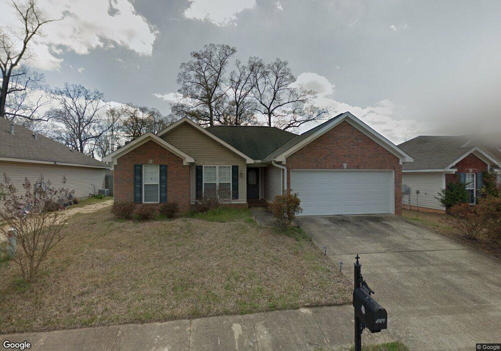
4809 Stewart Parc Dr Northport, AL 35473
Estimated Value: $215,000 - $248,000
3
Beds
2
Baths
1,397
Sq Ft
$170/Sq Ft
Est. Value
About This Home
This home is located at 4809 Stewart Parc Dr, Northport, AL 35473 and is currently estimated at $237,989, approximately $170 per square foot. 4809 Stewart Parc Dr is a home located in Tuscaloosa County with nearby schools including Crestmont Elementary School, Echols Middle School, and Tuscaloosa County High School.
Ownership History
Date
Name
Owned For
Owner Type
Purchase Details
Closed on
Apr 18, 2007
Sold by
Todd Jason
Bought by
Smith Phillip E
Current Estimated Value
Home Financials for this Owner
Home Financials are based on the most recent Mortgage that was taken out on this home.
Original Mortgage
$142,907
Outstanding Balance
$86,168
Interest Rate
6.1%
Mortgage Type
VA
Estimated Equity
$151,822
Create a Home Valuation Report for This Property
The Home Valuation Report is an in-depth analysis detailing your home's value as well as a comparison with similar homes in the area
Home Values in the Area
Average Home Value in this Area
Purchase History
| Date | Buyer | Sale Price | Title Company |
|---|---|---|---|
| Smith Phillip E | $142,907 | -- |
Source: Public Records
Mortgage History
| Date | Status | Borrower | Loan Amount |
|---|---|---|---|
| Open | Smith Phillip E | $142,907 |
Source: Public Records
Tax History Compared to Growth
Tax History
| Year | Tax Paid | Tax Assessment Tax Assessment Total Assessment is a certain percentage of the fair market value that is determined by local assessors to be the total taxable value of land and additions on the property. | Land | Improvement |
|---|---|---|---|---|
| 2024 | $1,601 | $41,580 | $6,000 | $35,580 |
| 2023 | $1,601 | $42,040 | $6,000 | $36,040 |
| 2022 | $1,545 | $40,120 | $6,000 | $34,120 |
| 2021 | $1,427 | $37,060 | $6,000 | $31,060 |
| 2020 | $1,389 | $36,080 | $6,000 | $30,080 |
| 2019 | $1,247 | $32,380 | $6,000 | $26,380 |
| 2018 | $1,311 | $34,060 | $6,000 | $28,060 |
| 2017 | $1,123 | $0 | $0 | $0 |
| 2016 | $1,120 | $0 | $0 | $0 |
| 2015 | $1,120 | $0 | $0 | $0 |
| 2014 | $1,082 | $28,100 | $5,000 | $23,100 |
Source: Public Records
Map
Nearby Homes
- 5120 Stewart Parc Dr
- 4922 Allums Ave
- 4801 Boh Ave
- 5118 Azalea Trail
- 5206 Azalea Trail
- 4531 White Dogwood Ln
- 5211 Briarcliff Dr
- 5203 Candlewood Dr
- 5204 Applewood Dr
- 4115 Malvern Hill Dr
- 4007 Savanah St
- 4810 Oak Way
- 5100 Oak Way
- 4600 Oak Way
- 4605 Oak Way
- 5213 Oak Way
- 0 Tulip Tree Ln
- 4517 Bluestem Ln
- 3906 Silver Maple Dr
- 6115 Ashbury Ln
- 4907 Stewart Parc Dr
- 4805 Stewart Parc Dr
- 4806 Highway 43 N
- 4927 Allums Ave
- 4812 Stewart Parc Dr
- 4923 Allums Ave
- 4816 Stewart Parc Dr
- 4808 Stewart Parc Dr
- 4825 Allums Ave
- 4906 Stewart Parc Dr
- 4804 Stewart Parc Dr
- 4821 Allums Ave
- 4910 Stewart Parc Dr
- 0 Allums Ave
- 4817 Allums Ave
- 4914 Stewart Parc Dr
- 4813 Allums Ave
- 4918 Stewart Parc Dr
- 4824 Allums Ave
- 4820 Allums Ave