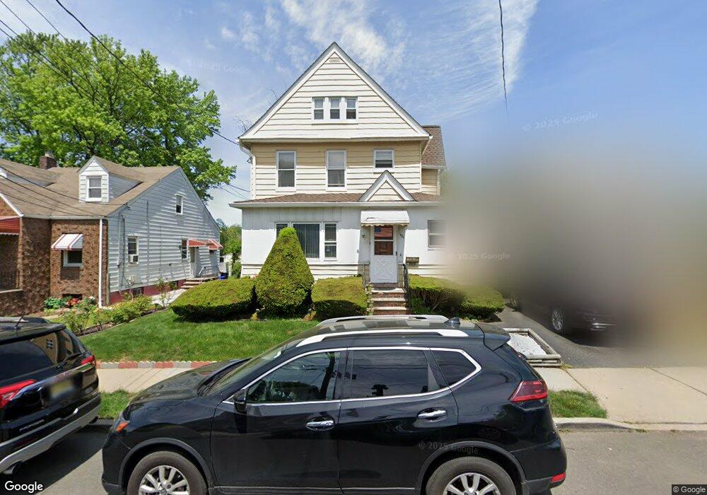
481 Aldene Rd Roselle, NJ 07203
Estimated Value: $446,640 - $567,000
Studio
--
Bath
1,635
Sq Ft
$301/Sq Ft
Est. Value
About This Home
This home is located at 481 Aldene Rd, Roselle, NJ 07203 and is currently estimated at $492,160, approximately $301 per square foot. 481 Aldene Rd is a home located in Union County with nearby schools including Washington Elementary School, Leonard V. Moore Middle School, and Grace Wilday Junior High School.
Ownership History
Date
Name
Owned For
Owner Type
Purchase Details
Closed on
Aug 16, 2023
Sold by
Crews John W and Crews Patricia
Bought by
481 Aldene Road Llc
Current Estimated Value
Home Financials for this Owner
Home Financials are based on the most recent Mortgage that was taken out on this home.
Original Mortgage
$399,000
Outstanding Balance
$389,857
Interest Rate
6.78%
Mortgage Type
Construction
Estimated Equity
$102,303
Create a Home Valuation Report for This Property
The Home Valuation Report is an in-depth analysis detailing your home's value as well as a comparison with similar homes in the area
Home Values in the Area
Average Home Value in this Area
Purchase History
| Date | Buyer | Sale Price | Title Company |
|---|---|---|---|
| 481 Aldene Road Llc | $410,000 | First American Title | |
| 481 Aldene Road Llc | $410,000 | First American Title |
Source: Public Records
Mortgage History
| Date | Status | Borrower | Loan Amount |
|---|---|---|---|
| Open | 481 Aldene Road Llc | $399,000 | |
| Closed | 481 Aldene Road Llc | $399,000 |
Source: Public Records
Tax History
| Year | Tax Paid | Tax Assessment Tax Assessment Total Assessment is a certain percentage of the fair market value that is determined by local assessors to be the total taxable value of land and additions on the property. | Land | Improvement |
|---|---|---|---|---|
| 2025 | $10,938 | $125,800 | $62,000 | $63,800 |
| 2024 | $10,664 | $125,800 | $62,000 | $63,800 |
| 2023 | $10,664 | $125,800 | $62,000 | $63,800 |
| 2022 | $10,738 | $125,800 | $62,000 | $63,800 |
| 2021 | $10,674 | $125,800 | $62,000 | $63,800 |
| 2020 | $10,640 | $125,800 | $62,000 | $63,800 |
| 2019 | $10,504 | $125,800 | $62,000 | $63,800 |
| 2018 | $10,446 | $125,800 | $62,000 | $63,800 |
| 2017 | $10,391 | $125,800 | $62,000 | $63,800 |
| 2016 | $10,162 | $125,800 | $62,000 | $63,800 |
| 2015 | $10,161 | $125,800 | $62,000 | $63,800 |
| 2014 | $9,878 | $125,800 | $62,000 | $63,800 |
Source: Public Records
Map
Nearby Homes
Your Personal Tour Guide
Ask me questions while you tour the home.