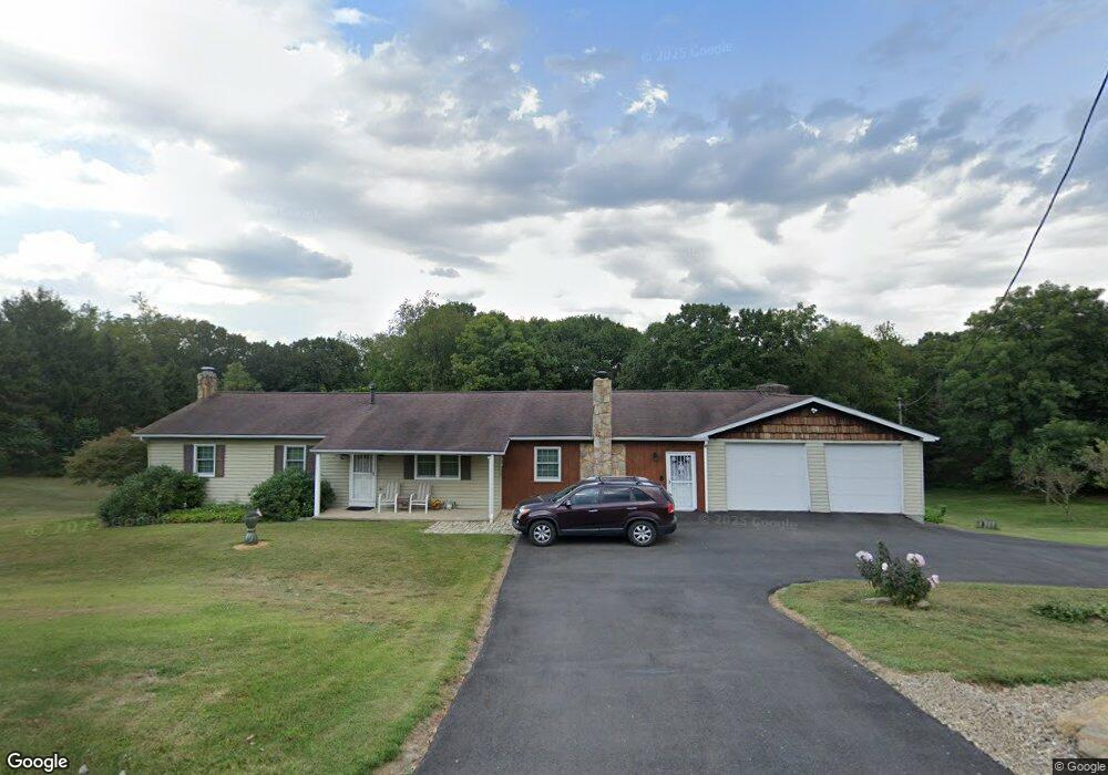
481 Baker Rd Freedom, PA 15042
New Sewickley Township NeighborhoodEstimated Value: $358,419 - $435,000
3
Beds
2
Baths
1,904
Sq Ft
$207/Sq Ft
Est. Value
About This Home
This home is located at 481 Baker Rd, Freedom, PA 15042 and is currently estimated at $394,855, approximately $207 per square foot. 481 Baker Rd is a home located in Beaver County with nearby schools including Freedom Area Elementary School, Freedom Area Middle School, and Freedom Area Senior High School.
Ownership History
Date
Name
Owned For
Owner Type
Purchase Details
Closed on
Oct 29, 2012
Sold by
Uhernik John E and Uhernik Linda M
Bought by
Uhernik John E and Uhernik Linda M
Current Estimated Value
Create a Home Valuation Report for This Property
The Home Valuation Report is an in-depth analysis detailing your home's value as well as a comparison with similar homes in the area
Home Values in the Area
Average Home Value in this Area
Purchase History
| Date | Buyer | Sale Price | Title Company |
|---|---|---|---|
| Uhernik John E | -- | None Available |
Source: Public Records
Tax History Compared to Growth
Tax History
| Year | Tax Paid | Tax Assessment Tax Assessment Total Assessment is a certain percentage of the fair market value that is determined by local assessors to be the total taxable value of land and additions on the property. | Land | Improvement |
|---|---|---|---|---|
| 2025 | $1,278 | $174,100 | $24,300 | $149,800 |
| 2024 | $5,265 | $174,100 | $24,300 | $149,800 |
| 2023 | $3,444 | $31,200 | $5,750 | $25,450 |
| 2022 | $3,398 | $31,200 | $5,750 | $25,450 |
| 2021 | $3,398 | $31,200 | $5,750 | $25,450 |
| 2020 | $3,145 | $31,200 | $5,750 | $25,450 |
| 2019 | $3,145 | $31,200 | $5,750 | $25,450 |
| 2018 | $2,980 | $31,200 | $5,750 | $25,450 |
| 2017 | $2,980 | $31,200 | $5,750 | $25,450 |
| 2016 | $2,749 | $31,200 | $5,750 | $25,450 |
| 2015 | $693 | $31,200 | $5,750 | $25,450 |
| 2014 | $693 | $31,200 | $5,750 | $25,450 |
Source: Public Records
Map
Nearby Homes
- 261 Patriot Ln
- 00 Freedom Crider Rd
- 613 Old Glory Ln
- 334 Patriot Ln
- 553 Pioneer Ln Unit 188
- 237 Patriot Ln
- 235 Patriot Ln
- 221 Patriot Ln
- 135 Pinehurst Dr
- 331 Rolling Hills Rd
- 325 Sunridge Dr
- 44 Concord Cir
- 936 McElhaney Rd
- 250 Constellation Dr
- 300 Moonridge Dr
- 195 Fezell Rd
- 615 Nova Dr
- 135 Paul St
- 146 Graham Dr
- Freedom Crider Rd
