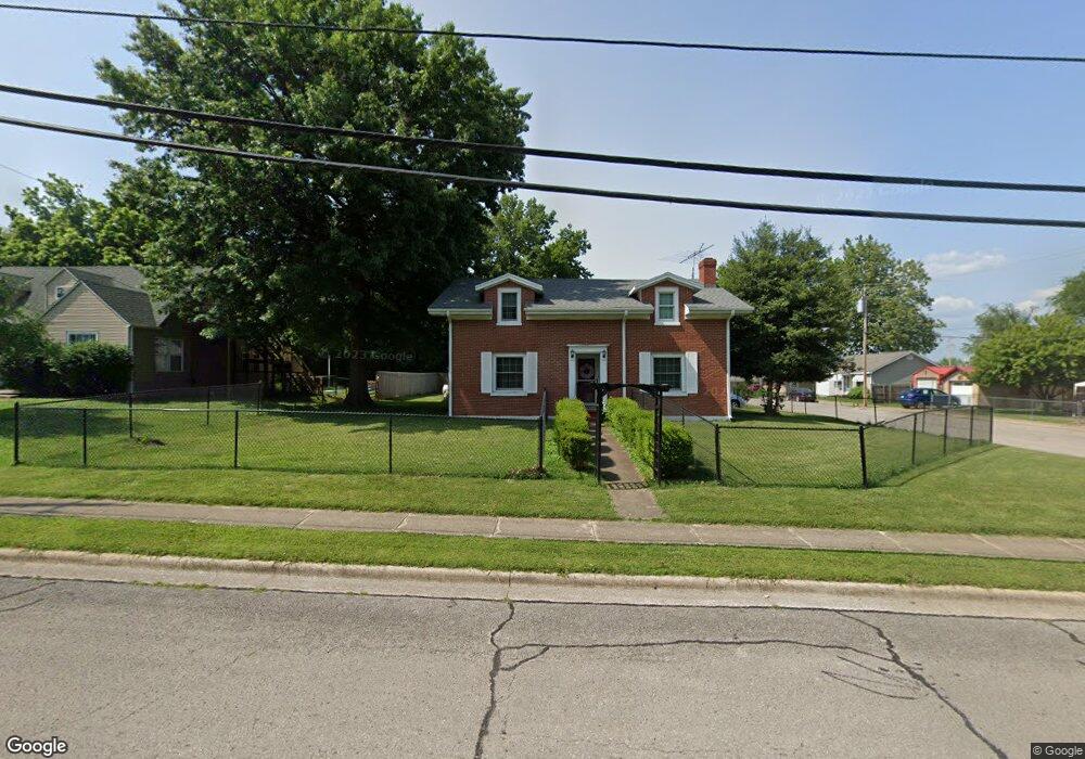
481 Bland Ave Lebanon, MO 65536
Estimated Value: $158,000 - $236,000
5
Beds
--
Bath
2,885
Sq Ft
$67/Sq Ft
Est. Value
About This Home
This home is located at 481 Bland Ave, Lebanon, MO 65536 and is currently estimated at $194,456, approximately $67 per square foot. 481 Bland Ave is a home located in Laclede County with nearby schools including Joe D. Esther Elementary School, Boswell Elementary School, and Maplecrest Elementary School.
Ownership History
Date
Name
Owned For
Owner Type
Purchase Details
Closed on
Dec 12, 2023
Sold by
Seeley Michael L and Seeley Pamela C
Bought by
Michael L Seeley And Pamela C Seeley Revocabl and Seeley
Current Estimated Value
Purchase Details
Closed on
Jun 30, 2006
Sold by
Darnell Charles E
Bought by
Seeley Michael L and Seeley Pamela C
Home Financials for this Owner
Home Financials are based on the most recent Mortgage that was taken out on this home.
Original Mortgage
$80,000
Interest Rate
6.58%
Mortgage Type
New Conventional
Create a Home Valuation Report for This Property
The Home Valuation Report is an in-depth analysis detailing your home's value as well as a comparison with similar homes in the area
Home Values in the Area
Average Home Value in this Area
Purchase History
| Date | Buyer | Sale Price | Title Company |
|---|---|---|---|
| Michael L Seeley And Pamela C Seeley Revocabl | -- | None Listed On Document | |
| Seeley Michael L | -- | None Available |
Source: Public Records
Mortgage History
| Date | Status | Borrower | Loan Amount |
|---|---|---|---|
| Previous Owner | Seeley Michael L | $80,000 |
Source: Public Records
Tax History Compared to Growth
Tax History
| Year | Tax Paid | Tax Assessment Tax Assessment Total Assessment is a certain percentage of the fair market value that is determined by local assessors to be the total taxable value of land and additions on the property. | Land | Improvement |
|---|---|---|---|---|
| 2025 | $752 | $17,590 | $0 | $0 |
| 2024 | $752 | $15,710 | $0 | $0 |
| 2023 | $778 | $13,240 | $0 | $0 |
| 2022 | $725 | $13,240 | $0 | $0 |
| 2021 | $798 | $13,243 | $1,577 | $11,666 |
| 2020 | $802 | $13,243 | $1,577 | $11,666 |
| 2019 | $768 | $13,250 | $1,580 | $11,670 |
| 2018 | $721 | $13,250 | $1,580 | $11,670 |
| 2017 | $684 | $13,240 | $0 | $0 |
| 2016 | $684 | $13,240 | $0 | $0 |
| 2015 | $684 | $13,240 | $0 | $0 |
| 2014 | $684 | $13,240 | $0 | $0 |
| 2013 | -- | $13,240 | $0 | $0 |
Source: Public Records
Map
Nearby Homes
- 0 County Rd 64-152 N A
- 169 Grand Ave
- 377 Lincoln Ave
- 540 Pearl St
- 440 Railroad Ave
- 411 South St
- 480 Center Ave
- 371 N Washington Ave
- Lot 20 Missouri 64
- 1719 State Hwy 64
- 015 Missouri 64
- Lot 19 Missouri 64
- Lot 18 Missouri 64
- Lot 17 Missouri 64
- 014 Missouri 64
- 016 Missouri 64
- 757 S Adams Ave
- 957 Wood St
- 233 N Park Manor Blvd
- 466 Lynn St
- 467 Bland Ave
- 175 Minkler Ave
- 511 Bland Ave
- 533 Bland Ave
- 155 Minkler Ave
- 174 Minkler Ave
- 170 Morris St
- 480 Bland Ave
- 450 Bland Ave
- 490 Bland Ave
- 575 Bland Ave
- 150 Morris St
- 150 Morris Ave Unit A & B
- 150 Morris St Unit A & B
- 179 Lenz Minkler Ave
- 530 Bland Ave
- 488 Millcreek Rd
- 410 Bland Ave
- 585 Bland Ave
- 550 Bland Ave