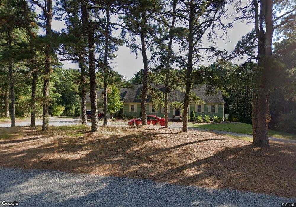
481 Cotuit Bay Dr Cotuit, MA 02635
Cotuit NeighborhoodEstimated Value: $1,250,282
About This Home
This home is located at 481 Cotuit Bay Dr, Cotuit, MA 02635 and is currently priced at $1,250,282, approximately $568 per square foot. 481 Cotuit Bay Dr is a home located in Barnstable County.
Ownership History
We collect this data history from publicly available records. To have your information removed, we recommend requesting removal directly through your county’s website.
Purchase Details
Purchase Details
Home Values in the Area
Average Home Value in this Area
Purchase History
We collect this data history from publicly available records. To have your information removed, we recommend requesting removal directly through your county’s website.
| Date | Buyer | Sale Price | Title Company |
|---|---|---|---|
| $294,000 | -- | ||
| $294,000 | -- | ||
| $300,000 | -- |
Mortgage History
We collect this data history from publicly available records. To have your information removed, we recommend requesting removal directly through your county’s website.
| Date | Status | Borrower | Loan Amount |
|---|---|---|---|
| Open | $256,000 | ||
| Closed | $179,165 | ||
| Closed | $260,311 | ||
| Previous Owner | $267,000 |
Tax History
We collect this data history from publicly available records. To have your information removed, we recommend requesting removal directly through your county’s website.
| Year | Tax Paid | Tax Assessment Tax Assessment Total Assessment is a certain percentage of the fair market value that is determined by local assessors to be the total taxable value of land and additions on the property. | Land | Improvement |
|---|---|---|---|---|
| 2025 | $8,367 | $1,002,000 | $300,300 | $701,700 |
| 2024 | $7,618 | $966,800 | $300,300 | $666,500 |
| 2023 | $7,446 | $889,600 | $297,100 | $592,500 |
| 2022 | $7,174 | $693,800 | $190,500 | $503,300 |
| 2021 | $2,767 | $642,400 | $202,400 | $440,000 |
| 2020 | $7,688 | $656,500 | $228,400 | $428,100 |
| 2019 | $1,447 | $625,500 | $241,000 | $384,500 |
| 2018 | $2,470 | $580,600 | $240,300 | $340,300 |
| 2017 | $6,760 | $572,900 | $247,100 | $325,800 |
| 2016 | $6,669 | $579,400 | $253,600 | $325,800 |
| 2015 | $6,197 | $537,900 | $235,700 | $302,200 |
Map
- 174 Little River Rd
- 102 Waterford Dr
- 205 Little River Rd
- 71 Sand Point
- 359 Baxter Neck Rd
- 375 Baxters Neck Rd
- 476 Baxters Neck Rd
- 23 Prudence Ln
- 25 Oyster Way
- 25 Oyster Way
- 280 Ice Valley Rd
- 46 Great Bay Rd
- 93 Oyster Way
- 552 Main St
- 16 Pine View Dr
- 140 Seapuit Rd
- 179 Pineleigh Path
- 34 Farm Valley Rd
- 440 Grand Island Dr
- 33 Oyster Place Rd
- 465 Cotuit Bay Dr
- 36 Forsyth Ct
- 501 Cotuit Bay Dr
- 468 Cotuit Bay Dr
- 46 Forsyth Ct
- 490 Cotuit Bay Dr
- 451 Cotuit Bay Dr
- 24 Forsyth Ct
- 508 Cotuit Bay Dr
- 448 Cotuit Bay Dr
- 44 Eaton Ct
- 525 Cotuit Bay Dr
- 59 Forsyth Ct
- 38 Eaton Ct
- 33 Amanda Ct
- 437 Cotuit Bay Dr
- 520 Cotuit Bay Dr
- 12 Forsyth Ct
- 21 Amanda Ct
- 55 Forsyth Ct
Ask me questions while you tour the home.