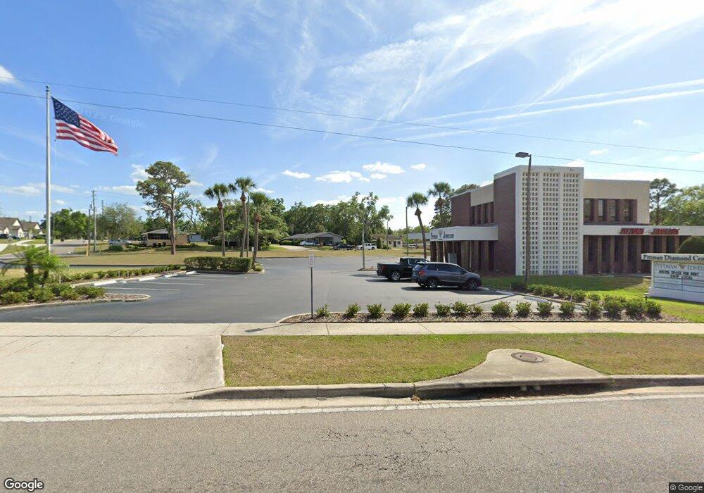
481 E Highway 50 Unit 101 Clermont, FL 34711
Studio
3
Baths
5,472
Sq Ft
79,628
Sq Ft Lot
About This Home
This home is located at 481 E Highway 50 Unit 101, Clermont, FL 34711. 481 E Highway 50 Unit 101 is a home located in Lake County with nearby schools including Aurelia Cole Academy, East Ridge High School, and Wesley Christian Academy.
Ownership History
Date
Name
Owned For
Owner Type
Purchase Details
Closed on
Apr 16, 2014
Sold by
State Of Florida
Bought by
Pittco Llc
Purchase Details
Closed on
Apr 1, 2011
Sold by
Thompson Susan L and Thompson Robert D
Bought by
Lake Investment Group Llc
Home Financials for this Owner
Home Financials are based on the most recent Mortgage that was taken out on this home.
Original Mortgage
$325,000
Interest Rate
4.92%
Mortgage Type
Future Advance Clause Open End Mortgage
Purchase Details
Closed on
Dec 2, 2010
Sold by
Federal Deposit Insurance Corporation
Bought by
Thompson Robert D and Thompson Susan L
Create a Home Valuation Report for This Property
The Home Valuation Report is an in-depth analysis detailing your home's value as well as a comparison with similar homes in the area
Purchase History
| Date | Buyer | Sale Price | Title Company |
|---|---|---|---|
| Pittco Llc | -- | None Available | |
| Pittco Llc | -- | None Available | |
| Lake Investment Group Llc | -- | Attorney | |
| Lake Investment Group Llc | -- | Attorney | |
| Thompson Robert D | $250,000 | Attorney | |
| Thompson Robert D | $250,000 | Attorney |
Source: Public Records
Mortgage History
| Date | Status | Borrower | Loan Amount |
|---|---|---|---|
| Previous Owner | Lake Investment Group Llc | $325,000 |
Source: Public Records
Tax History
| Year | Tax Paid | Tax Assessment Tax Assessment Total Assessment is a certain percentage of the fair market value that is determined by local assessors to be the total taxable value of land and additions on the property. | Land | Improvement |
|---|---|---|---|---|
| 2026 | $17,720 | $1,085,963 | $637,564 | $448,399 |
| 2025 | $16,389 | $1,073,518 | $637,564 | $435,954 |
| 2024 | $16,389 | $1,062,032 | $637,564 | $424,468 |
| 2023 | $16,389 | $970,617 | $579,643 | $390,974 |
| 2022 | $14,840 | $862,486 | $526,948 | $335,538 |
| 2021 | $13,051 | $770,096 | $0 | $0 |
| 2020 | $13,129 | $768,874 | $0 | $0 |
| 2019 | $13,112 | $744,829 | $0 | $0 |
| 2018 | $11,584 | $655,822 | $0 | $0 |
| 2017 | $10,944 | $616,232 | $0 | $0 |
| 2016 | $10,432 | $576,641 | $0 | $0 |
| 2015 | $10,484 | $562,091 | $0 | $0 |
| 2014 | $9,841 | $537,224 | $0 | $0 |
Source: Public Records
Map
Nearby Homes
- 191 Sunnyside Dr
- 220 E Desoto St Unit 4
- 1219 East Ave
- 110 W Minnehaha Ave
- 0 East Ave Unit MFRG5095417
- 1347 East Ave
- 0 E Minneola Ave
- 660 Shady Nook Dr
- 550 Disston Ave
- 627 Anderson St
- 1654 East Ave
- 245 W Magnolia St
- 1841 Moorings Ct
- 1828 Moorings Ct
- 754 Pine Ln
- 747 Roane Rd
- 748 Oak Dr
- 1825 Moorings Ct Unit Lot 14
- 747/749 Pitt St
- 190 Crystal Lake Dr
- 481 E Highway 50 Unit 201
- 440 Almond St
- 477 E Highway 50
- 442 Almond St
- 424 Almond St
- 1312 Disston Ave
- 1309 Anderson St
- 0000 State Route 50
- 1291 Disston Ave
- 1319 Anderson St
- 1150 Anderson St
- 1150 Anderson St Unit A
- 1293 Disston Ave
- 1335 Disston Ave Unit B
- 1335 Disston Ave Unit A
- 1335 Disston Ave
- 1140 Anderson St
- 1258 Anderson St
- 501 Almond St
- 375 E Highway 50
Your Personal Tour Guide
Ask me questions while you tour the home.