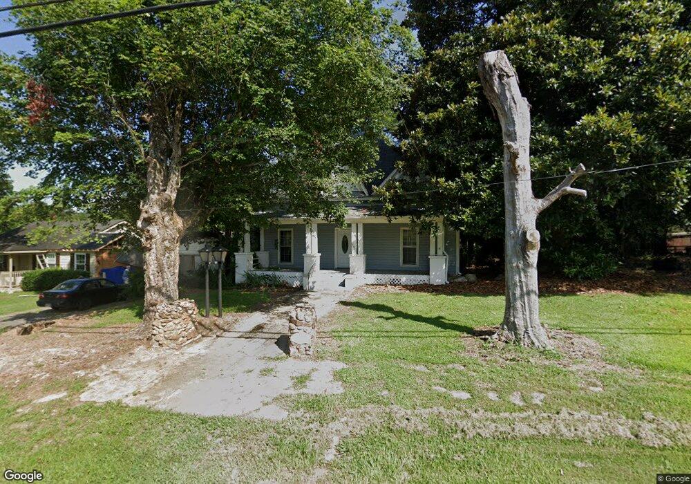
481 Main St Suwanee, GA 30024
Estimated Value: $341,000 - $454,000
2
Beds
1
Bath
1,332
Sq Ft
$301/Sq Ft
Est. Value
About This Home
This home is located at 481 Main St, Suwanee, GA 30024 and is currently estimated at $400,275, approximately $300 per square foot. 481 Main St is a home located in Gwinnett County with nearby schools including Roberts Elementary School, North Gwinnett Middle School, and North Gwinnett High School.
Ownership History
Date
Name
Owned For
Owner Type
Purchase Details
Closed on
Jul 12, 2023
Sold by
Paxton Matt
Bought by
Rohloff Catherine D and Rohloff Robert D
Current Estimated Value
Purchase Details
Closed on
Jan 31, 2022
Sold by
Townsend Edward M
Bought by
Rohloff Robert D and Rohloff Catherine D
Purchase Details
Closed on
Jun 25, 2021
Sold by
Maddox Keith B
Bought by
Townsend Edward M and Keystone Southeast Properties
Create a Home Valuation Report for This Property
The Home Valuation Report is an in-depth analysis detailing your home's value as well as a comparison with similar homes in the area
Home Values in the Area
Average Home Value in this Area
Purchase History
| Date | Buyer | Sale Price | Title Company |
|---|---|---|---|
| Rohloff Catherine D | $425,000 | -- | |
| Rohloff Robert D | $362,375 | -- | |
| Paxton Matt | $366,575 | -- | |
| Townsend Edward M | $410,000 | -- |
Source: Public Records
Tax History
| Year | Tax Paid | Tax Assessment Tax Assessment Total Assessment is a certain percentage of the fair market value that is determined by local assessors to be the total taxable value of land and additions on the property. | Land | Improvement |
|---|---|---|---|---|
| 2025 | -- | $69,320 | $28,000 | $41,320 |
| 2024 | $2,218 | $69,320 | $28,000 | $41,320 |
| 2023 | $2,218 | $69,320 | $28,000 | $41,320 |
| 2022 | $2,175 | $56,320 | $20,920 | $35,400 |
| 2021 | $1,614 | $56,320 | $20,920 | $35,400 |
| 2020 | $1,628 | $56,320 | $20,920 | $35,400 |
| 2019 | $1,387 | $58,080 | $17,160 | $40,920 |
| 2018 | $1,395 | $58,080 | $17,160 | $40,920 |
| 2016 | $1,401 | $58,080 | $17,160 | $40,920 |
| 2015 | $1,411 | $58,080 | $17,160 | $40,920 |
| 2014 | -- | $53,080 | $22,760 | $30,320 |
Source: Public Records
Map
Nearby Homes
- 0 Mary Lou St Unit 7445497
- 0 Mary Lou St Unit 10365827
- 557 Cypher Dr
- 3656 Chicago St
- 3930 Charleston Market St Unit 221
- 3941 Savannah Square St
- 3971 Savannah Square St
- 3843 Suwanee Green Pkwy
- 220 Suwanee Ave
- 228 Suwanee Ave
- 224 Suwanee Ave
- 216 Suwanee Ave
- 212 Suwanee Ave
- 3779 Lawrenceville Suwanee
- 821 Scales Rd
- 704 Urban Grange Way
- 255 Sims Park Place
- 0 Mohawk Trail Unit 7688155
- 0 Mohawk Trail Unit 10652266
- 722 Urban Grange Way
Your Personal Tour Guide
Ask me questions while you tour the home.