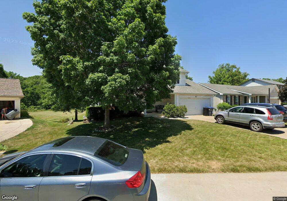
481 Prentice Dr Saint Peters, MO 63376
Estimated Value: $337,000 - $413,000
4
Beds
3
Baths
1,996
Sq Ft
$187/Sq Ft
Est. Value
About This Home
This home is located at 481 Prentice Dr, Saint Peters, MO 63376 and is currently estimated at $373,071, approximately $186 per square foot. 481 Prentice Dr is a home located in St. Charles County with nearby schools including Progress South Elementary School, Fort Zumwalt South Middle School, and Fort Zumwalt South High School.
Ownership History
Date
Name
Owned For
Owner Type
Purchase Details
Closed on
Feb 11, 2022
Sold by
Carnes Michael J and Carnes Anne Leigh
Bought by
Michael J Carnes Revocable Trust and Leigh A Carnes Revocable Trust
Current Estimated Value
Home Financials for this Owner
Home Financials are based on the most recent Mortgage that was taken out on this home.
Original Mortgage
$160,720
Outstanding Balance
$124,959
Interest Rate
2.77%
Mortgage Type
New Conventional
Estimated Equity
$248,112
Purchase Details
Closed on
Nov 6, 1998
Sold by
Donald E Meyer Real Estate Co
Bought by
Carnes Michael J and Carnes Leigh Anne
Home Financials for this Owner
Home Financials are based on the most recent Mortgage that was taken out on this home.
Original Mortgage
$96,600
Interest Rate
6.92%
Purchase Details
Closed on
Jul 1, 1998
Sold by
Marut John A Linda S and Countrywide Funding Corp
Bought by
Donald E Meyer Real Estate Company
Create a Home Valuation Report for This Property
The Home Valuation Report is an in-depth analysis detailing your home's value as well as a comparison with similar homes in the area
Home Values in the Area
Average Home Value in this Area
Purchase History
| Date | Buyer | Sale Price | Title Company |
|---|---|---|---|
| Michael J Carnes Revocable Trust | -- | Investors Title | |
| Carnes Michael J | $122,300 | -- | |
| Donald E Meyer Real Estate Company | $94,505 | -- |
Source: Public Records
Mortgage History
| Date | Status | Borrower | Loan Amount |
|---|---|---|---|
| Open | Michael J Carnes Revocable Trust | $160,720 | |
| Previous Owner | Carnes Michael J | $96,600 |
Source: Public Records
Tax History
| Year | Tax Paid | Tax Assessment Tax Assessment Total Assessment is a certain percentage of the fair market value that is determined by local assessors to be the total taxable value of land and additions on the property. | Land | Improvement |
|---|---|---|---|---|
| 2025 | $4,337 | $67,815 | -- | -- |
| 2023 | $4,339 | $65,636 | $0 | $0 |
| 2022 | $3,217 | $45,147 | $0 | $0 |
| 2021 | $3,219 | $45,147 | $0 | $0 |
| 2020 | $2,944 | $39,985 | $0 | $0 |
| 2019 | $2,951 | $39,985 | $0 | $0 |
| 2018 | $2,672 | $34,547 | $0 | $0 |
| 2017 | $2,635 | $34,547 | $0 | $0 |
| 2016 | $2,441 | $31,869 | $0 | $0 |
| 2015 | $2,269 | $31,869 | $0 | $0 |
| 2014 | $2,137 | $29,516 | $0 | $0 |
Source: Public Records
Map
Nearby Homes
- 12 Belleau Lake Ct
- 9 Schrader Farm Ct
- 111 Barrington Dr
- 366 Strawberry Grove Dr
- 369 Strawberry Grove Dr
- Franklin Plan at Strawberry Farms - Liberty Series
- Hamilton II Plan at Strawberry Farms - Liberty Series
- Adams Plan at Strawberry Farms - Liberty Series
- Washington Plan at Strawberry Farms - Liberty Series
- Madison Plan at Strawberry Farms - Liberty Series
- 169 Blue Water Dr
- 830 Whispering Rock Dr
- 1678 Belleau Wood Dr
- 79 Four Winds Dr
- 107 Twelve Oaks Dr Unit 1D
- 23 Wild Deer Ln
- 8 Archers Ct
- 17 Trade Winds Dr
- 41 Pheasant Ring Dr
- 39 Huntsman Trail
- 479 Prentice Dr
- 483 Prentice Dr
- 477 Prentice Dr
- 480 Prentice Dr
- 485 Prentice Dr
- 478 Prentice Dr
- 488 Prentice Dr
- 475 Prentice Dr
- 489 Prentice Dr
- 7 Questover Ct
- 476 Prentice Dr
- 9 Questover Ct
- 2 Tamerton Ct
- 4 Tamerton Ct
- 5 Questover Ct
- 6 Tamerton Ct
- 473 Prentice Dr
- 800 Tamerton Place
- 3 Questover Ct
- 11 Questover Ct