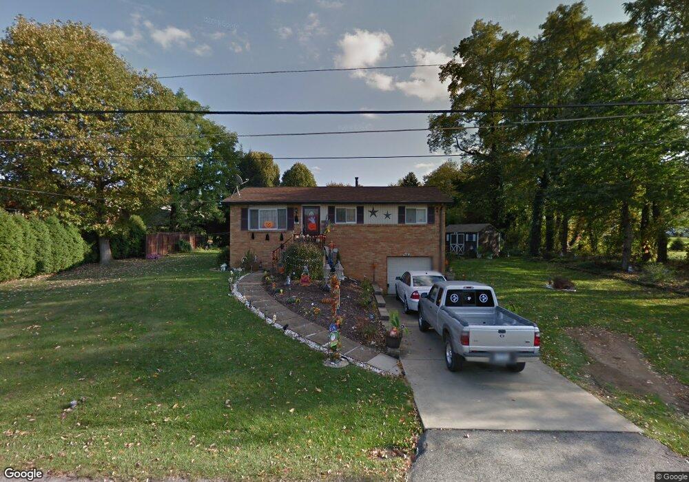
481 Schultz Ave Latrobe, PA 15650
Estimated Value: $59,236 - $193,000
Studio
--
Bath
--
Sq Ft
10,019
Sq Ft Lot
About This Home
This home is located at 481 Schultz Ave, Latrobe, PA 15650 and is currently estimated at $140,309. 481 Schultz Ave is a home located in Westmoreland County with nearby schools including Christ the Divine Teacher School and Grace Bible Academy.
Ownership History
Date
Name
Owned For
Owner Type
Purchase Details
Closed on
Aug 1, 2007
Sold by
King Williametta Y
Bought by
Shaffer Patricia L
Current Estimated Value
Home Financials for this Owner
Home Financials are based on the most recent Mortgage that was taken out on this home.
Original Mortgage
$104,077
Outstanding Balance
$66,065
Interest Rate
6.71%
Mortgage Type
FHA
Estimated Equity
$74,244
Create a Home Valuation Report for This Property
The Home Valuation Report is an in-depth analysis detailing your home's value as well as a comparison with similar homes in the area
Home Values in the Area
Average Home Value in this Area
Purchase History
| Date | Buyer | Sale Price | Title Company |
|---|---|---|---|
| Shaffer Patricia L | $104,900 | None Available |
Source: Public Records
Mortgage History
| Date | Status | Borrower | Loan Amount |
|---|---|---|---|
| Open | Shaffer Patricia L | $104,077 |
Source: Public Records
Tax History
| Year | Tax Paid | Tax Assessment Tax Assessment Total Assessment is a certain percentage of the fair market value that is determined by local assessors to be the total taxable value of land and additions on the property. | Land | Improvement |
|---|---|---|---|---|
| 2025 | $1,764 | $14,190 | $2,730 | $11,460 |
| 2024 | $1,764 | $14,190 | $2,730 | $11,460 |
| 2023 | $1,664 | $14,190 | $2,730 | $11,460 |
| 2022 | $1,650 | $14,190 | $2,730 | $11,460 |
| 2021 | $1,650 | $14,190 | $2,730 | $11,460 |
| 2020 | $1,622 | $14,190 | $2,730 | $11,460 |
| 2019 | $1,586 | $14,190 | $2,730 | $11,460 |
| 2018 | $1,515 | $14,190 | $2,730 | $11,460 |
| 2017 | $1,476 | $14,190 | $2,730 | $11,460 |
| 2016 | $1,412 | $14,190 | $2,730 | $11,460 |
| 2015 | $1,412 | $14,190 | $2,730 | $11,460 |
| 2014 | $1,412 | $14,190 | $2,730 | $11,460 |
Source: Public Records
Map
Nearby Homes
- 485 Schultz Ave
- 2409 Jodi Ave
- 471 Schultz Ave
- 2414 Locust St
- 472 Schultz Ave
- 484 Schultz Ave
- 484 Schultz Ave
- 2410 Jodi Ave
- 2404 Jodi Ave
- 2402 Jodi Ave
- 488 Schultz Ave
- 488 Schultz Ave
- 2421 Jodi Ave
- 460 Schultz Ave
- 2416 Jodi Ave
- 457 Schultz Ave
- 2411 Locust St
- 2425 Jodi Ave
- 2424 Locust St
- 2424 Jodi Ave
Your Personal Tour Guide
Ask me questions while you tour the home.