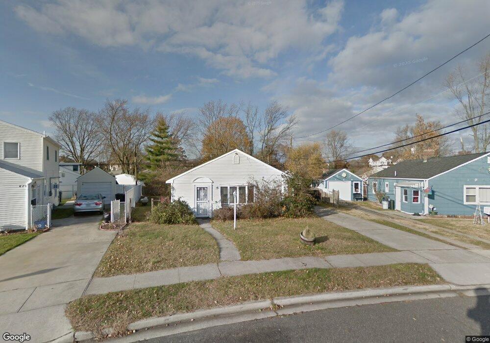
481 Sunnybrook Dr Oceanside, NY 11572
Estimated Value: $670,524 - $725,000
Studio
1
Bath
1,232
Sq Ft
$566/Sq Ft
Est. Value
About This Home
This home is located at 481 Sunnybrook Dr, Oceanside, NY 11572 and is currently estimated at $697,762, approximately $566 per square foot. 481 Sunnybrook Dr is a home located in Nassau County with nearby schools including Oaks Elementary School - School 3, Oceanside Middle School, and Oceanside High School.
Ownership History
Date
Name
Owned For
Owner Type
Purchase Details
Closed on
Oct 15, 2020
Sold by
Moussavi Seyed A
Bought by
Oliveri Mario J and Oliveri Barbara J
Current Estimated Value
Home Financials for this Owner
Home Financials are based on the most recent Mortgage that was taken out on this home.
Original Mortgage
$292,200
Outstanding Balance
$259,423
Interest Rate
2.8%
Mortgage Type
New Conventional
Estimated Equity
$438,339
Purchase Details
Closed on
Feb 24, 2020
Sold by
Becker Kenneth A
Bought by
Moussavi Seyed A
Home Financials for this Owner
Home Financials are based on the most recent Mortgage that was taken out on this home.
Original Mortgage
$210,000
Interest Rate
3.6%
Mortgage Type
New Conventional
Purchase Details
Closed on
Sep 12, 2008
Sold by
Becker Donald and Becker Kenneth A
Bought by
Becker Kenneth A
Create a Home Valuation Report for This Property
The Home Valuation Report is an in-depth analysis detailing your home's value as well as a comparison with similar homes in the area
Home Values in the Area
Average Home Value in this Area
Purchase History
| Date | Buyer | Sale Price | Title Company |
|---|---|---|---|
| Oliveri Mario J | $505,000 | Amtrust Title | |
| Moussavi Seyed A | $270,000 | None Available | |
| Becker Kenneth A | $172,500 | Attorney |
Source: Public Records
Mortgage History
| Date | Status | Borrower | Loan Amount |
|---|---|---|---|
| Open | Oliveri Mario J | $292,200 | |
| Previous Owner | Moussavi Seyed A | $210,000 |
Source: Public Records
Tax History
| Year | Tax Paid | Tax Assessment Tax Assessment Total Assessment is a certain percentage of the fair market value that is determined by local assessors to be the total taxable value of land and additions on the property. | Land | Improvement |
|---|---|---|---|---|
| 2025 | $11,929 | $458 | $205 | $253 |
| 2024 | $3,555 | $458 | $205 | $253 |
Source: Public Records
Map
Nearby Homes
- 25 Sunnybrook Dr E
- 2941 Moreland Ave
- 30 Gifford Ave
- 2860 Lenox Rd
- 3354 Knight St
- 2730 Remsen St
- 613 Smith Place
- 3195 Nantucket Ln
- 2910 Yale Place
- 647 Lincoln St
- 704 Barnes Ave
- 2929 Yale Place
- 222 Chance Dr
- 3432 Bayfield Blvd
- 2778 King St
- 2860 Nicole Ct
- 3483 Frederick St
- 689 Arlington Ave
- 2962 Grand Ave
- 2847 Grand Ave
- 481 Sunnybrook Dr W
- 475 Sunnybrook Dr W
- 475 Sunnybrook Dr
- 493 Sunnybrook Dr
- 2987 Fortesque Ave
- 2840 Sunnybrook Dr W
- 2993 Fortesque Ave
- 2991 Fortesque Ave
- 21 Sunnybrook Dr W
- 499 Sunnybrook Dr
- 2999 Fortesque Ave
- 496 Sunnybrook Dr
- 514 Derby Dr S
- 2846 Sunnybrook Dr W
- 10 Sunnybrook Dr
- 2983 Fortesque Ave
- 3005 Fortesque Ave
- 2976 Derby Dr W
- 2861 Sunnybrook Dr W
- 518 Derby Dr S
Your Personal Tour Guide
Ask me questions while you tour the home.