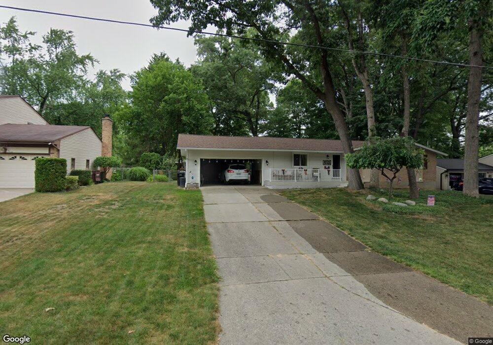
4810 Brookgate Dr NW Comstock Park, MI 49321
Estimated Value: $306,000 - $345,000
2
Beds
2
Baths
1,208
Sq Ft
$269/Sq Ft
Est. Value
About This Home
This home is located at 4810 Brookgate Dr NW, Comstock Park, MI 49321 and is currently estimated at $324,883, approximately $268 per square foot. 4810 Brookgate Dr NW is a home located in Kent County with nearby schools including Stoney Creek Elementary School, Pine Island Elementary School, and Mill Creek Middle School.
Ownership History
Date
Name
Owned For
Owner Type
Purchase Details
Closed on
Aug 16, 2022
Sold by
Arthur Berg Donald and Roselynne Cheryl
Bought by
Berg Donald Arthur and Berg Cheryl Roselynne
Current Estimated Value
Purchase Details
Closed on
Jun 16, 2022
Sold by
Arthur Berg Donald and Roselynne Cheryl
Bought by
Donald Arthur Berg Trust
Purchase Details
Closed on
Jun 12, 1987
Bought by
Berg D and Berg Donald A
Purchase Details
Closed on
May 1, 1979
Purchase Details
Closed on
May 1, 1978
Create a Home Valuation Report for This Property
The Home Valuation Report is an in-depth analysis detailing your home's value as well as a comparison with similar homes in the area
Home Values in the Area
Average Home Value in this Area
Purchase History
| Date | Buyer | Sale Price | Title Company |
|---|---|---|---|
| Berg Donald Arthur | -- | -- | |
| Donald Arthur Berg Trust | -- | -- | |
| Berg D | $65,000 | -- | |
| -- | $46,000 | -- | |
| -- | $39,000 | -- |
Source: Public Records
Tax History Compared to Growth
Tax History
| Year | Tax Paid | Tax Assessment Tax Assessment Total Assessment is a certain percentage of the fair market value that is determined by local assessors to be the total taxable value of land and additions on the property. | Land | Improvement |
|---|---|---|---|---|
| 2025 | $1,944 | $137,300 | $0 | $0 |
| 2024 | $1,944 | $121,700 | $0 | $0 |
| 2023 | $1,791 | $109,300 | $0 | $0 |
| 2022 | $2,251 | $87,600 | $0 | $0 |
| 2021 | $2,197 | $83,600 | $0 | $0 |
| 2020 | $1,645 | $77,400 | $0 | $0 |
| 2019 | $1,971 | $66,800 | $0 | $0 |
| 2018 | $1,933 | $66,800 | $0 | $0 |
| 2017 | $1,879 | $61,900 | $0 | $0 |
| 2016 | $1,821 | $58,000 | $0 | $0 |
| 2015 | -- | $58,000 | $0 | $0 |
| 2013 | -- | $50,800 | $0 | $0 |
Source: Public Records
Map
Nearby Homes
- 4893 Stony Creek Ave NW
- 33 Star Gazer Ln NE
- 4678 Westshire Dr NW
- 452 Springfield St NW
- 4581 Westshire Dr NW
- 72 6 Mile Rd NE
- 681 Strawberry Valley Ave NW Unit 7
- 510 Clark St NW
- 4154 Woodrush Ln NW Unit 65
- 996 Scioto Dr NW Unit 1
- 5090 Wakefield Ave NE
- Wilshire Plan at The Range
- Remington Plan at The Range
- Linden Plan at The Range
- Enclave Plan at The Range
- Croswell Plan at The Range
- Cascade Plan at The Range
- Carson Plan at The Range
- Avery Plan at The Range
- Ashton Plan at The Range
- 4800 Brookgate Dr NW
- 4820 Brookgate Dr NW
- 4837 Stony Creek Ave NW
- 4849 Stony Creek Ave NW
- 4815 Brookgate Dr NW
- 4825 Stony Creek Ave NW
- 4830 Brookgate Dr NW
- 4774 Brookgate Dr NW
- 4805 Brookgate Dr NW
- 4861 Stony Creek Ave NW
- 4825 Brookgate Dr NW
- 4813 Stony Creek Ave NW
- 4835 Brookgate Dr NW
- 4795 Brookgate Dr NW
- 4840 Brookgate Dr NW
- 4873 Stony Creek Ave NW
- 4836 Stony Creek Ave NW
- 4848 Stony Creek Ave NW
- 4785 Brookgate Dr NW
- 4860 Stony Creek Ave NW