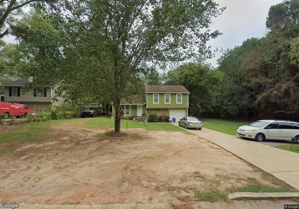
4810 Burns Rd NW Lilburn, GA 30047
Estimated Value: $307,000 - $332,003
3
Beds
3
Baths
1,104
Sq Ft
$289/Sq Ft
Est. Value
About This Home
This home is located at 4810 Burns Rd NW, Lilburn, GA 30047 and is currently estimated at $318,751, approximately $288 per square foot. 4810 Burns Rd NW is a home located in Gwinnett County with nearby schools including Hopkins Elementary School, Berkmar Middle School, and Berkmar High School.
Ownership History
Date
Name
Owned For
Owner Type
Purchase Details
Closed on
Mar 27, 2014
Sold by
Bank Of America Na
Bought by
Thomas Lizy F
Current Estimated Value
Purchase Details
Closed on
Jun 5, 2012
Sold by
Buruca Santos S
Bought by
Bank Of America Na
Purchase Details
Closed on
Mar 30, 2001
Sold by
Pless Gail S
Bought by
Buruca Santos S
Home Financials for this Owner
Home Financials are based on the most recent Mortgage that was taken out on this home.
Original Mortgage
$123,954
Interest Rate
7.11%
Mortgage Type
New Conventional
Purchase Details
Closed on
Jun 28, 1994
Sold by
Coy David L Carol
Bought by
Pless Gail S
Home Financials for this Owner
Home Financials are based on the most recent Mortgage that was taken out on this home.
Original Mortgage
$71,950
Interest Rate
8.51%
Mortgage Type
FHA
Create a Home Valuation Report for This Property
The Home Valuation Report is an in-depth analysis detailing your home's value as well as a comparison with similar homes in the area
Home Values in the Area
Average Home Value in this Area
Purchase History
| Date | Buyer | Sale Price | Title Company |
|---|---|---|---|
| Thomas Lizy F | $65,625 | -- | |
| Bank Of America Na | $149,517 | -- | |
| Buruca Santos S | $125,900 | -- | |
| Pless Gail S | $71,500 | -- |
Source: Public Records
Mortgage History
| Date | Status | Borrower | Loan Amount |
|---|---|---|---|
| Previous Owner | Buruca Santos S | $123,954 | |
| Previous Owner | Pless Gail S | $71,950 |
Source: Public Records
Tax History Compared to Growth
Tax History
| Year | Tax Paid | Tax Assessment Tax Assessment Total Assessment is a certain percentage of the fair market value that is determined by local assessors to be the total taxable value of land and additions on the property. | Land | Improvement |
|---|---|---|---|---|
| 2024 | $3,531 | $108,800 | $21,120 | $87,680 |
| 2023 | $3,531 | $83,280 | $21,600 | $61,680 |
| 2022 | $2,718 | $83,280 | $21,600 | $61,680 |
| 2021 | $2,042 | $60,920 | $14,160 | $46,760 |
| 2020 | $2,491 | $60,920 | $14,160 | $46,760 |
| 2019 | $2,328 | $56,840 | $14,160 | $42,680 |
| 2018 | $2,035 | $48,840 | $12,400 | $36,440 |
| 2016 | $1,186 | $26,240 | $8,000 | $18,240 |
| 2015 | $1,198 | $26,240 | $8,000 | $18,240 |
| 2014 | -- | $29,120 | $7,200 | $21,920 |
Source: Public Records
Map
Nearby Homes
- 790 Indian Lake Dr NW
- 736 Indian Lake Dr NW
- 849 Cadet Ct NW
- 4716 Mossy Ln NW Unit 1
- 1360 Dickens Rd NW
- 1411 Indian Way NW
- 4596 Mossy Ln NW Unit 1
- 862 Brandlwood Way NW Unit 2
- 4608 Rosemear Ct Unit 9
- 1033 Park Forest Ct NW
- 5016 Comanche Ct NW
- 1027 Mansfield Ct
- 1089 Brittwood Place
- 1095 Darby Ct Unit 1095
- 1098 Mansfield Ct
- 1097 Rock Creek Ln
- 1066 Rock Creek Ln
- 220 Jackson Place NW
- 170 Jackson Place NW
- 230 Jackson Place NW
- 210 Jackson Place NW
- 4815 Kellys Mill Dr NW
- 4815 Kellys Mill Dr NW Unit 14
- 4802 Burns Rd NW Unit 1
- 4825 Kellys Mill Dr NW Unit 1
- 4796 Burns Rd NW
- 4795 Kellys Mill Dr NW
- 4790 Burns Rd NW
- 4785 Kellys Mill Dr NW Unit 1
- 799 Jodeco Cir NW
- 4845 Kellys Mill Dr NW Unit 1
- 4784 Burns Rd NW
- 4796 Kellys Mill Dr NW
- 4796 Kelly Mill Dr
- 4775 Kellys Mill Dr NW Unit 1
- 4855 Kellys Mill Dr NW
- 4786 Kellys Mill Dr NW