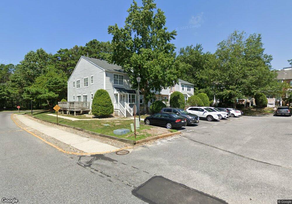
4810 Hawthorne Ln Mays Landing, NJ 08330
Estimated Value: $219,961 - $237,000
--
Bed
--
Bath
1,112
Sq Ft
$207/Sq Ft
Est. Value
About This Home
This home is located at 4810 Hawthorne Ln, Mays Landing, NJ 08330 and is currently estimated at $230,320, approximately $207 per square foot. 4810 Hawthorne Ln is a home located in Atlantic County with nearby schools including George L. Hess Educational Complex, Joseph Shaner School, and William Davies Middle School.
Ownership History
Date
Name
Owned For
Owner Type
Purchase Details
Closed on
Jul 29, 1994
Sold by
Bailey John G
Bought by
Balnis Marie
Current Estimated Value
Home Financials for this Owner
Home Financials are based on the most recent Mortgage that was taken out on this home.
Original Mortgage
$50,000
Interest Rate
8.65%
Purchase Details
Closed on
Apr 24, 1992
Sold by
Bailey John Glen
Bought by
Bailey John Glen and Beth Anne
Create a Home Valuation Report for This Property
The Home Valuation Report is an in-depth analysis detailing your home's value as well as a comparison with similar homes in the area
Home Values in the Area
Average Home Value in this Area
Purchase History
| Date | Buyer | Sale Price | Title Company |
|---|---|---|---|
| Balnis Marie | $70,000 | -- | |
| Bailey John Glen | -- | -- |
Source: Public Records
Mortgage History
| Date | Status | Borrower | Loan Amount |
|---|---|---|---|
| Closed | Balnis Marie | $50,000 |
Source: Public Records
Tax History Compared to Growth
Tax History
| Year | Tax Paid | Tax Assessment Tax Assessment Total Assessment is a certain percentage of the fair market value that is determined by local assessors to be the total taxable value of land and additions on the property. | Land | Improvement |
|---|---|---|---|---|
| 2025 | $3,935 | $114,700 | $20,000 | $94,700 |
| 2024 | $3,935 | $114,700 | $20,000 | $94,700 |
| 2023 | $3,700 | $114,700 | $20,000 | $94,700 |
| 2022 | $3,700 | $114,700 | $20,000 | $94,700 |
| 2021 | $3,692 | $114,700 | $20,000 | $94,700 |
| 2020 | $3,692 | $114,700 | $20,000 | $94,700 |
| 2019 | $3,701 | $114,700 | $20,000 | $94,700 |
| 2018 | $3,572 | $114,700 | $20,000 | $94,700 |
| 2017 | $3,706 | $120,900 | $25,000 | $95,900 |
| 2016 | $3,602 | $120,900 | $25,000 | $95,900 |
| 2015 | $3,480 | $120,900 | $25,000 | $95,900 |
| 2014 | $3,859 | $146,900 | $45,000 | $101,900 |
Source: Public Records
Map
Nearby Homes
- 4915 Winterbury Dr Unit B14
- 4945 Rosebay Place Unit B17
- 4830 Green Ash Ln Unit 287
- 4772 Summersweet Dr
- 4944 Rosebay Place
- 4934 Winterbury Dr Unit I86
- 4922 Denbigh Ct
- 4930 Denbigh Ct
- 4944 Flintshire Ct
- 1544 Ben Franklin Ct
- 1574 John Adams Ct Unit 1574
- 1535 Benjamin Franklin Ct
- 1544 Benjamin Franklin Ct
- 1553 Madison Ct Unit 153
- 1531 Hamilton Ct Unit 231
- 1531 Hamilton Ct
- 1553 John Adams Ct Unit 653
- 5022 Laydon Ct
- 4505 Concord Place Unit K86
- 2614 Dogwood Ct Unit 2614
- 4808 Hawthorne Ln
- 4809 Hawthorne Ln
- 4809 Hawthorne Ln Unit 204
- 4807 Hawthorne Ln Unit Z203
- 4804 Hawthorne Ln Unit Z198
- 4805 Hawthorne Ln Unit Z200
- 4801 Hawthorne Ln Unit Z199
- 4802 Hawthorne Ln Unit Z197
- 4813 Hawthorne Ln
- 4811 Hawthorne Ln Unit AA205
- 4812 Hawthorne Ln Unit AA207
- 4814 Hawthorne Ln
- 4816 Hawthorne Ln Unit AA209
- 4817 Hawthorne Ln Unit AA211
- 4815 Hawthorne Ln
- 4818 Hawthorne Ln
- 4820 Hawthorne Ln
- 4822 Hawthorne Ln Unit AA214
- 2821 Hawthorne Ln
- 4830 Hawthorne Ln Unit BB217