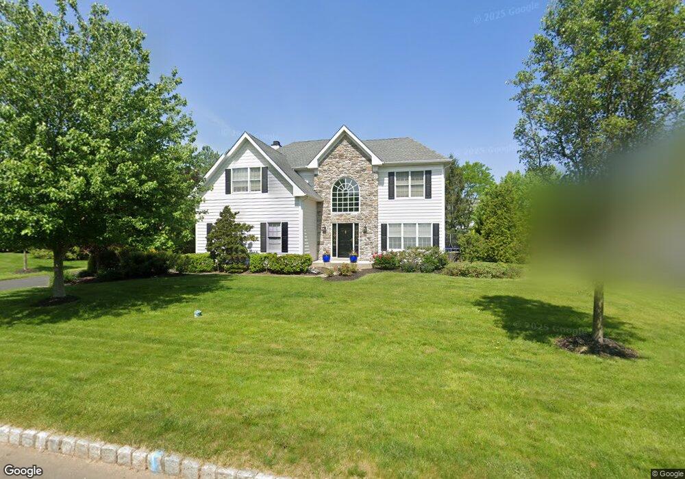
4810 Redfield Rd Doylestown, PA 18902
Estimated Value: $849,174 - $963,000
4
Beds
3
Baths
3,080
Sq Ft
$291/Sq Ft
Est. Value
About This Home
This home is located at 4810 Redfield Rd, Doylestown, PA 18902 and is currently estimated at $894,794, approximately $290 per square foot. 4810 Redfield Rd is a home located in Bucks County with nearby schools including Cold Spring Elementary School, Holicong Middle School, and Central Bucks High School - East.
Ownership History
Date
Name
Owned For
Owner Type
Purchase Details
Closed on
May 19, 2011
Sold by
Wasilewski John R and Wasilewski Betty Jeanne
Bought by
Skulsky Robert J and Skulsky Deemarie
Current Estimated Value
Home Financials for this Owner
Home Financials are based on the most recent Mortgage that was taken out on this home.
Original Mortgage
$288,000
Outstanding Balance
$195,378
Interest Rate
4.37%
Mortgage Type
New Conventional
Estimated Equity
$699,416
Purchase Details
Closed on
Mar 12, 1997
Sold by
Cold Spring Hunt Lp
Bought by
Wasilewski John R and Bolton Betty Jeanne
Home Financials for this Owner
Home Financials are based on the most recent Mortgage that was taken out on this home.
Original Mortgage
$136,000
Interest Rate
7.68%
Create a Home Valuation Report for This Property
The Home Valuation Report is an in-depth analysis detailing your home's value as well as a comparison with similar homes in the area
Home Values in the Area
Average Home Value in this Area
Purchase History
| Date | Buyer | Sale Price | Title Company |
|---|---|---|---|
| Skulsky Robert J | $492,000 | None Available | |
| Wasilewski John R | $274,350 | -- |
Source: Public Records
Mortgage History
| Date | Status | Borrower | Loan Amount |
|---|---|---|---|
| Open | Skulsky Robert J | $288,000 | |
| Previous Owner | Wasilewski John R | $136,000 |
Source: Public Records
Tax History
| Year | Tax Paid | Tax Assessment Tax Assessment Total Assessment is a certain percentage of the fair market value that is determined by local assessors to be the total taxable value of land and additions on the property. | Land | Improvement |
|---|---|---|---|---|
| 2025 | $8,572 | $52,650 | $10,320 | $42,330 |
| 2024 | $8,572 | $52,650 | $10,320 | $42,330 |
| 2023 | $8,281 | $52,650 | $10,320 | $42,330 |
| 2022 | $8,182 | $52,650 | $10,320 | $42,330 |
| 2021 | $8,427 | $54,880 | $10,320 | $44,560 |
| 2020 | $8,427 | $54,880 | $10,320 | $44,560 |
| 2019 | $8,372 | $54,880 | $10,320 | $44,560 |
| 2018 | $8,372 | $54,880 | $10,320 | $44,560 |
| 2017 | $8,303 | $54,880 | $10,320 | $44,560 |
| 2016 | $8,386 | $54,880 | $10,320 | $44,560 |
| 2015 | -- | $54,880 | $10,320 | $44,560 |
| 2014 | -- | $54,880 | $10,320 | $44,560 |
Source: Public Records
Map
Nearby Homes
- 4179 Miladies Ln
- 4533 Deep Creek Way
- 4783 Landisville Rd
- 3960 S Mallard Ln
- 4745 Nottingham Way
- 3689 Hancock Ln
- 5087 Raintree Ct
- 4625 Old Oak Rd
- 4990 Point Pleasant Pike
- 5182 Point Pleasant Pike
- 5491 Long Ln
- 3468 Holicong Rd
- 6680 Point Pleasant Pike
- 30 John Dyer Way
- 5380 Point Pleasant Pike
- 4215 Ferguson Dr
- 4306 Kleinot Dr
- 4298 Kleinot Dr
- 4330 Kleinot Dr
- 4246 Kleinot Dr
- 4820 Redfield Rd
- 4803 Mead Dr
- 4841 Mead Dr
- 4835 Mead Dr
- 4845 Mead Dr
- 4830 Redfield Rd
- 4815 Redfield Rd
- 4809 Redfield Rd
- 4825 Redfield Rd
- 4855 Mead Dr
- 4801 Redfield Rd
- 4806 Mead Dr
- 4840 Redfield Rd
- 4814 Mead Dr
- 4842 Mead Dr
- 4834 Mead Dr
- 4861 Mead Dr
- 4848 Mead Dr
- 4836 Cold Spring Creamery Rd
- 4820 Mead Dr
Your Personal Tour Guide
Ask me questions while you tour the home.