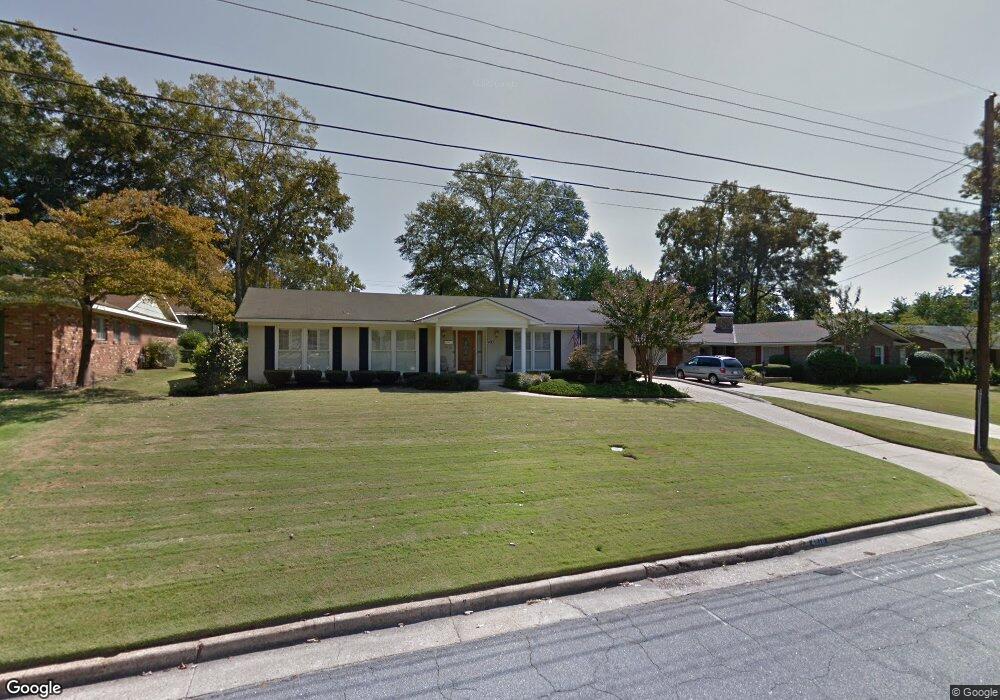
4810 Saint Francis Ave Columbus, GA 31904
Estimated Value: $213,931 - $236,000
3
Beds
3
Baths
1,806
Sq Ft
$125/Sq Ft
Est. Value
About This Home
This home is located at 4810 Saint Francis Ave, Columbus, GA 31904 and is currently estimated at $226,483, approximately $125 per square foot. 4810 Saint Francis Ave is a home located in Muscogee County with nearby schools including Allen Elementary School, Arnold Middle School, and Jordan Vocational High School.
Ownership History
Date
Name
Owned For
Owner Type
Purchase Details
Closed on
Oct 5, 2015
Sold by
Trustee Of Edgar & Mary
Bought by
Lensch Wayne D and Lensch Beverly A
Current Estimated Value
Home Financials for this Owner
Home Financials are based on the most recent Mortgage that was taken out on this home.
Original Mortgage
$121,410
Outstanding Balance
$95,425
Interest Rate
3.93%
Mortgage Type
New Conventional
Estimated Equity
$131,058
Create a Home Valuation Report for This Property
The Home Valuation Report is an in-depth analysis detailing your home's value as well as a comparison with similar homes in the area
Home Values in the Area
Average Home Value in this Area
Purchase History
| Date | Buyer | Sale Price | Title Company |
|---|---|---|---|
| Lensch Wayne D | $134,900 | -- |
Source: Public Records
Mortgage History
| Date | Status | Borrower | Loan Amount |
|---|---|---|---|
| Open | Lensch Wayne D | $121,410 |
Source: Public Records
Tax History Compared to Growth
Tax History
| Year | Tax Paid | Tax Assessment Tax Assessment Total Assessment is a certain percentage of the fair market value that is determined by local assessors to be the total taxable value of land and additions on the property. | Land | Improvement |
|---|---|---|---|---|
| 2025 | $1,522 | $69,704 | $10,320 | $59,384 |
| 2024 | $152 | $69,704 | $10,320 | $59,384 |
| 2023 | $836 | $69,704 | $10,320 | $59,384 |
| 2022 | $1,586 | $58,828 | $10,320 | $48,508 |
| 2021 | $1,579 | $52,924 | $10,320 | $42,604 |
| 2020 | $1,579 | $52,924 | $10,320 | $42,604 |
| 2019 | $1,586 | $52,924 | $10,320 | $42,604 |
| 2018 | $1,586 | $52,924 | $10,320 | $42,604 |
| 2017 | $1,593 | $52,924 | $10,320 | $42,604 |
| 2016 | $1,600 | $52,059 | $7,972 | $44,087 |
| 2015 | $1,090 | $42,837 | $7,972 | $34,865 |
| 2014 | $437 | $42,837 | $7,972 | $34,865 |
| 2013 | -- | $42,837 | $7,972 | $34,865 |
Source: Public Records
Map
Nearby Homes
- 2323 Devonshire Dr
- 2206 Devonshire Dr
- 2222 51st St
- 2813 Hart Dr
- 4814 20th Ave
- 4426 Chalfonte Dr
- 4214 Saint Francis Ave Unit A
- 2325 Coventry Dr
- 5239 23rd Ave
- 4714 18th Ave
- 4303 Armour Rd
- 2119 Lancaster Dr
- 4830 17th Ave
- 2012 42nd St
- 2122 40th St
- 4220 18th Ave
- 1717 42nd St
- 2208 Airport Thruway
- 2014 Airport Thruway
- 3905 Crestview Dr
- 4816 Saint Francis Ave
- 4806 Saint Francis Ave
- 4725 Rosemont Dr
- 4721 Rosemont Dr
- 4803 Rosemont Dr
- 4800 Saint Francis Ave
- 4809 Saint Francis Ave
- 4815 Saint Francis Ave
- 4809 Rosemont Dr
- 4805 Saint Francis Ave
- 4711 Rosemont Dr
- 4902 Saint Francis Ave
- 4821 Saint Francis Ave
- 4815 Rosemont Dr
- 4705 Rosemont Dr
- 4903 Saint Francis Ave
- 4810 Chesil Ave
- 4901 Rosemont Dr
- 4802 Chesil Ave
- 4908 Saint Francis Ave