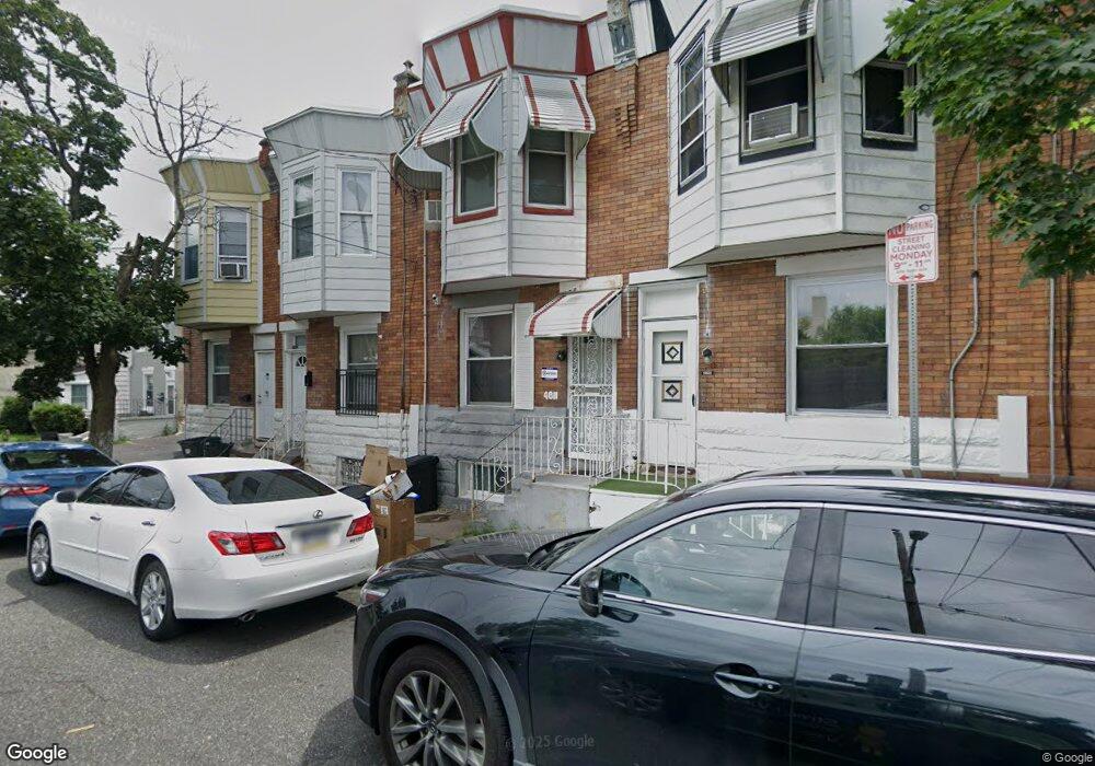
4811 Mulberry St Philadelphia, PA 19124
Frankford NeighborhoodEstimated Value: $86,000 - $132,000
3
Beds
1
Bath
942
Sq Ft
$109/Sq Ft
Est. Value
About This Home
This home is located at 4811 Mulberry St, Philadelphia, PA 19124 and is currently estimated at $103,020, approximately $109 per square foot. 4811 Mulberry St is a home located in Philadelphia County with nearby schools including Harding Warren G Middle School, Frankford High School, and Mastery Schools Smedley Elementary.
Ownership History
Date
Name
Owned For
Owner Type
Purchase Details
Closed on
Aug 18, 2025
Sold by
Lewis James Edward and Turner Denise
Bought by
Turner Denise
Current Estimated Value
Purchase Details
Closed on
Dec 9, 2016
Sold by
Turner Denise and Lewis James Edward
Bought by
Turner Denise and Lewis James Edward
Purchase Details
Closed on
Jul 7, 2015
Sold by
Turner Denise J and Estate Of James E Lewis
Bought by
Turner Denise and Lewis James Edward
Purchase Details
Closed on
Sep 10, 1959
Bought by
Argenta James E and Argenta Lewis
Create a Home Valuation Report for This Property
The Home Valuation Report is an in-depth analysis detailing your home's value as well as a comparison with similar homes in the area
Home Values in the Area
Average Home Value in this Area
Purchase History
| Date | Buyer | Sale Price | Title Company |
|---|---|---|---|
| Turner Denise | -- | None Listed On Document | |
| Turner Denise | -- | None Available | |
| Turner Denise | -- | None Available | |
| Argenta James E | -- | -- |
Source: Public Records
Tax History Compared to Growth
Tax History
| Year | Tax Paid | Tax Assessment Tax Assessment Total Assessment is a certain percentage of the fair market value that is determined by local assessors to be the total taxable value of land and additions on the property. | Land | Improvement |
|---|---|---|---|---|
| 2026 | $978 | $85,900 | $17,100 | $68,800 |
| 2025 | $978 | $85,900 | $17,100 | $68,800 |
| 2024 | $978 | $85,900 | $17,100 | $68,800 |
| 2023 | $978 | $69,900 | $13,980 | $55,920 |
| 2022 | $588 | $69,900 | $13,980 | $55,920 |
| 2021 | $588 | $0 | $0 | $0 |
| 2020 | $588 | $0 | $0 | $0 |
| 2019 | $564 | $0 | $0 | $0 |
| 2018 | $757 | $0 | $0 | $0 |
| 2017 | $757 | $0 | $0 | $0 |
| 2016 | $757 | $0 | $0 | $0 |
| 2015 | $323 | $0 | $0 | $0 |
| 2014 | -- | $54,100 | $7,370 | $46,730 |
| 2012 | -- | $5,536 | $514 | $5,022 |
Source: Public Records
Map
Nearby Homes
- 4812 Tackawanna St
- 1818 Harrison St
- 1724 Harrison St
- 4701 Mulberry St
- 4714 Hawthorne St
- 4843 Duffield St
- 1688 Fillmore St
- 4675 Hawthorne St
- 4669 Hawthorne St
- 1628 Margaret St
- 4938 Mulberry St
- 1934 Harrison St
- 1936 Harrison St
- 4942 Mulberry St
- 4206-14 Tackawanna St
- 4952 Charles St
- 1907 Wilmot St
- 1844 Wilmot St
- 4666 Duffield St
- 4943 Duffield St
- 4809 Mulberry St
- 4813 Mulberry St
- 4807 Mulberry St
- 4815 Mulberry St
- 4805 Mulberry St
- 4803 Mulberry St
- 1809 Foulkrod St
- 1811 Foulkrod St
- 1749 Foulkrod St
- 1813 Foulkrod St
- 4821 Mulberry St
- 1815 Foulkrod St
- 4818 Mulberry St
- 4823 Mulberry St
- 1817 Foulkrod St
- 1819 Foulkrod St
- 4825 Mulberry St
- 4749 Mulberry St
- 1821 Foulkrod St
- 1746 Fillmore St