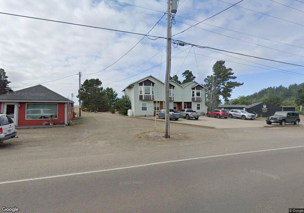
4811 Netarts Hwy W Tillamook, OR 97141
Estimated Value: $1,017,000 - $2,748,000
9
Beds
6
Baths
2,949
Sq Ft
$558/Sq Ft
Est. Value
About This Home
This home is located at 4811 Netarts Hwy W, Tillamook, OR 97141 and is currently estimated at $1,645,333, approximately $557 per square foot. 4811 Netarts Hwy W is a home with nearby schools including Tillamook High School.
Ownership History
Date
Name
Owned For
Owner Type
Purchase Details
Closed on
Mar 28, 2007
Sold by
Hathaway Benjamin H and Hathaway Mary Lou
Bought by
Harmsen David V
Current Estimated Value
Home Financials for this Owner
Home Financials are based on the most recent Mortgage that was taken out on this home.
Original Mortgage
$148,000
Outstanding Balance
$94,769
Interest Rate
7.25%
Mortgage Type
Purchase Money Mortgage
Estimated Equity
$1,550,564
Create a Home Valuation Report for This Property
The Home Valuation Report is an in-depth analysis detailing your home's value as well as a comparison with similar homes in the area
Home Values in the Area
Average Home Value in this Area
Purchase History
| Date | Buyer | Sale Price | Title Company |
|---|---|---|---|
| Harmsen David V | $185,000 | First American |
Source: Public Records
Mortgage History
| Date | Status | Borrower | Loan Amount |
|---|---|---|---|
| Open | Harmsen David V | $148,000 |
Source: Public Records
Tax History Compared to Growth
Tax History
| Year | Tax Paid | Tax Assessment Tax Assessment Total Assessment is a certain percentage of the fair market value that is determined by local assessors to be the total taxable value of land and additions on the property. | Land | Improvement |
|---|---|---|---|---|
| 2024 | $8,098 | $641,400 | $91,760 | $549,640 |
| 2023 | $8,067 | $622,720 | $89,080 | $533,640 |
| 2022 | $7,842 | $604,590 | $86,490 | $518,100 |
| 2021 | $7,663 | $586,990 | $83,970 | $503,020 |
| 2020 | $7,496 | $569,900 | $81,510 | $488,390 |
| 2019 | $7,342 | $553,310 | $79,150 | $474,160 |
| 2018 | $7,199 | $537,200 | $76,850 | $460,350 |
| 2017 | $7,060 | $521,560 | $74,610 | $446,950 |
| 2016 | $6,837 | $506,370 | $72,440 | $433,930 |
| 2015 | $6,733 | $491,630 | $70,330 | $421,300 |
| 2014 | $6,650 | $477,320 | $68,280 | $409,040 |
| 2013 | -- | $463,420 | $66,290 | $397,130 |
Source: Public Records
Map
Nearby Homes
- 4830 Netarts Hwy W
- 4805 Leonard St W
- 4745 Netarts Hwy W
- 4850 Netarts Hwy W Unit 6
- TL 3800 Vista View Dr W
- 0 Tl 3800 Unit 479246395
- 4803 Holly Heights Ave
- 1540 Vista View Dr W
- 218 Holly Heights Ave
- 223 Holly Heights Ave
- 224 Holly Heights Ave
- 1960 Alder Cove Rd W
- 0 Moondancer Ln Unit 25-198
- 0 Moondancer Ln Unit 62
- 1480 Emerald Ln
- 4380 Sequoia Loop
- VL Sequoia Loop
- 116 Sequoia Loop
- 4900 Clam Way
- 4300 Sequoia Loop
- 4825 Netarts Hwy W
- TBD Old State Rd W
- VL Old State Rd
- 4828 Alder Cove Rd W
- 4819 Old State Rd W
- 4820 Alder Cove Rd W
- 4819 Old State Rd
- 4823 Netarts Hwy W
- 4819 Netarts Hwy W
- 4855 John R Rd W
- 4785 Netarts Hwy W
- 4785 Netarts Hwy W Unit 1
- 4831 Netarts Hwy W
- 4825 Old State Rd
- 4825 Old State Rd Unit 1&2
- 4845 John R St
- 4845 John R Rd W
- 4845 John R St W
- 4855 John R St W
- 4810 Alder Cove Rd W