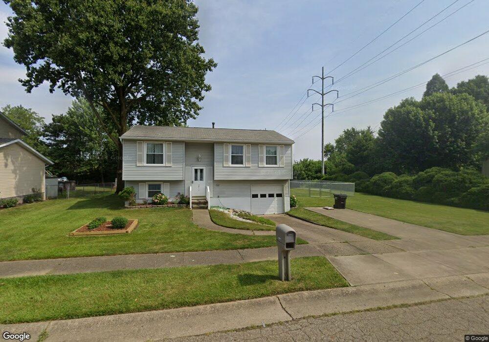
4811 Piccadilly St SW Canton, OH 44706
Westview NeighborhoodEstimated Value: $153,603 - $190,000
3
Beds
1
Bath
864
Sq Ft
$200/Sq Ft
Est. Value
About This Home
This home is located at 4811 Piccadilly St SW, Canton, OH 44706 and is currently estimated at $172,401, approximately $199 per square foot. 4811 Piccadilly St SW is a home located in Stark County with nearby schools including Pfeiffer Intermediate School, Edison Middle School, and Perry High School.
Ownership History
Date
Name
Owned For
Owner Type
Purchase Details
Closed on
Aug 2, 2019
Sold by
Baughman Seth M
Bought by
Baughman Charity D
Current Estimated Value
Purchase Details
Closed on
Mar 29, 2017
Sold by
Baughman Charity D
Bought by
Baughman Charity D and Baughman Seth M
Purchase Details
Closed on
Apr 20, 2015
Sold by
Baughman Rosemary J
Bought by
Baughman Charity D and The Rosemary Baughman Trust
Create a Home Valuation Report for This Property
The Home Valuation Report is an in-depth analysis detailing your home's value as well as a comparison with similar homes in the area
Home Values in the Area
Average Home Value in this Area
Purchase History
| Date | Buyer | Sale Price | Title Company |
|---|---|---|---|
| Baughman Charity D | $10,000 | None Available | |
| Baughman Charity D | -- | None Available | |
| Baughman Charity D | -- | None Available |
Source: Public Records
Tax History Compared to Growth
Tax History
| Year | Tax Paid | Tax Assessment Tax Assessment Total Assessment is a certain percentage of the fair market value that is determined by local assessors to be the total taxable value of land and additions on the property. | Land | Improvement |
|---|---|---|---|---|
| 2025 | -- | $42,850 | $18,310 | $24,540 |
| 2024 | -- | $42,850 | $18,310 | $24,540 |
| 2023 | $1,921 | $38,300 | $15,090 | $23,210 |
| 2022 | $1,932 | $38,300 | $15,090 | $23,210 |
| 2021 | $2,058 | $38,300 | $15,090 | $23,210 |
| 2020 | $1,815 | $32,410 | $12,670 | $19,740 |
| 2019 | $1,638 | $32,410 | $12,670 | $19,740 |
| 2018 | $1,618 | $32,410 | $12,670 | $19,740 |
| 2017 | $1,549 | $28,040 | $10,920 | $17,120 |
| 2016 | $1,047 | $28,040 | $10,920 | $17,120 |
| 2015 | $1,056 | $28,040 | $10,920 | $17,120 |
| 2014 | $978 | $26,330 | $10,260 | $16,070 |
| 2013 | $468 | $26,330 | $10,260 | $16,070 |
Source: Public Records
Map
Nearby Homes
- 4722 Navarre Rd SW
- 2227 Perry Dr SW
- 2611 Bordner Ave SW
- 2644 Delaware Ave SW
- 4870 15th St SW
- 4871 15th St SW
- 1425 Channonbrook St SW
- 5292 Pisces St SW
- 1227 Ellwood Ave SW
- 1220 Ellwood Ave SW
- 5528 Oakcliff St SW
- 1259 Hawthorne Ave SW
- 1729 Gambrinus Ave SW
- 2490 Lombardi Ave SW
- 119 Saratoga Ave SW
- 1103 Manor Ave SW
- 726 Ellwood Ave SW
- 1226 Poplar Ave SW
- 119 Cayuga Ave NW
- 3827 Hazelbrook St SW
- 4819 Piccadilly St SW
- 4801 Piccadilly St SW
- 4823 Piccadilly St SW
- 2202 Times Ave SW
- 4760 Piccadilly St SW
- 4765 Piccadilly St SW
- 4833 Piccadilly St SW
- 2208 Times Ave SW
- 4740 Piccadilly St SW
- 4839 Piccadilly St SW
- 4757 Piccadilly St SW
- 4830 Piccadilly St SW
- 4732 Piccadilly St SW
- 4836 Piccadilly St SW
- 4845 Piccadilly St SW
- 4753 Piccadilly St SW
- 2220 Times Ave SW
- 4745 Piccadilly St SW
- 4842 Piccadilly St SW
- 4728 Piccadilly St SW