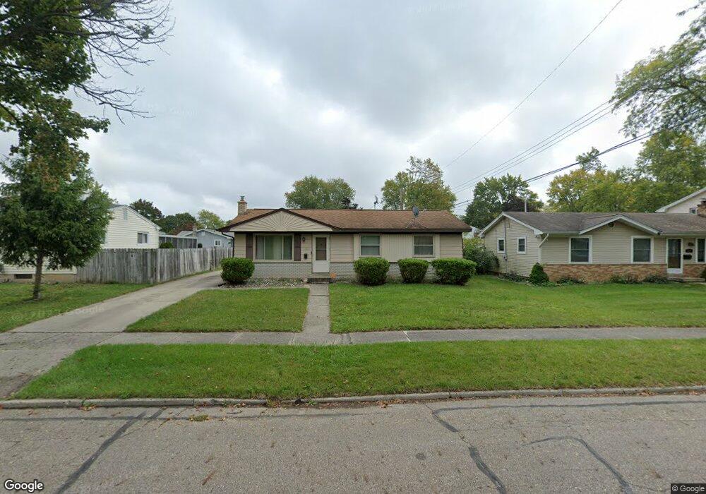
4811 Sylvester Ave Lansing, MI 48911
Churchill Downs NeighborhoodEstimated Value: $109,346 - $153,000
--
Bed
1
Bath
984
Sq Ft
$138/Sq Ft
Est. Value
About This Home
This home is located at 4811 Sylvester Ave, Lansing, MI 48911 and is currently estimated at $135,337, approximately $137 per square foot. 4811 Sylvester Ave is a home located in Ingham County with nearby schools including Reo Elementary School, Attwood School, and Everett High School.
Ownership History
Date
Name
Owned For
Owner Type
Purchase Details
Closed on
Dec 15, 2015
Sold by
Embry Ronald T and Embry Sheila Y
Bought by
Embry Ronald T and Embry Candace Y
Current Estimated Value
Purchase Details
Closed on
Jul 18, 2012
Sold by
Ron Can Mar Llc
Bought by
Embry Sheila Y
Purchase Details
Closed on
Sep 11, 2006
Sold by
Embry Ronald T and Embry Sheila Y
Bought by
Embry Sheila Y
Create a Home Valuation Report for This Property
The Home Valuation Report is an in-depth analysis detailing your home's value as well as a comparison with similar homes in the area
Home Values in the Area
Average Home Value in this Area
Purchase History
| Date | Buyer | Sale Price | Title Company |
|---|---|---|---|
| Embry Ronald T | -- | None Available | |
| Embry Sheila Y | -- | None Available | |
| Embry Sheila Y | -- | None Available | |
| Ron Can Mar Llc | -- | None Available |
Source: Public Records
Tax History Compared to Growth
Tax History
| Year | Tax Paid | Tax Assessment Tax Assessment Total Assessment is a certain percentage of the fair market value that is determined by local assessors to be the total taxable value of land and additions on the property. | Land | Improvement |
|---|---|---|---|---|
| 2025 | $2,069 | $54,800 | $8,800 | $46,000 |
| 2024 | $16 | $50,900 | $8,800 | $42,100 |
| 2023 | $1,942 | $44,900 | $8,800 | $36,100 |
| 2022 | $1,753 | $39,700 | $8,800 | $30,900 |
| 2021 | $1,717 | $36,000 | $5,600 | $30,400 |
| 2020 | $1,706 | $33,000 | $5,600 | $27,400 |
| 2019 | $1,634 | $31,500 | $5,600 | $25,900 |
| 2018 | $1,533 | $27,100 | $5,600 | $21,500 |
| 2017 | $1,467 | $27,100 | $5,600 | $21,500 |
| 2016 | $1,893 | $25,300 | $5,600 | $19,700 |
| 2015 | $1,893 | $24,700 | $11,195 | $13,505 |
| 2014 | $1,893 | $25,000 | $17,676 | $7,324 |
Source: Public Records
Map
Nearby Homes
- 3523 Lucie St
- 5100 Wexford Rd
- 4709 Stillwell Ave
- 5200 Wise Rd
- 4809 Ballard Rd
- 3115 Risdale Ave
- 4828 Ingham St
- 3941 Glenburne Blvd
- 4400 Chadburne Dr
- 4009 Heathgate Dr
- 2416 Midwood St
- 3818 Churchill Ave
- 3814 Wedgewood Dr
- 2816 Greenbelt Dr
- 3006 Hillcrest St
- 4317 Seaway Dr
- 4205 Glenburne Blvd
- 4107 Windward Dr
- 4245 W Jolly Rd Unit 197
- 4628 Pleasant Grove Rd
- 4817 Sylvester Ave
- 3535 Karen St
- 3534 Lucie St
- 4823 Sylvester Ave
- 3521 Karen St
- 3528 Lucie St
- 4810 Sylvester Ave
- 4816 Sylvester Ave
- 3601 Karen St
- 3515 Karen St
- 3522 Lucie St
- 4822 Sylvester Ave
- 3538 Karen St
- 3532 Karen St
- 3528 Karen St
- 3600 Karen St
- 3522 Karen St
- 3516 Lucie St
- 3509 Karen St
- 3545 Lucie St