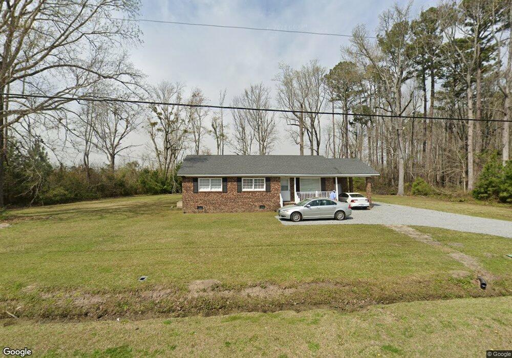
4813 Nc Highway 304 Bayboro, NC 28515
Estimated Value: $133,000 - $181,709
3
Beds
2
Baths
1,208
Sq Ft
$136/Sq Ft
Est. Value
About This Home
This home is located at 4813 Nc Highway 304, Bayboro, NC 28515 and is currently estimated at $164,236, approximately $135 per square foot. 4813 Nc Highway 304 is a home with nearby schools including Pamlico County Primary School, Fred A. Anderson Elementary School, and Pamlico County Middle School.
Ownership History
Date
Name
Owned For
Owner Type
Purchase Details
Closed on
Sep 27, 2023
Sold by
Bate Land Company Limited Partnership
Bought by
North Carolina Coastal Land Trust
Current Estimated Value
Purchase Details
Closed on
Feb 21, 2010
Sold by
Pearsall Douglas M and Sawyer Eugene
Bought by
Pearsall Douglas M and Sawyer Eugene
Purchase Details
Closed on
Sep 1, 1993
Bought by
Antioch Church Of Christ
Create a Home Valuation Report for This Property
The Home Valuation Report is an in-depth analysis detailing your home's value as well as a comparison with similar homes in the area
Home Values in the Area
Average Home Value in this Area
Purchase History
| Date | Buyer | Sale Price | Title Company |
|---|---|---|---|
| North Carolina Coastal Land Trust | $2,495,000 | None Listed On Document | |
| Pearsall Douglas M | -- | -- | |
| Antioch Church Of Christ | -- | -- |
Source: Public Records
Tax History Compared to Growth
Tax History
| Year | Tax Paid | Tax Assessment Tax Assessment Total Assessment is a certain percentage of the fair market value that is determined by local assessors to be the total taxable value of land and additions on the property. | Land | Improvement |
|---|---|---|---|---|
| 2025 | $575 | $82,723 | $15,138 | $67,585 |
| 2024 | $575 | $82,723 | $15,138 | $67,585 |
| 2023 | $558 | $82,723 | $15,138 | $67,585 |
| 2022 | $542 | $82,723 | $15,138 | $67,585 |
| 2021 | $542 | $82,723 | $15,138 | $67,585 |
| 2020 | $542 | $82,723 | $15,138 | $67,585 |
| 2019 | $603 | $92,007 | $16,029 | $75,978 |
| 2018 | $603 | $0 | $0 | $0 |
| 2017 | $603 | $0 | $0 | $0 |
| 2016 | $603 | $0 | $0 | $0 |
| 2015 | $603 | $92,007 | $16,029 | $75,978 |
| 2014 | $603 | $92,007 | $16,029 | $75,978 |
Source: Public Records
Map
Nearby Homes
- 188 Myrtlewood Ln
- 000 Blue Heron Dr
- 0 Smith Creek Rd
- 804 Murphy Farm Rd
- 0 Seawell Loop Rd
- 1328 Pennsylvania Ave
- 901 Murphy Farm Rd
- 153 Oswell Brinson Rd
- 117 Oswell Brinson Rd
- 517 Arant Farm
- 20 Bay Point Rd
- 26 Mason Ln
- 87 Mason Ln
- 61 Arant Farm Rd
- 60 Arant Farm Rd
- 880 Arant Farm Rd
- 278 Mason Bay Rd
- 2180 N Carolina 304 Unit C
- 2180 N Carolina 304 Unit B
- 2180 N Carolina 304 Unit A
- 4875 N Carolina 304
- 4866 Nc Highway 304
- 4875 Nc Highway 304
- 41 Lynchs Beach Rd
- 52 Lynchs Beach Rd
- 59 Lynchs Beach Rd
- 4921 N Carolina 304
- 4900 Nc Highway 304
- 4921 Nc Highway 304
- 4920 Nc Highway 304
- 90 Lynchs Beach Rd
- 4935 Nc Highway 304
- 4934 Nc Highway 304
- 4947 Nc Highway 304
- 4948 Nc Highway 304
- 114 Lynchs Beach Rd
- 4959 Nc Highway 304
- 4997 Nc Highway 304
- 57 Fentress Farm Rd
- 5004 Nc Highway 304