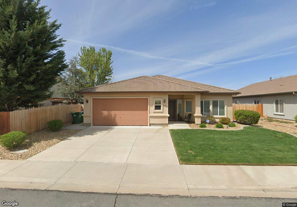
4815 Deedee Way Sparks, NV 89436
Los Altos Parkway NeighborhoodEstimated Value: $540,946 - $576,000
3
Beds
2
Baths
1,664
Sq Ft
$332/Sq Ft
Est. Value
About This Home
This home is located at 4815 Deedee Way, Sparks, NV 89436 and is currently estimated at $552,987, approximately $332 per square foot. 4815 Deedee Way is a home located in Washoe County with nearby schools including Bud Beasley Elementary School, Edward C Reed High School, and Excel Christian School.
Ownership History
Date
Name
Owned For
Owner Type
Purchase Details
Closed on
Feb 18, 2010
Sold by
Labrensz Charles E and Labrensz Robin C
Bought by
Labrensz Charles Edward and Labrensz Robin Carla
Current Estimated Value
Purchase Details
Closed on
Jan 26, 2004
Sold by
C & M Properties Llc
Bought by
Labrensz Charles E and Labrensz Robin C
Create a Home Valuation Report for This Property
The Home Valuation Report is an in-depth analysis detailing your home's value as well as a comparison with similar homes in the area
Home Values in the Area
Average Home Value in this Area
Purchase History
| Date | Buyer | Sale Price | Title Company |
|---|---|---|---|
| Labrensz Charles Edward | -- | None Available | |
| Labrensz Charles E | $232,000 | Stewart Title Of Northern Nv |
Source: Public Records
Tax History Compared to Growth
Tax History
| Year | Tax Paid | Tax Assessment Tax Assessment Total Assessment is a certain percentage of the fair market value that is determined by local assessors to be the total taxable value of land and additions on the property. | Land | Improvement |
|---|---|---|---|---|
| 2025 | $2,717 | $119,601 | $40,285 | $79,316 |
| 2024 | $2,717 | $113,884 | $33,880 | $80,004 |
| 2023 | $2,639 | $113,978 | $38,430 | $75,548 |
| 2022 | $2,562 | $94,716 | $31,745 | $62,971 |
| 2021 | $2,488 | $90,015 | $27,405 | $62,610 |
| 2020 | $2,415 | $88,722 | $26,040 | $62,682 |
| 2019 | $2,345 | $85,390 | $25,655 | $59,735 |
| 2018 | $2,256 | $76,048 | $18,375 | $57,673 |
| 2017 | $2,190 | $75,069 | $17,325 | $57,744 |
| 2016 | $2,134 | $75,132 | $16,275 | $58,857 |
| 2015 | $537 | $73,205 | $14,455 | $58,750 |
| 2014 | $2,004 | $66,970 | $12,005 | $54,965 |
| 2013 | -- | $53,655 | $9,310 | $44,345 |
Source: Public Records
Map
Nearby Homes
- 1550 Istrice Rd
- 1560 Freeman Way
- 4675 Firtree Ln
- 1685 Southview Dr
- 4788 Ravello Dr
- 1484 Serendipity Ct
- 1388 Lambrays Ln
- 1215 Ebling Dr
- 1850 Almonte Ct
- 1716 Canyon Terrace Dr
- 5276 Santa Rosa Ave
- 5105 Santa Anita Dr
- 1304 Lambrusca Dr
- 1557 Satellite Dr
- 4515 Whitney Cir
- 4748 Pradera St
- 1357 Silver View Cir
- 1475 Golddust Dr
- 1425 Heaven Dr
- 4950 San Diego Ct
- 4821 Deedee Way
- 1530 Istrice Rd
- 1520 Istrice Rd
- 4812 Santa Barbara Ave
- 4827 Deedee Way
- 4818 Santa Barbara Ave
- 1510 Istrice Rd
- 4816 Deedee Way
- 4824 Santa Barbara Ave
- 4822 Deedee Way
- 1525 Freeman Way
- 4828 Deedee Way
- 1515 Freeman Way
- 1560 Istrice Rd
- 1535 Istrice Rd
- 1525 Istrice Rd
- 1505 Freeman Way
- 1545 Istrice Rd
- 1545 Freeman Way
- 1515 Istrice Rd