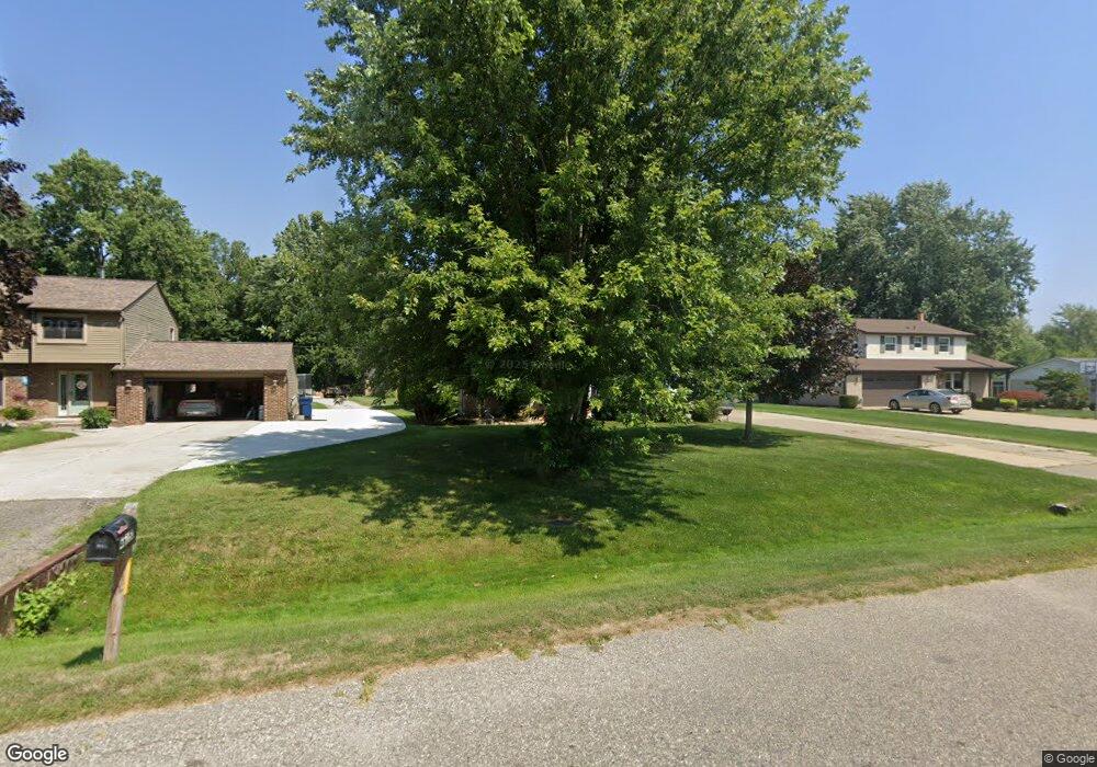
48155 Forbes Dr Chesterfield, MI 48047
Estimated Value: $282,695 - $300,000
3
Beds
2
Baths
1,352
Sq Ft
$215/Sq Ft
Est. Value
About This Home
This home is located at 48155 Forbes Dr, Chesterfield, MI 48047 and is currently estimated at $290,924, approximately $215 per square foot. 48155 Forbes Dr is a home located in Macomb County with nearby schools including Dean A. Naldrett School, Anchor Bay Middle School South, and Anchor Bay High School.
Ownership History
Date
Name
Owned For
Owner Type
Purchase Details
Closed on
May 6, 2010
Sold by
Morency Michael E and Morency Maureen N
Bought by
Biljan Thomas J and Biljan Laura M
Current Estimated Value
Purchase Details
Closed on
Oct 5, 1994
Sold by
Mark Cummins
Bought by
Morency Michael E and Morency Maureen N
Home Financials for this Owner
Home Financials are based on the most recent Mortgage that was taken out on this home.
Original Mortgage
$84,000
Interest Rate
6.38%
Mortgage Type
New Conventional
Create a Home Valuation Report for This Property
The Home Valuation Report is an in-depth analysis detailing your home's value as well as a comparison with similar homes in the area
Home Values in the Area
Average Home Value in this Area
Purchase History
| Date | Buyer | Sale Price | Title Company |
|---|---|---|---|
| Biljan Thomas J | $135,000 | Greater Macomb Title Agency | |
| Morency Michael E | $106,000 | -- |
Source: Public Records
Mortgage History
| Date | Status | Borrower | Loan Amount |
|---|---|---|---|
| Previous Owner | Morency Michael E | $84,000 |
Source: Public Records
Tax History Compared to Growth
Tax History
| Year | Tax Paid | Tax Assessment Tax Assessment Total Assessment is a certain percentage of the fair market value that is determined by local assessors to be the total taxable value of land and additions on the property. | Land | Improvement |
|---|---|---|---|---|
| 2025 | $2,777 | $128,200 | $0 | $0 |
| 2024 | $1,599 | $121,000 | $0 | $0 |
| 2023 | $1,516 | $103,900 | $0 | $0 |
| 2022 | $2,513 | $96,600 | $0 | $0 |
| 2021 | $2,420 | $93,400 | $0 | $0 |
| 2020 | $1,380 | $87,600 | $0 | $0 |
| 2019 | $2,145 | $84,000 | $0 | $0 |
| 2018 | $2,175 | $81,000 | $18,000 | $63,000 |
| 2017 | $2,149 | $75,350 | $17,950 | $57,400 |
| 2016 | $2,145 | $75,350 | $0 | $0 |
| 2015 | $997 | $67,050 | $0 | $0 |
| 2014 | $997 | $64,600 | $15,200 | $49,400 |
| 2012 | -- | $0 | $0 | $0 |
Source: Public Records
Map
Nearby Homes
- 48041 Sugarbush Rd
- 47978 Jefferson Ave
- 50426 Jim Dr
- 47812 Forbes Dr
- 50013 S Jimmy Ct
- 47685 Jefferson Ave
- 48526 Jefferson Ave
- 48556 Harbor Dr
- 29705 Alexandra Ln Unit 13
- 50218 N Benny Ct
- 29213 Rachid Ln
- 50131 N Benny Ct
- 25200 23 Mile Rd
- 28771 Squire Dr
- 28734 Yarmouth Ct Unit 18
- 29371 Bayside Cir N
- 28715 Portsmouth Ct Unit 32
- 31450 23 Mile Rd
- 48713 Chelmsford Ct Unit 127
- 48832 Birmingham Dr
- 48163 Forbes Dr
- 48147 Forbes Dr
- 48141 Forbes Dr
- 48171 Forbes Dr
- 48152 Forbes St
- 48162 Forbes St
- 48179 Forbes St
- 48144 Forbes St
- 48172 Forbes St
- 48133 Forbes Dr
- 48136 Forbes Dr
- 48180 Forbes Dr
- 48187 Forbes Dr
- 48125 Forbes St
- 48128 Forbes St
- 48188 Forbes St
- 48195 Forbes Dr
- 48135 Mallard Dr
- 48117 Forbes Dr
- 48118 Forbes Dr