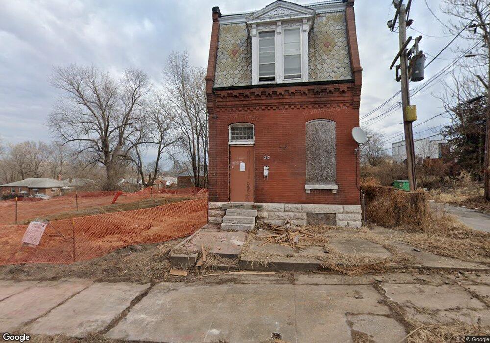
4816 N 20th St Saint Louis, MO 63107
College Hill NeighborhoodEstimated Value: $82,000 - $106,000
--
Bed
4
Baths
2,837
Sq Ft
$33/Sq Ft
Est. Value
About This Home
This home is located at 4816 N 20th St, Saint Louis, MO 63107 and is currently estimated at $94,000, approximately $33 per square foot. 4816 N 20th St is a home located in St. Louis City with nearby schools including Bryan Hill Elementary School, Yeatman-Liddell Middle School, and Vashon High School.
Ownership History
Date
Name
Owned For
Owner Type
Purchase Details
Closed on
Oct 17, 2011
Sold by
Murphy James W
Bought by
The Land Reutilization Authority Of The
Current Estimated Value
Purchase Details
Closed on
Nov 9, 2001
Sold by
The Cit Group
Bought by
Johnson Michael W and Johnson W M
Purchase Details
Closed on
Nov 23, 1998
Sold by
Anderson and Yana
Bought by
Pearson James
Home Financials for this Owner
Home Financials are based on the most recent Mortgage that was taken out on this home.
Original Mortgage
$41,455
Interest Rate
6.81%
Mortgage Type
Purchase Money Mortgage
Create a Home Valuation Report for This Property
The Home Valuation Report is an in-depth analysis detailing your home's value as well as a comparison with similar homes in the area
Home Values in the Area
Average Home Value in this Area
Purchase History
| Date | Buyer | Sale Price | Title Company |
|---|---|---|---|
| The Land Reutilization Authority Of The | -- | None Available | |
| Johnson Michael W | -- | -- | |
| Pearson James | -- | -- |
Source: Public Records
Mortgage History
| Date | Status | Borrower | Loan Amount |
|---|---|---|---|
| Previous Owner | Pearson James | $41,455 |
Source: Public Records
Tax History Compared to Growth
Tax History
| Year | Tax Paid | Tax Assessment Tax Assessment Total Assessment is a certain percentage of the fair market value that is determined by local assessors to be the total taxable value of land and additions on the property. | Land | Improvement |
|---|---|---|---|---|
| 2025 | -- | -- | -- | -- |
| 2024 | -- | -- | -- | -- |
| 2023 | -- | -- | -- | -- |
| 2022 | -- | -- | -- | -- |
| 2021 | $0 | $1,770 | $150 | $1,620 |
| 2020 | $0 | $1,770 | $150 | $1,620 |
| 2019 | $0 | $1,770 | $150 | $1,620 |
| 2018 | $0 | $1,670 | $150 | $1,520 |
| 2017 | $0 | $1,670 | $150 | $1,520 |
| 2016 | $0 | $1,810 | $290 | $1,520 |
| 2015 | -- | $1,810 | $290 | $1,520 |
| 2014 | -- | $1,810 | $290 | $1,520 |
| 2013 | -- | $1,850 | $440 | $1,410 |
Source: Public Records
Map
Nearby Homes
- 2010 E Obear Ave
- 2009 E Prairie Ave
- 1433 E Obear Ave
- 4512 N 19th St
- 1113 E John Ave
- 4417 Strodtman Place
- 4410 N 19th St
- 4337 Strodtman Place
- 4329 N 20th St
- 4320 N 20th St
- 4315 N 19th St
- 4306 Strodtman Place
- 4239 Obear Ave
- 4309 Blair Ave
- 4202 Gano Ave
- 2032 E Adelaide Ave
- 3010 Lee Ave
- 1923 Newhouse Ave
- 3937 Lee Ave
- 1409-1411 Newhouse Ave Unit 1411
- 1915 E John Ave
- 1917 E John Ave
- 1909 E John Ave
- 1927 E John Ave
- 4814 N 20th St
- 1912 E Gano Ave
- 1908 E Gano Ave
- 4722 N 20th St
- 1904 E Gano Ave
- 1914 E John Ave
- 1529 E John Ave
- 1900 E Gano Ave
- 4714 N 20th St
- 1900 E John Ave
- 2001 E John Ave
- 1528 E Gano Ave
- 1523 E John Ave
- 1532 E John Ave
- 1524 E Gano Ave
- 1526 E John Ave