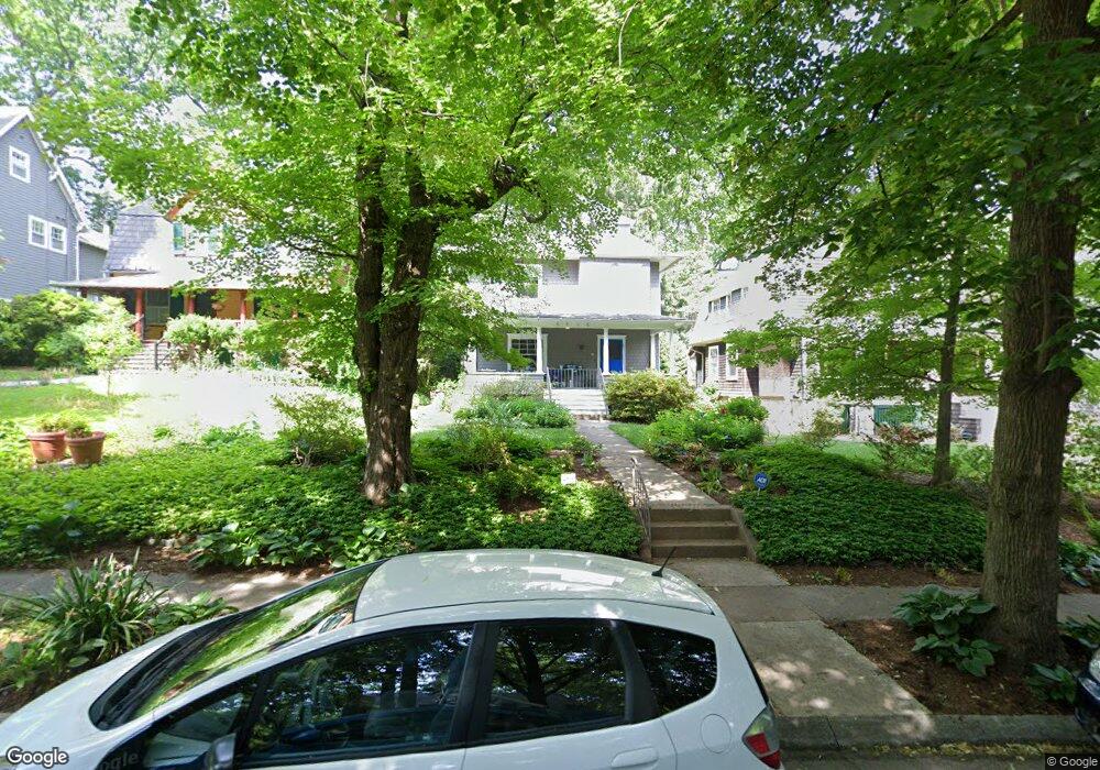
4818 Keswick Rd Baltimore, MD 21210
Roland Park NeighborhoodEstimated Value: $600,000 - $667,899
4
Beds
4
Baths
2,516
Sq Ft
$252/Sq Ft
Est. Value
About This Home
This home is located at 4818 Keswick Rd, Baltimore, MD 21210 and is currently estimated at $633,950, approximately $251 per square foot. 4818 Keswick Rd is a home located in Baltimore City with nearby schools including Roland Park Elementary/Middle School, Booker T. Washington Middle School, and Frederick Douglass High School.
Ownership History
Date
Name
Owned For
Owner Type
Purchase Details
Closed on
Dec 23, 2004
Sold by
White William E
Current Estimated Value
Purchase Details
Closed on
Aug 29, 1996
Sold by
Mcginn Marie L
Bought by
White William E and White Blair G
Purchase Details
Closed on
Jun 21, 1995
Sold by
Mccabe Mary E
Bought by
Mcginn Marie L
Home Financials for this Owner
Home Financials are based on the most recent Mortgage that was taken out on this home.
Original Mortgage
$150,000
Interest Rate
7.82%
Create a Home Valuation Report for This Property
The Home Valuation Report is an in-depth analysis detailing your home's value as well as a comparison with similar homes in the area
Home Values in the Area
Average Home Value in this Area
Purchase History
| Date | Buyer | Sale Price | Title Company |
|---|---|---|---|
| -- | $579,000 | -- | |
| White William E | $251,000 | -- | |
| Mcginn Marie L | $225,000 | -- |
Source: Public Records
Mortgage History
| Date | Status | Borrower | Loan Amount |
|---|---|---|---|
| Previous Owner | Mcginn Marie L | $150,000 |
Source: Public Records
Tax History
| Year | Tax Paid | Tax Assessment Tax Assessment Total Assessment is a certain percentage of the fair market value that is determined by local assessors to be the total taxable value of land and additions on the property. | Land | Improvement |
|---|---|---|---|---|
| 2025 | $9,418 | $453,533 | -- | -- |
| 2024 | $9,418 | $430,200 | $164,900 | $265,300 |
| 2023 | $10,090 | $427,533 | $0 | $0 |
| 2022 | $9,292 | $424,867 | $0 | $0 |
| 2021 | $9,964 | $422,200 | $164,900 | $257,300 |
| 2020 | $8,951 | $410,133 | $0 | $0 |
| 2019 | $8,622 | $398,067 | $0 | $0 |
| 2018 | $8,557 | $386,000 | $164,900 | $221,100 |
| 2017 | $8,628 | $386,000 | $0 | $0 |
| 2016 | $9,858 | $386,000 | $0 | $0 |
| 2015 | $9,858 | $386,000 | $0 | $0 |
| 2014 | $9,858 | $386,000 | $0 | $0 |
Source: Public Records
Map
Nearby Homes
- 520 Woodlawn Rd
- 5001 Roland Ave
- 5009 Roland Ave
- 728 Colorado Ave
- 107 Upnor Rd
- 103 Saint Dunstans Rd
- 4401 Roland Ave Unit 307
- 1040 Deer Ridge Dr Unit 402
- 1040 Deer Ridge Dr Unit 516
- 22 Cross Keys Rd
- 4 Cross Keys Rd Unit 4E
- 21 Hamill Rd Unit 21F
- 4332 N Charles St
- 5512 Woodlawn Rd
- 4450 Newport Ave
- 1002 W 43rd St
- 15 Charlcote Place
- 4289 Falls Rd
- 380 Homeland Southway Unit 3A
- 5510 N Charles St
- 4820 Keswick Rd
- 4816 Keswick Rd
- 4822 Keswick Rd
- 4814 Keswick Rd
- 419 Hawthorne Rd
- 417 Hawthorne Rd
- 4819 Keswick Rd
- 4821 Keswick Rd
- 4817 Keswick Rd
- 415 Hawthorne Rd
- 423 Hawthorn Rd
- 4810 Keswick Rd
- 4824 Keswick Rd
- 4815 Keswick Rd
- 425 Hawthorne Rd
- 413 Hawthorne Rd
- 4823 Keswick Rd
- 4826 Keswick Rd
- 4811 Keswick Rd
- 411 Hawthorne Rd
Your Personal Tour Guide
Ask me questions while you tour the home.