Estimated payment $1,506/month
Highlights
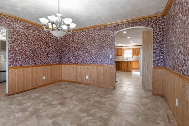
- Open Floorplan
- Main Floor Primary Bedroom
- 2 Car Attached Garage
- Vaulted Ceiling
- Fireplace
- Living Room
About This Home
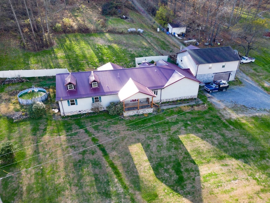
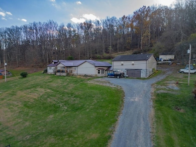
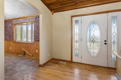
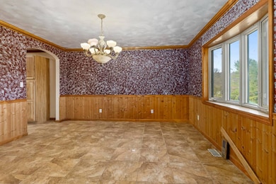
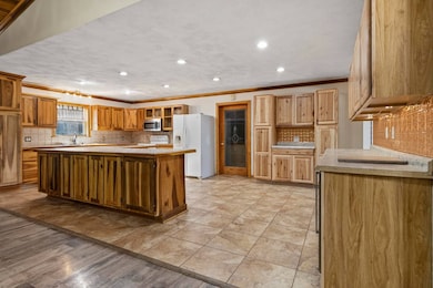
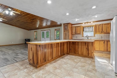
Disregard listing price. Property will be sold at auction. Roomy 5 bedroom, 4,780 +/- sqft home situated on 1.92 +/- acres located on Buckeye Road offering open concept throughout the main living area, living room with vaulted ceilings, huge kitchen with island, and first floor primary bedroom. The home features 1,280 +/- garage apartment or in-law suite, covered patio with built in fireplace, and 2 stall oversized garage. Fantastic opportunity! Call today for more information Property will be sold at public auction Wednesday, February 4th at 7PM. Online Bidding Only. Please visit Joe R. Pyle Auctions website for information on how to bid.
Home Details
Home Type
- Single Family
Est. Annual Taxes
- $1,707
Lot Details
- 1.92 Acre Lot
Parking
- 2 Car Attached Garage
Interior Spaces
- 4,780 Sq Ft Home
- Open Floorplan
- Vaulted Ceiling
- Fireplace
- Family Room
- Living Room
- Laundry Room
Bedrooms and Bathrooms
- 5 Bedrooms
- Primary Bedroom on Main
- En-Suite Primary Bedroom
Utilities
- Forced Air Heating and Cooling System
- Pellet Stove burns compressed wood to generate heat
Map
Tax History
| Year | Tax Paid | Tax Assessment Tax Assessment Total Assessment is a certain percentage of the fair market value that is determined by local assessors to be the total taxable value of land and additions on the property. | Land | Improvement |
|---|---|---|---|---|
| 2025 | $1,707 | $159,780 | $19,020 | $140,760 |
| 2024 | $1,707 | $161,460 | $19,020 | $142,440 |
| 2023 | $1,721 | $161,460 | $19,020 | $142,440 |
| 2022 | $1,641 | $160,080 | $19,020 | $141,060 |
| 2021 | $1,668 | $161,940 | $19,020 | $142,920 |
| 2020 | $1,675 | $161,940 | $19,020 | $142,920 |
| 2019 | $1,705 | $163,620 | $19,020 | $144,600 |
| 2018 | $1,710 | $163,620 | $19,020 | $144,600 |
| 2017 | $1,726 | $164,280 | $18,060 | $146,220 |
| 2016 | $1,684 | $159,300 | $17,100 | $142,200 |
| 2015 | $1,612 | $159,480 | $15,720 | $143,760 |
| 2014 | $1,512 | $156,840 | $15,060 | $141,780 |
Property History
| Date | Event | Price | List to Sale | Price per Sq Ft |
|---|---|---|---|---|
| 11/05/2025 11/05/25 | For Sale | $264,900 | -- | $55 / Sq Ft |
Purchase History
| Date | Type | Sale Price | Title Company |
|---|---|---|---|
| Deed | -- | None Available | |
| Deed | -- | None Available |
Mortgage History
| Date | Status | Loan Amount | Loan Type |
|---|---|---|---|
| Open | $35,400 | New Conventional | |
| Previous Owner | $96,500 | Adjustable Rate Mortgage/ARM |
Source: My State MLS
MLS Number: 11601514
APN: 03-1-00140004
- 96 Dunkard Valley Blvd
- 135 Virginia St
- 135 Fawn Meadow Dr
- TBD Mount Morris Rd
- 108 Caddie Ct
- Parcel B Guston Run Rd
- Parcel A Guston Run Rd
- Parcel C Guston Run Rd
- 115 Tee Dr
- 109 Tee Dr
- 145 Eagle Dr
- 504 Watson Dr
- 922 Bunker Ct
- 924 Bunker Ct
- 918 Bunker Ct
- 921 Bunker Ct
- 916 Bunker Ct
- 322 Wilson Rd
- 914 Bunker Ct
- 104 Eagle Dr
- 2044 Mountain Ash Ln
- 5000 Domain Dr
- 3557 Collins Ferry Rd
- 380 Richard Harrison Way
- 440 Kensington Ave
- 1341 Bitonti St
- 3406 Collins Ferry Rd Unit 2 BR/1 BA
- 1000 Mountain Valley Dr
- 521 Woodhaven Dr Unit SI ID1308987P
- 116 Marco Polo Dr
- 350 Wedgewood Dr
- 1208 Cambridge Ave
- 406 Treyson Ln
- 406 Treyson Ln
- 1000 Church Hill Dr
- 522 Blackstone Dr
- 108 Wedgewood Dr
- 678 Killarney Dr
- 1445 van Voorhis Rd
- 205 Glen Abbey Ln

Ask me questions while you tour the home.