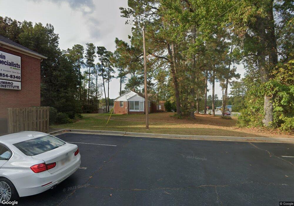
482 Furys Ferry Rd Augusta, GA 30907
Estimated Value: $210,820 - $332,000
--
Bed
2
Baths
1,514
Sq Ft
$169/Sq Ft
Est. Value
About This Home
This home is located at 482 Furys Ferry Rd, Augusta, GA 30907 and is currently estimated at $256,455, approximately $169 per square foot. 482 Furys Ferry Rd is a home located in Columbia County with nearby schools including Roosevelt Elementary School, Northmore Elementary School, and Stevens Creek Elementary School.
Ownership History
Date
Name
Owned For
Owner Type
Purchase Details
Closed on
Dec 14, 2009
Sold by
Bdt Llc
Bought by
Mims William B
Current Estimated Value
Purchase Details
Closed on
Jan 30, 2008
Sold by
Poppell Lewis Corey
Bought by
Bdt Llc
Home Financials for this Owner
Home Financials are based on the most recent Mortgage that was taken out on this home.
Original Mortgage
$178,468
Interest Rate
6.17%
Mortgage Type
New Conventional
Create a Home Valuation Report for This Property
The Home Valuation Report is an in-depth analysis detailing your home's value as well as a comparison with similar homes in the area
Home Values in the Area
Average Home Value in this Area
Purchase History
| Date | Buyer | Sale Price | Title Company |
|---|---|---|---|
| Mims William B | $220,000 | -- | |
| Bdt Llc | $167,500 | -- |
Source: Public Records
Mortgage History
| Date | Status | Borrower | Loan Amount |
|---|---|---|---|
| Previous Owner | Bdt Llc | $178,468 |
Source: Public Records
Tax History Compared to Growth
Tax History
| Year | Tax Paid | Tax Assessment Tax Assessment Total Assessment is a certain percentage of the fair market value that is determined by local assessors to be the total taxable value of land and additions on the property. | Land | Improvement |
|---|---|---|---|---|
| 2025 | $1,545 | $64,832 | $23,144 | $41,688 |
| 2024 | $1,429 | $57,237 | $22,221 | $35,016 |
| 2023 | $1,429 | $50,241 | $15,991 | $34,250 |
| 2022 | $1,243 | $47,854 | $13,914 | $33,940 |
| 2021 | $1,207 | $44,423 | $13,684 | $30,739 |
| 2020 | $1,239 | $44,637 | $13,683 | $30,954 |
| 2019 | $1,190 | $42,883 | $13,683 | $29,200 |
| 2018 | $1,170 | $42,032 | $13,683 | $28,349 |
| 2017 | $1,180 | $42,243 | $13,683 | $28,560 |
| 2016 | $1,089 | $40,429 | $12,875 | $27,554 |
| 2015 | $2,329 | $86,288 | $71,461 | $14,827 |
| 2014 | $2,412 | $88,253 | $71,461 | $16,792 |
Source: Public Records
Map
Nearby Homes
- 535 Crystal Creek E
- 3688 El Cordero Ranch Springs Rd
- 4120 Shady Oaks Dr
- 3750 Roscommon S
- 3766 Roscommon S
- 429 Wexford Ct
- 513 Crystal Creek W
- 511 Crystal Creek W
- 3829 Villa Ln
- 3812 Forest Creek Way
- 499 Crystal Creek W
- 3667 Foxfire Place
- 3683 Old Ferry Rd
- 3810 Inverness Way
- 344 Joshua Tree Dr
- 3641 Lake Shore Dr
- 271 Watervale Rd
- 497 Creekwalk Cir
- 351 Joshua Tree Dr
- 500 Oak Chase Dr
- 484 Furys Ferry Rd
- 501 Blackburn Dr
- 519 Blackburn Dr
- 535 Blackburn Dr
- 477 Furys Ferry Rd
- 500 Blackburn Dr
- 545 Blackburn Dr
- 487 Furys Ferry Rd
- 522 Blackburn Dr
- 532 Blackburn Dr
- 487 Furys Ferry Rd
- 534 Blackburn Dr Unit BURN
- 548 Blackburn Dr
- 467 Boulder Fork
- 465 Boulder Fork
- 463 Boulder Fork
- 469 Boulder Fork
- 461 Boulder Fork
- 489 Furys Ferry Rd
- 491 Furys Ferry Rd
