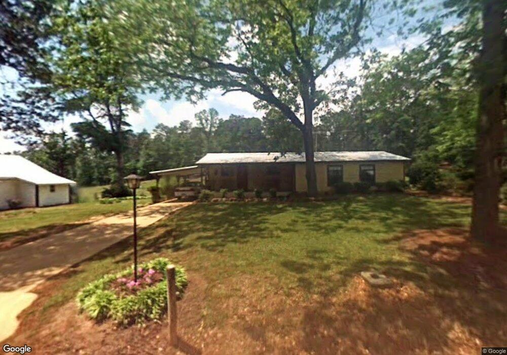
482 Locust Level Rd Deatsville, AL 36022
Estimated Value: $196,000 - $296,000
--
Bed
1
Bath
607
Sq Ft
$427/Sq Ft
Est. Value
About This Home
This home is located at 482 Locust Level Rd, Deatsville, AL 36022 and is currently estimated at $259,000, approximately $426 per square foot. 482 Locust Level Rd is a home located in Elmore County with nearby schools including Holtville Elementary School, Holtville Middle School, and Holtville High School.
Ownership History
Date
Name
Owned For
Owner Type
Purchase Details
Closed on
Jun 26, 2019
Sold by
Nelson Mark and Estate Of Zora Korb
Bought by
Rollan Robert M and Rollan Phyllis T
Current Estimated Value
Home Financials for this Owner
Home Financials are based on the most recent Mortgage that was taken out on this home.
Original Mortgage
$126,000
Outstanding Balance
$110,792
Interest Rate
4%
Mortgage Type
Future Advance Clause Open End Mortgage
Estimated Equity
$148,208
Create a Home Valuation Report for This Property
The Home Valuation Report is an in-depth analysis detailing your home's value as well as a comparison with similar homes in the area
Home Values in the Area
Average Home Value in this Area
Purchase History
| Date | Buyer | Sale Price | Title Company |
|---|---|---|---|
| Rollan Robert M | $150,000 | None Available |
Source: Public Records
Mortgage History
| Date | Status | Borrower | Loan Amount |
|---|---|---|---|
| Open | Rollan Robert M | $126,000 |
Source: Public Records
Tax History Compared to Growth
Tax History
| Year | Tax Paid | Tax Assessment Tax Assessment Total Assessment is a certain percentage of the fair market value that is determined by local assessors to be the total taxable value of land and additions on the property. | Land | Improvement |
|---|---|---|---|---|
| 2024 | $446 | $17,320 | $0 | $0 |
| 2023 | $445 | $295,630 | $165,390 | $130,240 |
| 2022 | $239 | $16,451 | $9,110 | $7,341 |
| 2021 | $310 | $13,824 | $9,980 | $3,844 |
| 2020 | $307 | $25,372 | $17,984 | $7,388 |
| 2019 | $354 | $27,532 | $17,944 | $9,588 |
| 2018 | $162 | $26,942 | $17,944 | $8,998 |
| 2017 | $169 | $8,300 | $5,408 | $2,892 |
| 2016 | $207 | $13,331 | $8,972 | $4,359 |
| 2014 | $198 | $134,470 | $91,340 | $43,130 |
Source: Public Records
Map
Nearby Homes
- 5500 Lightwood Rd
- 6857 Lightwood Rd
- 5326 Coosa River Rd
- 488 Sugar Loaf Hill Rd
- 436 Welona Creek Rd
- 0 Welona Creek Rd
- 150 Grays Ferry Rd
- 580 County Road 20 E
- 180 Grays Ferry Rd
- 2773 County Road 131
- 1415 Gold Mine Branch Rd
- 123 Trotters View Rd
- 120 Trotters View Rd
- 435 Kelly Rd
- 0 New Harmony Rd
- 418 Cliffside Dr
- 339 Gaddis Beach Dr
- 272 Briar Loop Rd
- 210 Tarilton Rd
- 0 Island Rd
- 380 Locust Level Rd
- 335 Locust Level Rd
- 171 Locust Level Rd
- 85 Country Ln
- 697 Locust Level Rd
- 275 Country Ln
- 195 Country Ln
- 55 Country Ln
- 138 Country Ln
- 5619 Lightwood Rd
- 5615 Lightwood Rd
- 6075 Lightwood Rd
- 5949 Lightwood Rd
- 6021 Lightwood Rd
- 5611 Lightwood Rd
- 5691 Lightwood Rd
- 5639 Lightwood Rd
- 59 Esco Rd
- 5560 Lightwood Rd
- 6117 Lightwood Rd