Estimated Value: $430,000 - $514,000
1
Bed
1
Bath
380
Sq Ft
$1,233/Sq Ft
Est. Value
About This Home
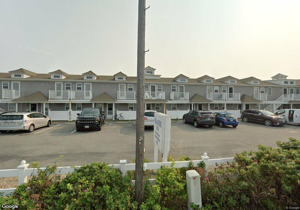
This home is located at 482 Shore Rd Unit 16, Truro, MA 02652 and is currently estimated at $468,443, approximately $1,232 per square foot. 482 Shore Rd Unit 16 is a home located in Barnstable County.
Ownership History
Date
Name
Owned For
Owner Type
Purchase Details
Closed on
Dec 16, 2020
Sold by
Allinger Stephen K and Kushner Susan M
Bought by
Cormier Susan and Edwards Lori A
Current Estimated Value
Home Financials for this Owner
Home Financials are based on the most recent Mortgage that was taken out on this home.
Original Mortgage
$227,200
Outstanding Balance
$201,342
Interest Rate
2.7%
Mortgage Type
New Conventional
Estimated Equity
$267,101
Purchase Details
Closed on
Jun 15, 2009
Sold by
Seaside Marketing Llc
Bought by
Allinger Stephen K and Kushner Susan M
Home Financials for this Owner
Home Financials are based on the most recent Mortgage that was taken out on this home.
Original Mortgage
$270,000
Interest Rate
4.82%
Mortgage Type
Purchase Money Mortgage
Create a Home Valuation Report for This Property
The Home Valuation Report is an in-depth analysis detailing your home's value as well as a comparison with similar homes in the area
Home Values in the Area
Average Home Value in this Area
Purchase History
| Date | Buyer | Sale Price | Title Company |
|---|---|---|---|
| Cormier Susan | $284,000 | None Available | |
| Allinger Stephen K | $300,000 | -- | |
| Allinger Stephen K | $300,000 | -- |
Source: Public Records
Mortgage History
| Date | Status | Borrower | Loan Amount |
|---|---|---|---|
| Open | Cormier Susan | $227,200 | |
| Previous Owner | Allinger Stephen K | $270,000 |
Source: Public Records
Tax History Compared to Growth
Tax History
| Year | Tax Paid | Tax Assessment Tax Assessment Total Assessment is a certain percentage of the fair market value that is determined by local assessors to be the total taxable value of land and additions on the property. | Land | Improvement |
|---|---|---|---|---|
| 2025 | $2,597 | $420,200 | $0 | $420,200 |
| 2024 | $2,378 | $397,000 | $0 | $397,000 |
| 2023 | $2,260 | $345,500 | $0 | $345,500 |
| 2022 | $2,032 | $262,900 | $0 | $262,900 |
| 2021 | $1,941 | $263,000 | $0 | $263,000 |
| 2020 | $1,868 | $254,800 | $0 | $254,800 |
| 2019 | $1,900 | $255,000 | $0 | $255,000 |
| 2018 | $1,809 | $245,500 | $0 | $245,500 |
| 2017 | $1,766 | $253,000 | $0 | $253,000 |
| 2016 | $1,795 | $265,100 | $0 | $265,100 |
| 2015 | $1,646 | $248,200 | $0 | $248,200 |
Source: Public Records
Map
Nearby Homes
- 496 Shore Rd Unit 21
- 496 Shore Rd Unit 3
- 544 Shore Rd Unit 3
- 658 Shore Rd Unit 8
- 334 Shore Rd Unit 1
- 953 Commercial St Unit 5
- 21 Dewey Ave Unit 4
- 897 Commercial St
- 63 Mayflower Ave Unit 1-2
- 169 Shore Rd Unit 15
- 777 Commercial St
- 168 Shore Rd Unit 9
- 174 Shore Rd Unit 15
- 125 Shore Rd Unit 10
- 132 Shore Rd Unit 7
- 690 Commercial St Unit 13C
- 350 Bradford St Unit 7
- 4 Bradford Acres Rd Unit F
- 4 Bradford Acres Rd Unit F
- 624 Commercial St
- 482 Shore Rd Unit 3
- 482 Shore Rd Unit 19
- 482 Shore Rd Unit 5
- 482 Shore Rd Unit 20 - 22
- 482 Shore Rd Unit 21 and 23
- 482 Shore Rd Unit 8-9
- 482 Shore Rd Unit 12
- 482 Shore Rd Unit 14
- 482 Shore Rd Unit 18
- 482 Shore Rd Unit 4
- 482 Shore Rd Unit 20
- 482 Shore Rd Unit 17
- 482 Shore Rd Unit 13
- 482 Shore Rd Unit 23
- 482 Shore Rd Unit 21
- 482 Shore Rd Unit 22
- 482 Shore Rd Unit 15
- 482 Shore Rd Unit 8
- 482 Shore Rd Unit 6
- 482 Shore Rd Unit 9