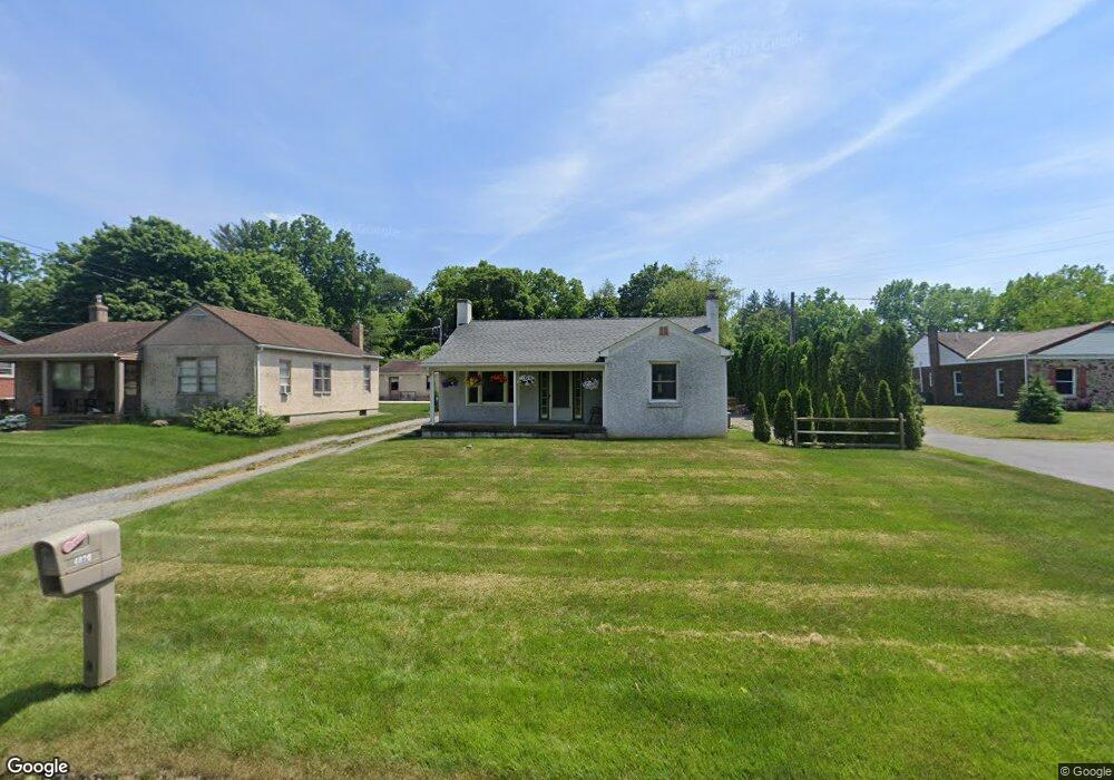
4820 Buckeye Rd Emmaus, PA 18049
Lower Macungie Township East NeighborhoodEstimated Value: $268,000 - $295,000
2
Beds
1
Bath
972
Sq Ft
$290/Sq Ft
Est. Value
About This Home
This home is located at 4820 Buckeye Rd, Emmaus, PA 18049 and is currently estimated at $281,579, approximately $289 per square foot. 4820 Buckeye Rd is a home located in Lehigh County with nearby schools including Macungie Elementary School, Eyer Middle School, and Emmaus High School.
Ownership History
Date
Name
Owned For
Owner Type
Purchase Details
Closed on
Jan 2, 2004
Sold by
Youse Walter G
Bought by
Brown Jory J
Current Estimated Value
Home Financials for this Owner
Home Financials are based on the most recent Mortgage that was taken out on this home.
Original Mortgage
$107,635
Outstanding Balance
$50,267
Interest Rate
5.88%
Mortgage Type
Purchase Money Mortgage
Estimated Equity
$231,312
Create a Home Valuation Report for This Property
The Home Valuation Report is an in-depth analysis detailing your home's value as well as a comparison with similar homes in the area
Home Values in the Area
Average Home Value in this Area
Purchase History
| Date | Buyer | Sale Price | Title Company |
|---|---|---|---|
| Brown Jory J | $113,300 | -- |
Source: Public Records
Mortgage History
| Date | Status | Borrower | Loan Amount |
|---|---|---|---|
| Open | Brown Jory J | $107,635 |
Source: Public Records
Tax History Compared to Growth
Tax History
| Year | Tax Paid | Tax Assessment Tax Assessment Total Assessment is a certain percentage of the fair market value that is determined by local assessors to be the total taxable value of land and additions on the property. | Land | Improvement |
|---|---|---|---|---|
| 2025 | $3,704 | $145,100 | $50,200 | $94,900 |
| 2024 | $3,540 | $145,100 | $50,200 | $94,900 |
| 2023 | $3,469 | $145,100 | $50,200 | $94,900 |
| 2022 | $3,386 | $145,100 | $94,900 | $50,200 |
| 2021 | $3,313 | $145,100 | $50,200 | $94,900 |
| 2020 | $3,281 | $145,100 | $50,200 | $94,900 |
| 2019 | $3,261 | $145,100 | $50,200 | $94,900 |
| 2018 | $3,177 | $145,100 | $50,200 | $94,900 |
| 2017 | $3,121 | $145,100 | $50,200 | $94,900 |
| 2016 | -- | $145,100 | $50,200 | $94,900 |
| 2015 | -- | $130,700 | $50,200 | $80,500 |
| 2014 | -- | $130,700 | $50,200 | $80,500 |
Source: Public Records
Map
Nearby Homes
- 4788 Buckeye Rd
- 4245 Tank Farm Rd
- 3989 Mink Rd
- 3721 Samantha Ln
- 3721 Samantha Ln Unit 76
- Foxgrove I - TR Plan at The Fields at Twin Run
- Folcroft -TR Plan at The Fields at Twin Run
- Sierra - TR Plan at The Fields at Twin Run
- Cheswick - TR Plan at The Fields at Twin Run
- 3754 Samantha Ln
- Penrose I - TR Plan at The Fields at Twin Run
- Gossamer - TR Plan at The Fields at Twin Run
- 3754 Samantha Ln Unit Lot 1
- Penrose II - TR Plan at The Fields at Twin Run
- Garland I - TR Plan at The Fields at Twin Run
- Olympia I - TR Plan at The Fields at Twin Run
- Daggerwing - TR Plan at The Fields at Twin Run
- Arden - TR Plan at The Fields at Twin Run
- 3703 Samantha Ln Unit Lot 70
- 3736 Samantha Ln Unit Lot 7
- 4802 Buckeye Rd
- 4836 Buckeye Rd
- 4772 Buckeye Rd
- 4764 Buckeye Rd
- 4753 Buckeye Rd
- 4754 Buckeye Rd
- 4858 Buckeye Rd
- 4864 Buckeye Rd
- 4735 Buckeye Rd
- 4736 Buckeye Rd
- 4198 Chestnut St
- 4857 Buckeye Rd
- 4723 Buckeye Rd
- 4724 Buckeye Rd
- 4194 Chestnut St
- 4875 Buckeye Rd
- 4711 Buckeye Rd
- 4705 Buckeye Rd
- 4712 Buckeye Rd
- 4190 Chestnut St