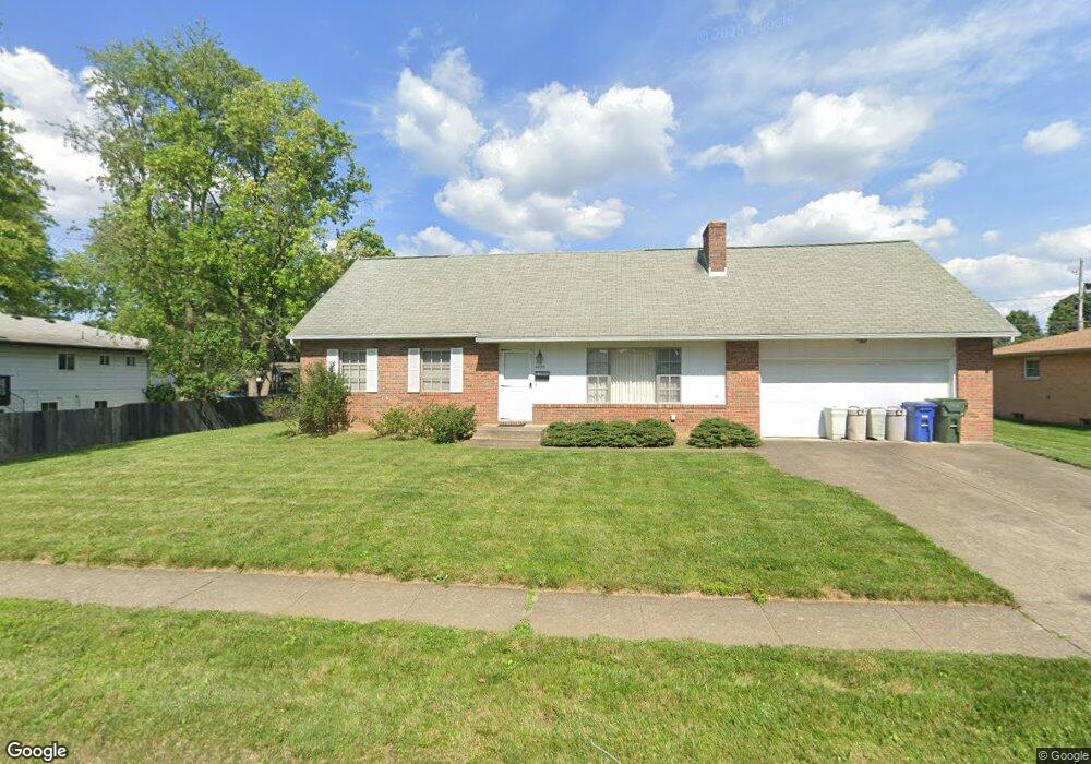
4820 Esterbrook Rd Columbus, OH 43229
Woodward Park NeighborhoodEstimated Value: $307,000 - $372,000
4
Beds
2
Baths
2,468
Sq Ft
$134/Sq Ft
Est. Value
About This Home
This home is located at 4820 Esterbrook Rd, Columbus, OH 43229 and is currently estimated at $331,608, approximately $134 per square foot. 4820 Esterbrook Rd is a home located in Franklin County with nearby schools including Valley Forge Elementary School, Woodward Park Middle School, and Northland High School.
Ownership History
Date
Name
Owned For
Owner Type
Purchase Details
Closed on
Jul 5, 2018
Sold by
Spangler John R and Dahlberg Dennis B
Bought by
Dahlberg Dennis B and Spangler Genevieve H
Current Estimated Value
Purchase Details
Closed on
Jul 17, 1985
Bought by
Spangler John R
Purchase Details
Closed on
Aug 1, 1984
Create a Home Valuation Report for This Property
The Home Valuation Report is an in-depth analysis detailing your home's value as well as a comparison with similar homes in the area
Home Values in the Area
Average Home Value in this Area
Purchase History
| Date | Buyer | Sale Price | Title Company |
|---|---|---|---|
| Dahlberg Dennis B | -- | None Available | |
| Spangler John R | -- | -- | |
| -- | $15,000 | -- |
Source: Public Records
Tax History
| Year | Tax Paid | Tax Assessment Tax Assessment Total Assessment is a certain percentage of the fair market value that is determined by local assessors to be the total taxable value of land and additions on the property. | Land | Improvement |
|---|---|---|---|---|
| 2025 | $4,614 | $100,670 | $19,080 | $81,590 |
| 2024 | $4,614 | $100,670 | $19,080 | $81,590 |
| 2023 | $4,556 | $100,660 | $19,075 | $81,585 |
| 2022 | $3,457 | $62,230 | $14,350 | $47,880 |
| 2021 | $3,503 | $62,230 | $14,350 | $47,880 |
| 2020 | $3,318 | $62,230 | $14,350 | $47,880 |
| 2019 | $2,954 | $48,690 | $11,480 | $37,210 |
| 2018 | $1,474 | $48,690 | $11,480 | $37,210 |
| 2017 | $2,421 | $48,690 | $11,480 | $37,210 |
| 2016 | $2,330 | $43,930 | $9,070 | $34,860 |
| 2015 | $1,058 | $43,930 | $9,070 | $34,860 |
| 2014 | $2,121 | $43,930 | $9,070 | $34,860 |
| 2013 | $1,176 | $48,300 | $9,555 | $38,745 |
Source: Public Records
Map
Nearby Homes
- 1116 Tulsa Dr
- 4800 Bourke Rd
- 4795 Colonel Perry Dr
- 1144 Reed Circle Dr
- 1485 Norma Rd
- 4923 Karl Rd Unit 4925
- 5004 Julie Place
- 5010 Julie Place
- 4605 Glenmawr Ave
- 4450 N 4th St
- 952 Minerva Ave
- 1685 Norma Rd
- 940 Minerva Ave
- 5318 Eisenhower Rd
- 4852 Snowbird Cir Unit 13B
- 4857 Tamarack Blvd
- 1130 Carbone Dr
- 4143 Karl Rd Unit 215
- 4143 Karl Rd Unit 314
- 4145 Karl Rd Unit 223
- 4827 Almont Dr
- 4808 Esterbrook Rd
- 4835 Almont Dr
- 4819 Almont Dr
- 4800 Esterbrook Rd
- 4825 Esterbrook Rd
- 4817 Esterbrook Rd
- 4833 Esterbrook Rd
- 4809 Esterbrook Rd
- 4801 Maize Rd
- 4841 Esterbrook Rd
- 4793 Maize Rd
- 4792 Esterbrook Rd
- 4799 Esterbrook Rd
- 4849 Esterbrook Rd
- 4832 Almont Dr
- 4820 Almont Dr
- 4816 Dechant Rd
- 4785 Maize Rd
- 4784 Esterbrook Rd
Your Personal Tour Guide
Ask me questions while you tour the home.