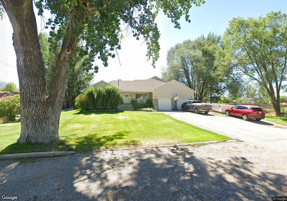
4820 W 14400 N Garland, UT 84312
Estimated Value: $382,000 - $439,000
--
Bed
--
Bath
1,331
Sq Ft
$308/Sq Ft
Est. Value
About This Home
This home is located at 4820 W 14400 N, Garland, UT 84312 and is currently estimated at $409,804, approximately $307 per square foot. 4820 W 14400 N is a home located in Box Elder County with nearby schools including Fielding School, Bear River Middle School, and Alice C. Harris Intermediate School.
Ownership History
Date
Name
Owned For
Owner Type
Purchase Details
Closed on
Apr 8, 2014
Sold by
Shaffer Janic S
Bought by
Shaffer Jesse Roy and Shaffer Courtney Serene
Current Estimated Value
Purchase Details
Closed on
Feb 27, 2014
Sold by
Shaffer J Dean
Bought by
Shaffer Janice S
Create a Home Valuation Report for This Property
The Home Valuation Report is an in-depth analysis detailing your home's value as well as a comparison with similar homes in the area
Home Values in the Area
Average Home Value in this Area
Purchase History
| Date | Buyer | Sale Price | Title Company |
|---|---|---|---|
| Shaffer Jesse Roy | -- | American Secure Title Tremon | |
| Shaffer Janice S | -- | Accommodation |
Source: Public Records
Tax History Compared to Growth
Tax History
| Year | Tax Paid | Tax Assessment Tax Assessment Total Assessment is a certain percentage of the fair market value that is determined by local assessors to be the total taxable value of land and additions on the property. | Land | Improvement |
|---|---|---|---|---|
| 2025 | $1,973 | $383,418 | $130,000 | $253,418 |
| 2024 | $1,728 | $380,984 | $130,000 | $250,984 |
| 2023 | $1,809 | $403,533 | $130,000 | $273,533 |
| 2022 | $1,742 | $201,352 | $35,750 | $165,602 |
| 2021 | $1,463 | $178,403 | $30,000 | $148,403 |
| 2020 | $984 | $178,403 | $30,000 | $148,403 |
| 2019 | $883 | $84,518 | $16,500 | $68,018 |
| 2018 | $847 | $75,646 | $16,500 | $59,146 |
| 2017 | $877 | $137,538 | $16,500 | $107,538 |
| 2016 | $838 | $72,830 | $16,500 | $56,330 |
| 2015 | $759 | $67,709 | $16,500 | $51,209 |
| 2014 | $759 | $65,270 | $16,500 | $48,770 |
| 2013 | -- | $60,837 | $16,500 | $44,337 |
Source: Public Records
Map
Nearby Homes
- 14296 N 5350 W
- 4770 W 13600 N
- 15125 N 4400 W
- 15270 N 5475 W
- 14360 N 6000 W
- 14376 N 6000 W
- 14345 N 6000 W
- 3536 W 14100 N
- 15920 N 4000 W Unit 14
- 13200 N 6000 W
- 16449 N 6000 W
- 627 N Main St
- 169 N 400 E
- 13700 N 3100 W
- 112 S Main St
- 16115 N 6000 W
- Berrington Plan at Lookout Mountain
- Stanton Plan at Lookout Mountain
- Cambria Plan at Lookout Mountain
- Brantwood Plan at Lookout Mountain
- 4810 W 14400 N
- 4840 W 14400 N
- 4825 W 14400 N
- 4805 W 14400 N
- 4780 W 14400 N
- 4865 W 14400 N
- 4760 W 14400 N
- 4760 W 14400 N Unit 30
- 4775 W 14400 N
- 4875 W 14400 N
- 4881 W 14400 N
- 4740 W 14400 N
- 4740 W 14400 N Unit 30
- 4910 W 14400 N
- 4895 W 14400 N
- 4925 W 14400 N
- 4930 W 14400 N
- 4950 W 14400 N
- 4680 W 14400 N
- 4965 W 14400 N