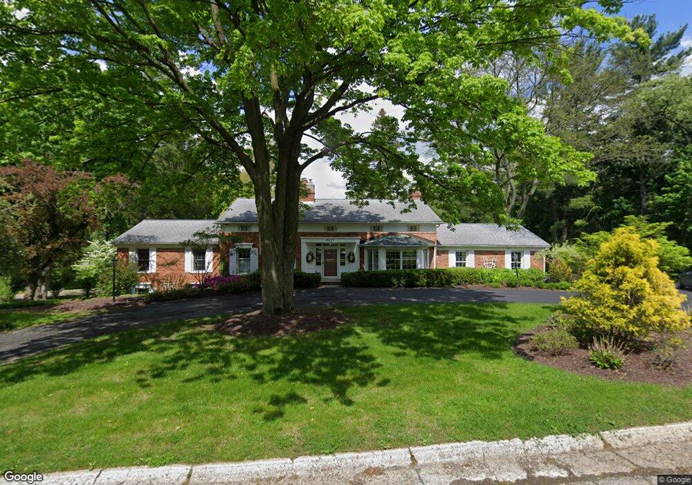
4821 N Harsdale Rd Bloomfield Hills, MI 48302
Estimated Value: $1,043,000 - $1,236,000
3
Beds
3
Baths
2,524
Sq Ft
$456/Sq Ft
Est. Value
About This Home
This home is located at 4821 N Harsdale Rd, Bloomfield Hills, MI 48302 and is currently estimated at $1,151,209, approximately $456 per square foot. 4821 N Harsdale Rd is a home located in Oakland County with nearby schools including Way Elementary School, South Hills Middle School, and Bloomfield Hills High School.
Ownership History
Date
Name
Owned For
Owner Type
Purchase Details
Closed on
Jun 23, 2021
Sold by
Brumm Gregg E
Bought by
Brumm Gregg E
Current Estimated Value
Purchase Details
Closed on
Mar 16, 2021
Sold by
Brumm Carole W
Bought by
Brumm Gregg E
Home Financials for this Owner
Home Financials are based on the most recent Mortgage that was taken out on this home.
Original Mortgage
$97,500
Outstanding Balance
$87,840
Interest Rate
3%
Mortgage Type
New Conventional
Estimated Equity
$1,063,369
Purchase Details
Closed on
Feb 4, 2014
Sold by
Brumm Gregg E and Brumm Carole Winnard
Bought by
Brumm Gregg E and Brumm Carole Winnard
Purchase Details
Closed on
Jun 5, 1997
Sold by
Cox Carol
Bought by
Brumm Gregg E
Home Financials for this Owner
Home Financials are based on the most recent Mortgage that was taken out on this home.
Original Mortgage
$150,000
Interest Rate
8.13%
Create a Home Valuation Report for This Property
The Home Valuation Report is an in-depth analysis detailing your home's value as well as a comparison with similar homes in the area
Home Values in the Area
Average Home Value in this Area
Purchase History
| Date | Buyer | Sale Price | Title Company |
|---|---|---|---|
| Brumm Gregg E | -- | None Available | |
| Brumm Gregg E | -- | None Available | |
| Brumm Gregg E | -- | None Available | |
| Brumm Gregg E | -- | None Available | |
| Brumm Gregg E | -- | -- |
Source: Public Records
Mortgage History
| Date | Status | Borrower | Loan Amount |
|---|---|---|---|
| Open | Brumm Gregg E | $97,500 | |
| Closed | Brumm Gregg E | $150,000 |
Source: Public Records
Tax History Compared to Growth
Tax History
| Year | Tax Paid | Tax Assessment Tax Assessment Total Assessment is a certain percentage of the fair market value that is determined by local assessors to be the total taxable value of land and additions on the property. | Land | Improvement |
|---|---|---|---|---|
| 2024 | $5,501 | $531,460 | $0 | $0 |
| 2023 | $5,323 | $462,420 | $0 | $0 |
| 2022 | $10,004 | $425,310 | $0 | $0 |
| 2021 | $9,933 | $422,830 | $0 | $0 |
| 2020 | $4,869 | $426,800 | $0 | $0 |
| 2019 | $9,345 | $403,410 | $0 | $0 |
| 2018 | $9,388 | $367,640 | $0 | $0 |
| 2017 | $9,322 | $354,290 | $0 | $0 |
| 2016 | $9,338 | $347,790 | $0 | $0 |
| 2015 | -- | $346,360 | $0 | $0 |
| 2014 | -- | $310,400 | $0 | $0 |
| 2011 | -- | $218,690 | $0 | $0 |
Source: Public Records
Map
Nearby Homes
- 1027 Joanne Ct
- 4650 Lahser Rd
- 5080 Tootmoor Rd
- 4255 Telegraph Rd
- 921 Pine Thistle Ln
- 801 W Long Lake Rd
- 692 Bennington Dr
- 931 Vaughan Rd
- 5129 Woodlands Ln
- 5137 Woodlands Dr Unit 24
- 00 Telegraph Rd
- 0 Telegraph Rd
- 5008 Kings Gate Way
- 3797 Burning Tree Dr
- 5100 Kings Gate Way
- 596 Rudgate Rd
- 1214 Copperwood Dr
- 830 N Pemberton Rd
- 3715 Lahser Rd
- 341 Keswick Rd
- 4830 N Harsdale Rd
- 910 Sunningdale Dr
- 4801 N Harsdale Rd
- 4800 N Harsdale Rd
- 930 Sunningdale Dr
- 890 Sunningdale Dr
- 4851 Ardmore Dr
- 4852 N Harsdale Rd
- 4805 N Harsdale Rd
- 4701 Ardmore Dr
- 4830 Ardmore Dr
- 955 Sunningdale Dr
- 4651 Ardmore Dr
- 4895 Ardmore Dr
- 859 Sunningdale Dr
- 4855 Ardmore Dr
- 4750 Ardmore Dr
- 4871 N Harsdale Rd
- 875 Harsdale Rd
- 4601 Ardmore Dr Unit Bldg-Unit